15-21 Hill St. History

Mission District, San Francisco

history of the land, the people, and the building

Explore the people, events, and records that shaped this corner of the Mission.

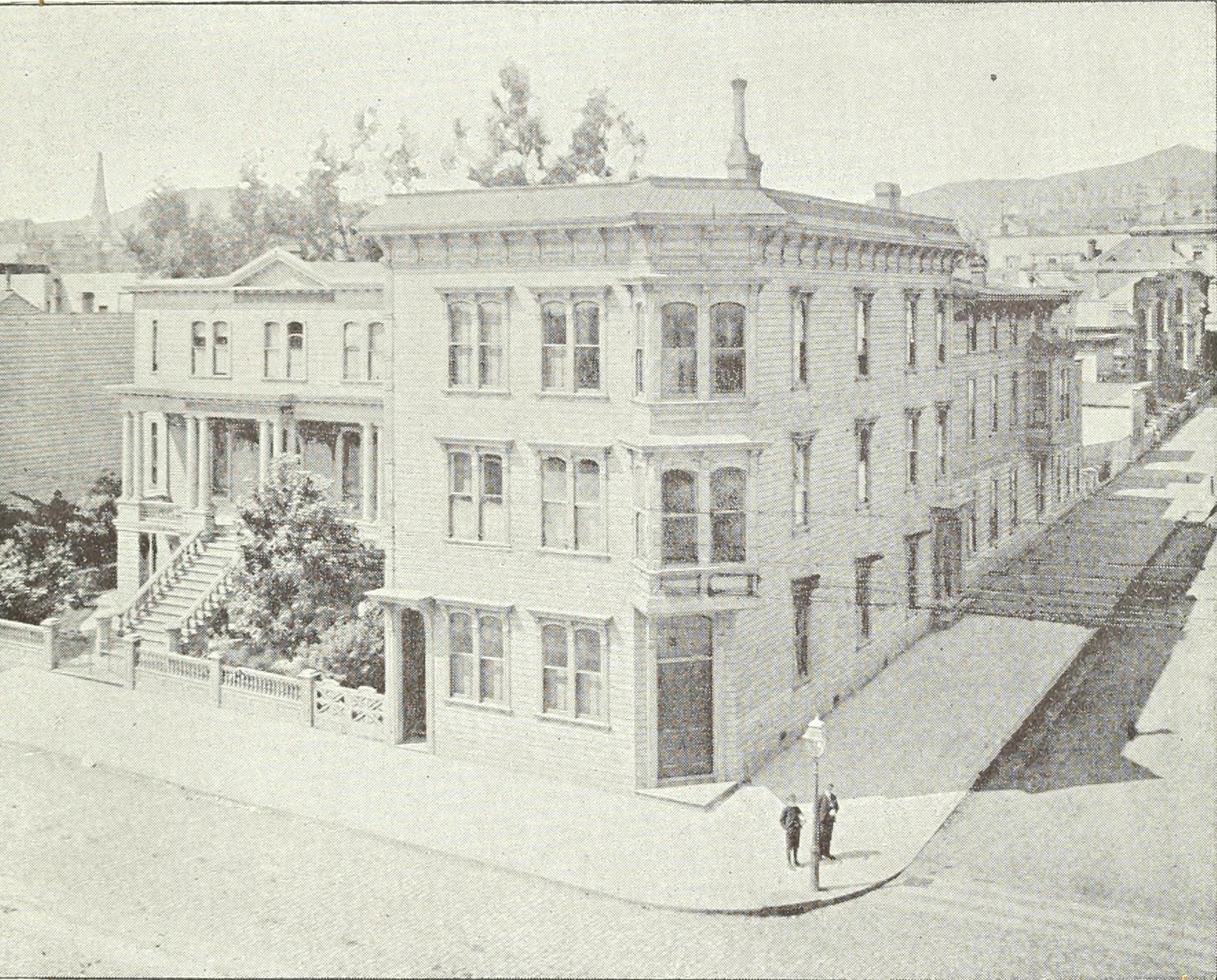
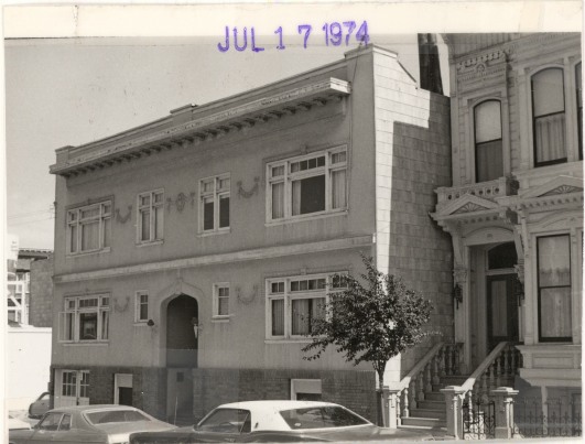
1974 assessor photograph of 15–21 Hill Street. Read the story of the bank’s demolition plan.

When Hibernia Bank tried to demolish the building

July 17, 1974 · Assessor photograph

A road along the valley floor

The future lot lay on the lower slope west of today’s Valencia Street, south of Mission Dolores and inland from the tidal marsh. The Old San Jose Road followed the valley floor nearby.

Landscape and records Original 1857 Coast Survey Engraved 1857 chart 1861 map of Hill Street
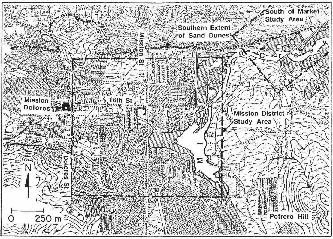
1857 map showing Mission Dolores, Mission Creek marshes, hills and Union Race Course.
1857 · the Mission valleyUSGS reproduced part of the U.S. Coast Survey map with later streets and contours marked. The Hidden Nature SF viewer has the survey at Hill Street.Approximate vicinity near the lower edge of the reproduced map, measured southeast from Mission Dolores with the printed scale.

A school occupied the site

Part of the Irving Institute stood on the future four-flat lot. Edward and Frances Church ran the school and lived on campus. A trade journal listed Gouldin as owner on two building jobs at and near the corner in 1885. By 1900, the Sanborn map recorded boarding rooms in the long building along Hill.

School history The Churches Other campus residents 1885 construction notices Gouldin’s 1891 will Boarding rooms

An elevated historic photograph looking southwest from Valencia Street at the three-story Irving Institute and its wing extending west along Hill Street.
1892 · the Hill Street wing of Irving InstituteValencia crosses the foreground. Hill climbs along the right side of the building. The present four-flat lot begins 85 feet up Hill from the corner, along the stretch where the rear section of the campus appears in the photo. The Blue Book gives the school’s address as 1036 Valencia.Full advertisementSchoolrooms and curriculumInternet Archive scanApproximate Hill Street wing and grounds, 85 to 135 feet west of Valencia.

Neighbors cooked in the street

After the earthquake and fire, people set up makeshift kitchens in the roadway between Valencia and Guerrero. The building that stands at 15–21 Hill today was completed in 1923.

Earthquake and fire records

Residents cook in temporary curbside kitchens in the 1906 photograph looking west up Hill Street.
1906 · people cook in the streetLooking west on Hill between Valencia and Guerrero after the earthquake. OpenSFHistory / wnp27.7915.Approximate south-side frontage on the left, looking west from the Valencia end.

The present building is built

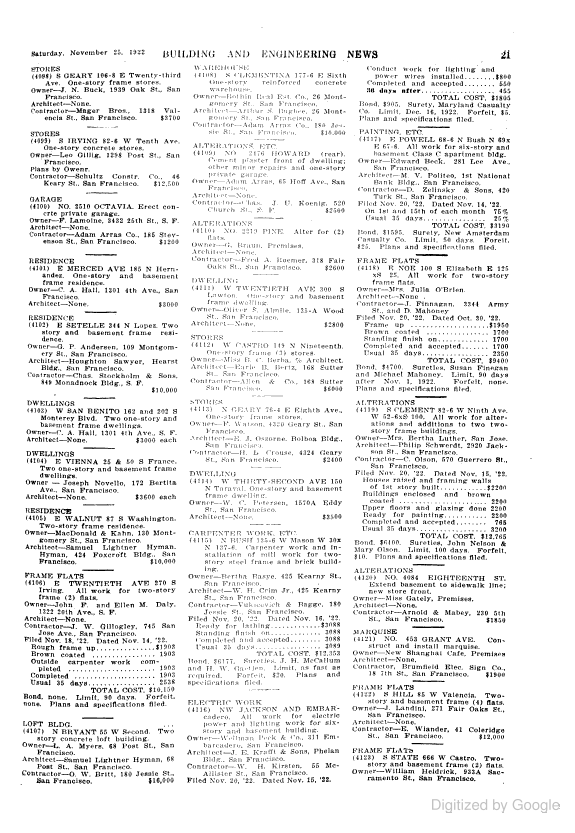
Electrician James F. Landini hired carpenter Emil V. Wiander to construct the building. The contract was published in November 1922. Landini accepted the work as completed on April 10, 1923. He and Zetta were listed at No. 21 the following year.

Landini deed Recorded completion Landini residence

November 25, 1922 trade journal page with the Landini and Wiander four-flat contract in the lower right column.
1922 · the $12,000 construction contractEntry 4122 near the lower right identifies the four-flat project 85 feet west of Valencia. Building and Engineering News, November 25, p. 21.

Neighbors opposed demolition

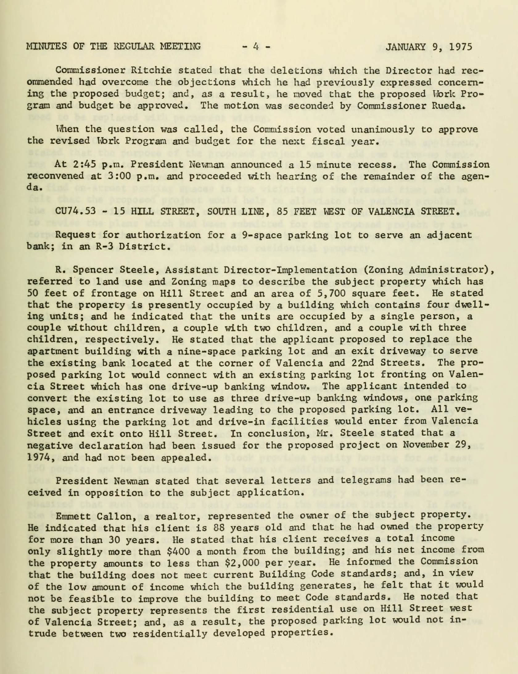
Hibernia Bank wanted a nine-space parking lot and a drive-through exit onto Hill Street. All four flats housed tenants. Larry Farage presented a petition with 92 signatures, and about 50 people at the hearing raised their hands in opposition. The Planning Commission voted unanimously to deny the application.

Hearing minutes and vote 1975 residents

January 9, 1975 hearing minutes, p. 4

Four flats became four parcels

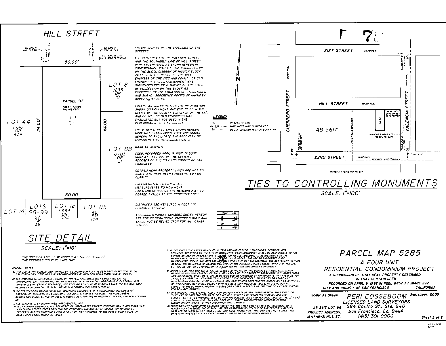
The city recorded Parcel Map 5285, which divided the historic lot into condo lots 106 through 109 for Nos. 15 through 21.

Recorded subdivision

Parcel Map 5285, the condominium boundary survey
Parcel Map 5285, the condominium boundary surveyThe outline follows the surveyed lot on the site plan and the block diagram.