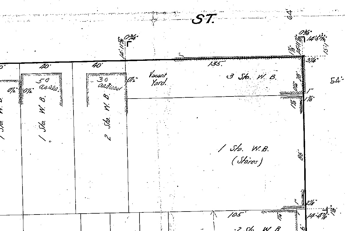
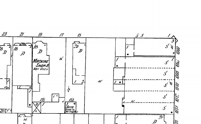
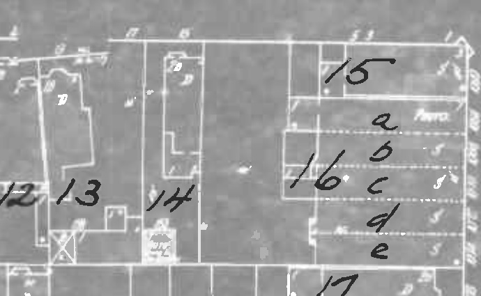
15-21 Hill St. History

History

Chronological archive

1820s

Along the old road

In the 1820s the Old San Jose Road followed the valley floor south of Mission San Francisco de Asís, in the homeland of the Ramaytush Ohlone. Mexico governed Alta California after independence, and the mission continued to operate north of the future Hill Street lot.

Association of Ramaytush Ohlone National Park Service Old road and historic landscape

The Old San Jose Road follows the Mission valley

The lot is in the homeland of the Ramaytush Ohlone, south of Mission San Francisco de Asís. By 1826, the mission operated under Mexican rule. The Old San Jose Road followed the floor of the valley close to the hills west of today’s Valencia Street.

The 1857 U.S. Coast Survey sheet T-687, aligned with modern streets in the Hidden Nature SF viewer, places the future lot on the lower slope west of Valencia, inland from the tidal marsh. The neighborhood-scale historical ecology layer shows a reconstructed creek near the Valencia end of the block.

Association of Ramaytush OhloneMission District context statement1857 survey and historical ecologyUSGS interpretation of the 1857 surveyUSGS interpretation of the 1857 survey · scan

Mission District context statement, PDF page 27

1830s

Surveyors and artists record Mexican-era San Francisco

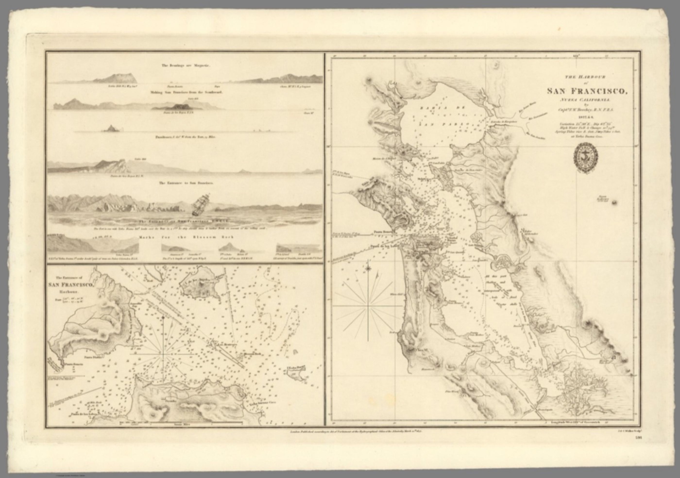
A British expedition visited San Francisco Bay in 1826 and 1827. Its chart and a view of Mission Dolores appeared in print the following decade.

San Francisco Bay was charted before the Mission valley had the street grid that would later include Hill Street.

An early chart of San Francisco Bay with soundings, shaded hills, and drawings of the harbor entrance.
Beechey’s chart records San Francisco Bay before the street gridThe Admiralty published the harbor chart in 1833 from survey work dated 1827 and 1828. The chart shows hills, coastlines and navigation routes at bay scale. It gives geographic context for the future Mission neighborhood.

Mission Dolores stood amid open land about half a mile north of the future Hill Street property.

Lithograph of Mission Dolores with a dirt road, grazing cattle, low buildings, and hills beyond.
A view from the 1826–27 expedition shows Mission Dolores and the surrounding fieldsWilliam Smyth’s view looks west toward the chapel, with cattle in open fields and hills behind the buildings. Alexander Forbes published this lithograph after Smyth’s watercolor in 1839. The scene records the landscape about half a mile north of the future four-flat lot. California Historical Society collection, CHS-5756, digitized by USC Libraries.

Original watercolor and provenance Beechey’s account, chapter XIII The old road and the future lot

1840s

The land becomes part of Rancho San Miguel

In the wake of Mission Dolores’s secularization in the 1830s, the Mexican government issued private land grants across the peninsula. In 1845, Governor Pío Pico granted Rancho San Miguel to José de Jesús Noé. The rancho included the future Hill Street lot and the land Noé would sell to John M. Horner.

National Park Service, secularization and ranchos Rancho San Miguel grant and deeds

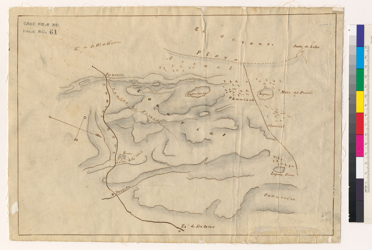
The future Hill Street lot lay within Rancho San Miguel, whose landscape was described in this land-claim sketch.

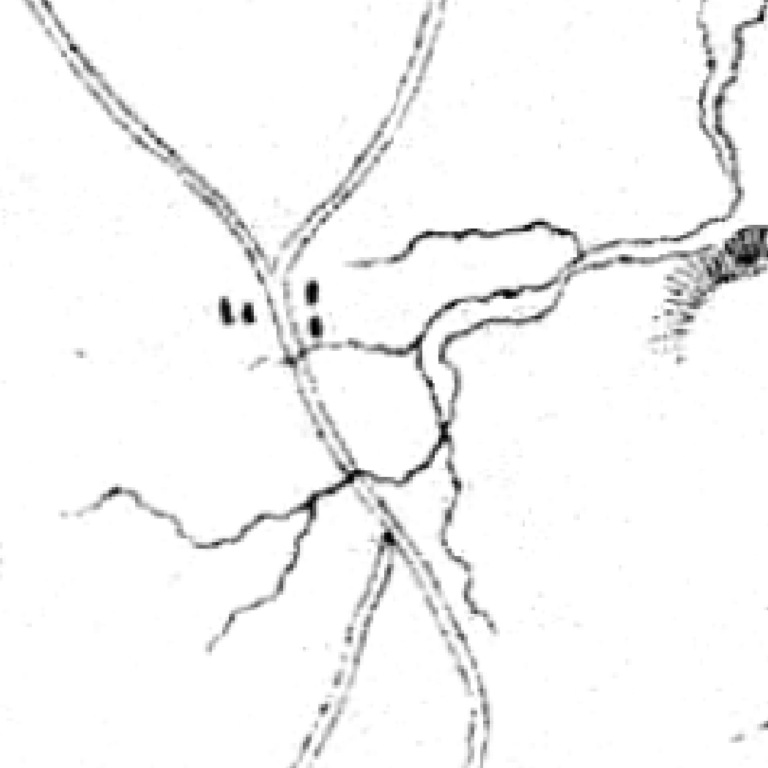
Hand-drawn Rancho San Miguel map with hills, ponds and roads.
A land-claim sketch traces roads and lagoons in Rancho San MiguelThis hand-drawn diseño shows hills, lagoons and routes in the larger rancho. Bancroft Library, land case 6 ND, p. 61, map B-9.Estimated vicinity along the road between Mission Dolores and the Precita crossing. The sketch has no parcel grid.SFEI dates the sketch to about 1840. Bancroft catalogs it under 1857 among the federal land case papers.SFEI datingBancroft catalog

Bancroft catalog · scan

A diseño depicts the geography of Rancho San Miguel

Noé conveys land for Horner’s Addition

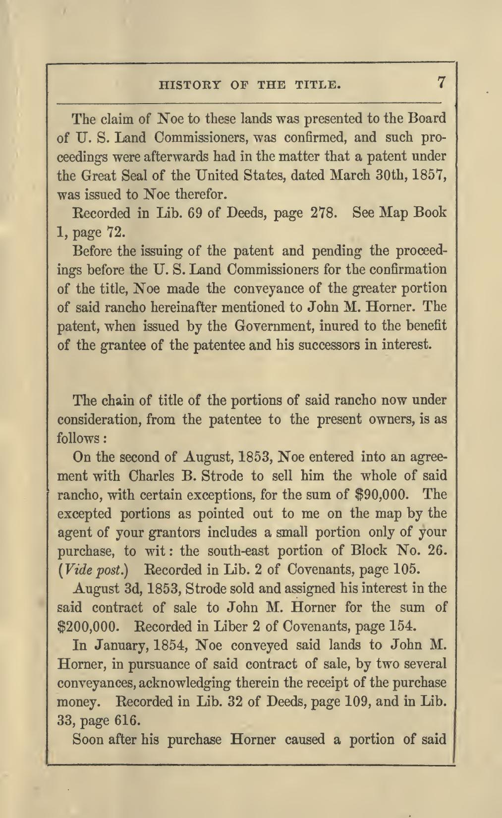
The future lot lies at the eastern edge of the land laid out as Horner’s Addition. Historian James T. Boyd’s 1864 title abstract records the August 1853 agreements through Charles B. Strode and two January 1854 deeds from José de Jesús Noé to John M. Horner. The city’s Corbett Heights study dates the conveyance to January 30, 1854. J. J. Gardiner’s 1854 plat lays out Hill Street in the subdivision. The U.S. patent for the original 4,443.38-acre Rancho San Miguel was issued to Noé on March 30, 1857.

The San Francisco Recorder’s map references are Book 1, page 72 for the rancho survey and Map Book C–D, pages 144–145 for Horner’s Addition. The 1864 Homestead Union tract in Boyd’s report ended at Guerrero Street, west of this site.

Noé’s federal land claimState Archives patent index1864 abstract citing the 1854 deedsCorbett Heights title historyHuntington subdivision mapGardiner’s 1854 platSouth Mission surveyHuntington subdivision map · scan

1864 abstract citing the 1854 deeds, PDF page 9
1864 abstract citing the 1854 deeds, PDF page 10
South Mission survey, PDF page 2

Governor Pío Pico grants Rancho San Miguel to José de Jesús Noé

Noé (1805–1862) was born in Mexico and came to California in 1834 with his wife Guadalupe Garduño and their young son Miguel. He was a rancher, justice of the peace and alcalde of Yerba Buena. Governor Pío Pico granted him Rancho San Miguel on December 23, 1845. The commonly reproduced photograph of Noé may show his son. Historian Mae Silver traced a sketch of Noé Sr. to his descendants.

John M. Horner (1821–1907) wrote that he grew up on the family farm in Monmouth County, New Jersey. A member of the Church of Jesus Christ of Latter-day Saints, he came to California aboard the Brooklyn in 1846 and farmed in the East Bay with his brother William. After the rancho purchase, Horner commissioned the layout of Horner’s Addition. The city’s survey describes the subdivision as sparsely developed in the 1850s. He moved to Hawaiʻi in 1879.

Rancho San Miguel land caseNoé’s biography and portrait identificationHorner’s autobiography and portraitWilliam Horner and the East Bay farmHistory of Horner’s AdditionHistory of Horner’s Addition, PDF page 2 · scanHistory of Horner’s Addition, PDF page 2 · original

William Horner and the East Bay farm, PDF page 11

1850s

Horner lays out a subdivision

As settlers farmed the Mission valley after the Gold Rush, Horner laid out a street grid on part of the rancho. The 1854 survey drew Hill Street. The Coast Survey still showed slopes and tidal marsh shaping the valley three years later.

Mission Area Plan, historical resources 1854 subdivision map Original 1857 Coast Survey

The Mission valley still had roads and waterways before Hill Street appeared on subdivision plans.

1850 · San Francisco Bay naval chart with the present lot marked.
A naval chart traces roads and waterways near the MissionSan Francisco’s historical map service dates this nautical chart layer to 1850. The inland detail shows roads and waterways near the Mission.The dashed outline marks the vicinity of the future lot. At the original 1:150,000 scale, individual lots are beyond the chart’s resolution.

Fields and the road south framed the Mission valley before the Hill Street block was laid out.

An 1850 pencil drawing shows the Mission Dolores settlement, fields and roads below the hills, with the bay in the distance.
William Dougal sketches the Mission and its road southThe mission buildings stand amid open ground, fenced plots and a few smaller buildings. San Francisco Planning identifies the road running southeast across the foreground as the Old Mission Road to San Jose, leading from today’s Dolores Street toward Valencia and San Jose Avenue. The drawing gives a view of the valley before Hill Street was laid out. The future parcel cannot be identified in this view.William H. Dougal, Mission Dolores, Looking Towards San Francisco. The Bancroft Library, BANC PIC 1960.018:016.

Bancroft finding aid San Francisco Planning identifies the road See the road on the 1857 survey

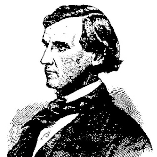
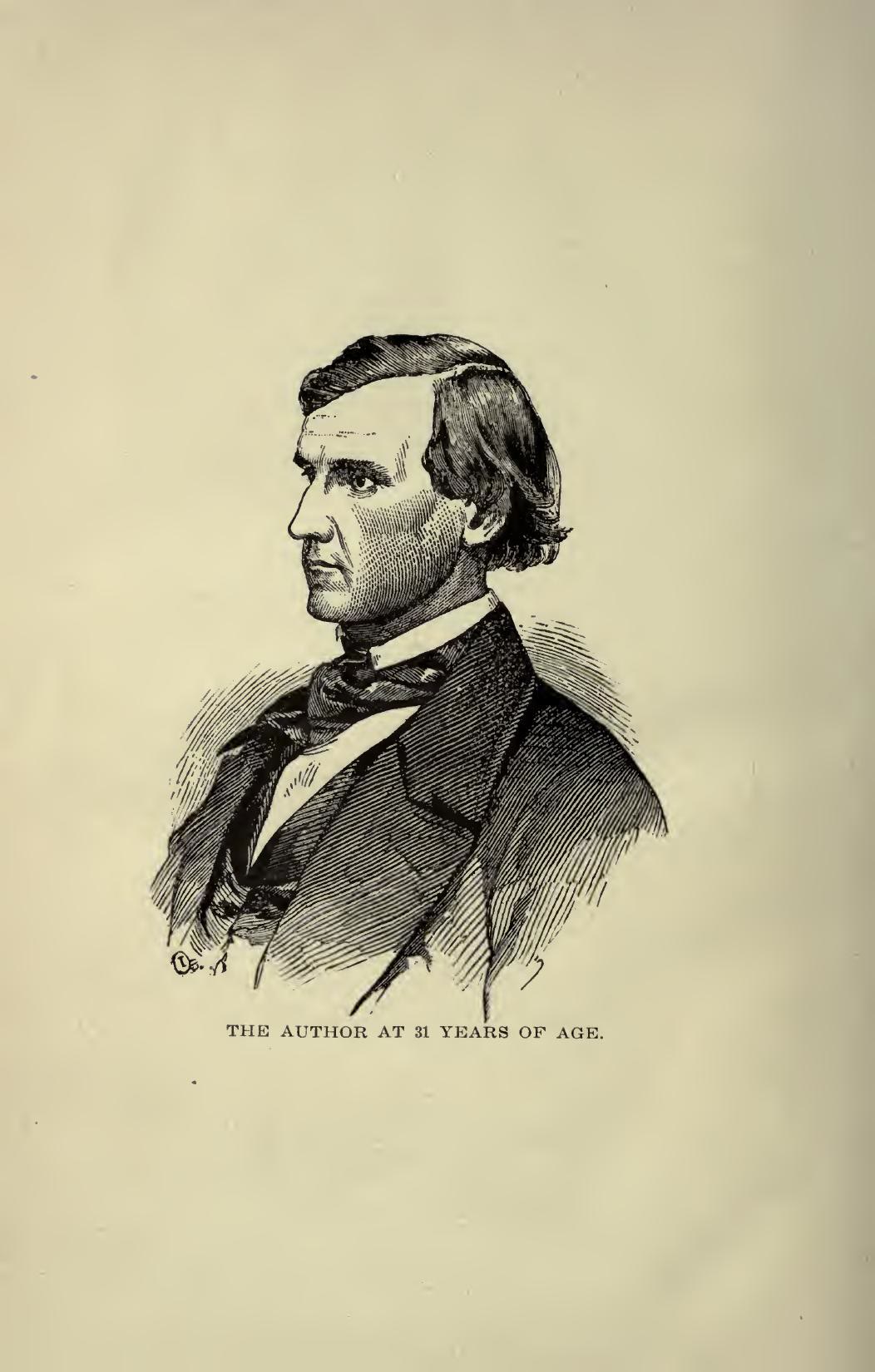
John M. Horner purchased land from José de Jesús Noé and commissioned the subdivision that laid out Hill Street.

Black-and-white portrait illustration of John M. Horner facing left.
John M. Horner appears in a portrait at age 31Horner’s 1898 book captions the portrait as age 31. He was born June 15, 1821, so the likeness represents him in 1852 or 1853. Horner published the portrait in his 1898 book.Museum of Local History, p. 7Horner’s 1898 book
Horner’s 1898 book
Horner’s 1898 book

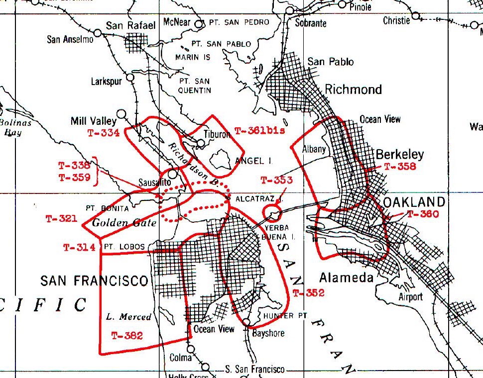
An earlier coastal survey may contain evidence of the Mission valley before the 1857 survey, but the sheet’s coverage of the lot is unconfirmed.

Coast Survey index with a red outline marked T-352 along the eastern shore of San Francisco.
An 1852 survey may reach the future Hill Street blockTopographic Index 37A places sheet T-352 along San Francisco’s eastern shore, from the city past Hunters Point toward Bayshore. Today’s Hill and Valencia intersection falls near the inland edge of that outline. The original sheet would show whether the survey reached the lot.

University of Alabama catalog · T-352 1857 manuscript map of the Mission

The Coast Survey traces the plank road to the Mission

Surveyor A. F. Rodgers shows a thin line of buildings along the new plank road from the city to the much smaller Mission Dolores settlement. The chart ends just south of the mission buildings. The future Hill Street parcel lies beyond the surveyed view on this plate.

1853 Coast Survey chart, electrotype copy New York Public Library copy

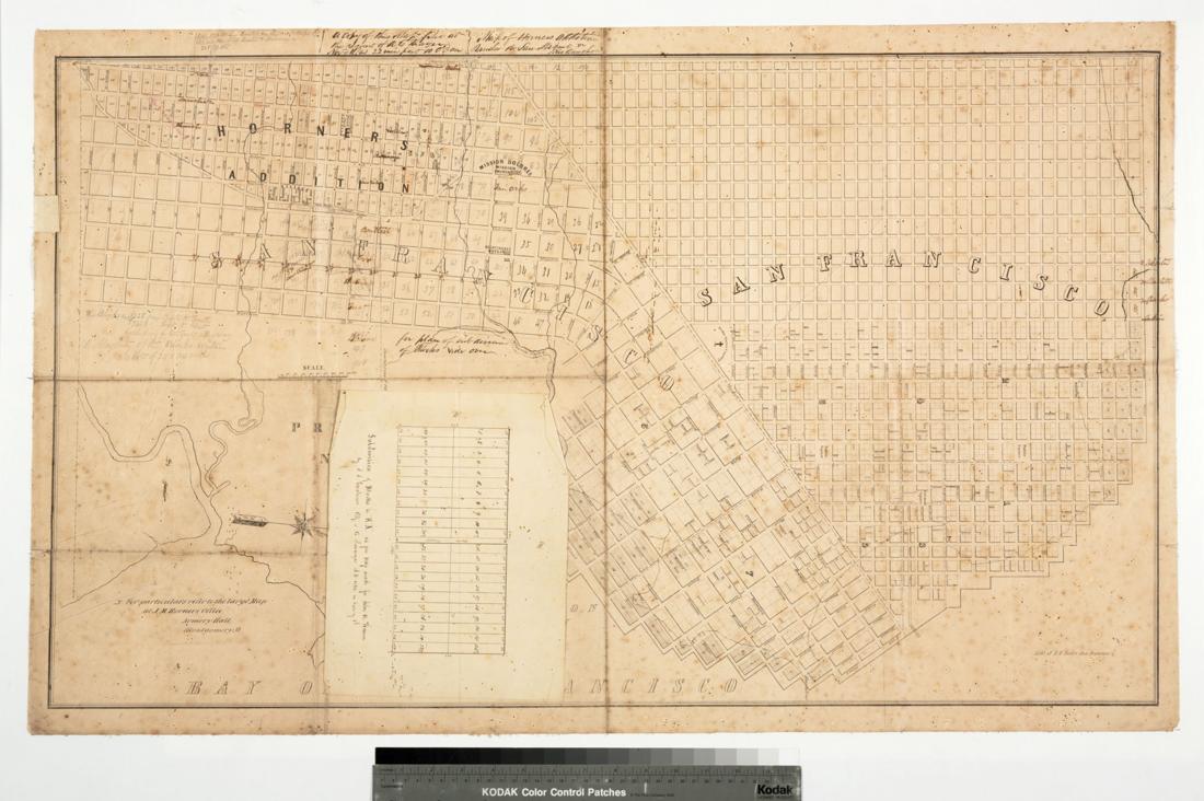
The future property fell within Horner’s Addition, the subdivision that introduced Hill Street to the map.

Circa 1854 map of San Francisco showing the gridded Horner subdivision at upper left.
Horner’s Addition lays out streets near the present lotThe subdivision plan appears toward the upper left. The Huntington Library, call number 442362.Estimated location using the early Valencia line, the street grid between present-day 21st and 22nd, and Mission Dolores.
The Horner plan shows printed block 14, Alta, Hill and John Streets, with the future home site marked near Valencia.
Gardiner’s subdivision places the future lot in Block 14The enlarged Huntington sheet shows Horner’s printed Block 14 immediately south of the projected Hill Street line. Alta and John are present-day 21st and 22nd Streets.The dashed outline uses the modern lot’s position west of Valencia. It identifies the vicinity within Block 14.

Huntington Library, 442362 Full-size reproduction hosted by Ness Software

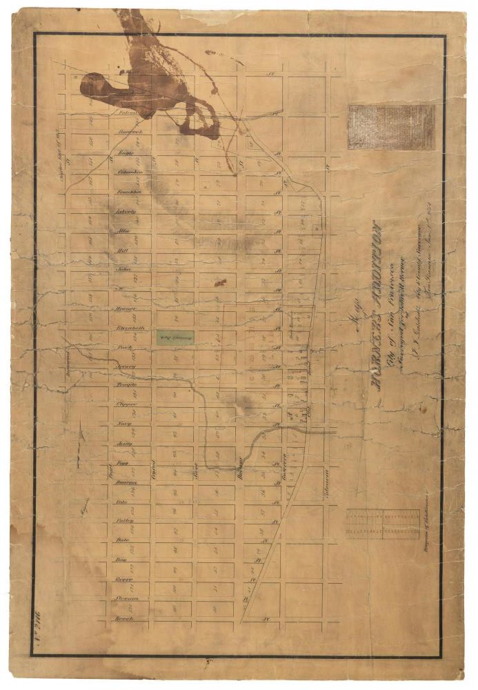
Large-format 1854 Horner’s Addition plat with the future home site marked.
Gardiner draws Hill Street on a separate subdivision platThe surviving 1854 sheet is shown north-up. Its title appears to read Jan. 1, 1854. The auction catalog reads June 1, 1854.The dashed outline places the future lot on the south side of the projected Hill line, just west of Valencia.

PBA Galleries, Sale 759, Lot 11 Photograph of the title and date

Huntington manuscript inset with two rows of lots and a central pathway.
A manuscript diagram gives the standard lot dimensionsThe diagram credits Gardiner and gives Jan. 1, 1854. Each standard lot is 25 by 114 feet. Two such lots match the dimensions of today’s 50-by-114-foot property. The diagram illustrates the subdivision layout. The original lot numbers and conveyances for the present property remain unverified.

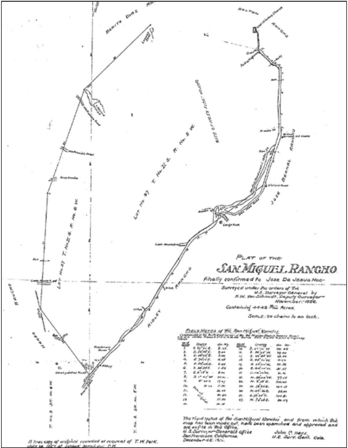
The federal rancho survey establishes the larger land claim that included the future Hill Street property.

Federal rancho survey plat with boundaries and a table of field notes.
A. W. von Schmidt surveys Rancho San MiguelA. W. von Schmidt surveyed the rancho for the U.S. Surveyor General in November 1856; the city recorded the survey in 1857. San Francisco Recorder, Map Book 1, p. 72.Estimated vicinity southeast of Mission Dolores, using the mapped mission, the rancho boundary and the survey scale.

The city records the Rancho San Miguel survey

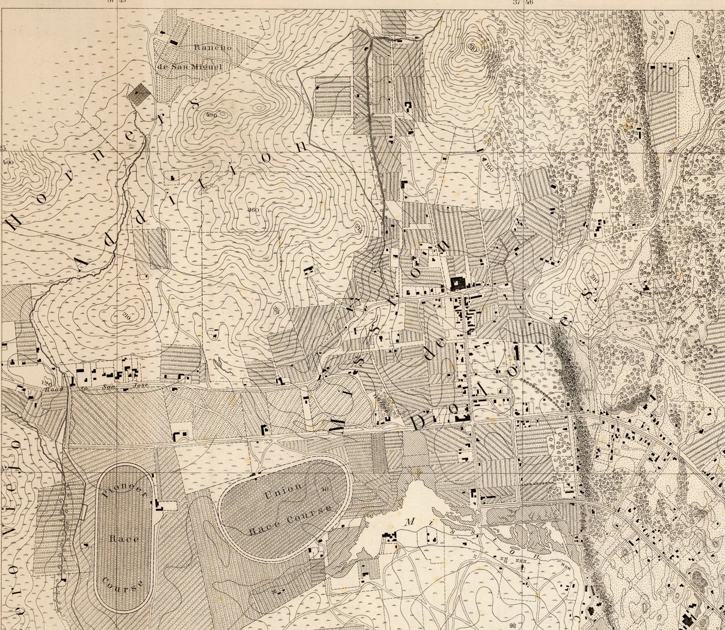
Before dense development, the future lot lay near the lower slopes above the Mission valley.

Original 1857 survey sheet detail showing the Mission, valley roads, farm fields, two racetracks and contour lines, with the modern lot vicinity circled.
The Coast Survey records slopes, fields and roadsThe original plane-table sheet, T-687, shows the Old Road to San Jose, two racetracks and cultivated tracts across the Mission valley. The future lot was near the foot of the hills, between the Mission church to the north and the racetracks to the east. Surveyed by August F. Rodgers at 1:10,000.Approximate vicinity aligned to the engraved chart at Mission Dolores and the two racetracks. The map does not establish whether the future lot itself had a building or what grew there.

Full map NOAA survey index Survey symbols and methods

Horner’s Addition sat beside the roads and cultivated land of the Mission valley before the block was built up.

Engraved 1857 Coast Survey chart showing Horner’s Addition, Mission Dolores, cultivated fields and racetracks. The modern lot vicinity is circled.
An engraved chart puts Horner’s Addition beside the valley fieldsThe 1857 printed Coast Survey chart names Horner’s Addition on the hills west of the Old Road to San Jose. Its black building symbols cluster along roads and around Mission Dolores. The future lot lies well inland from Mission Creek’s marshes.Approximate position from the chart registered to the 1938 aerial. North points to the right.

Full map Georeferenced chart

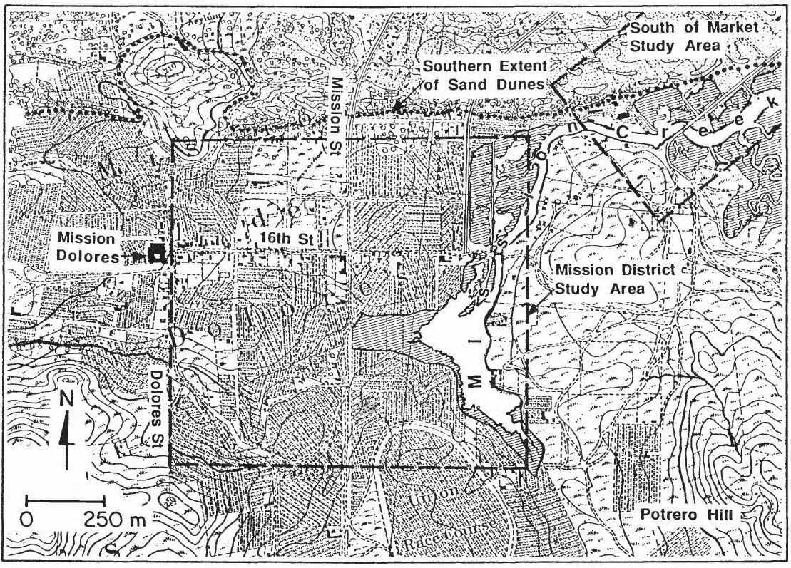
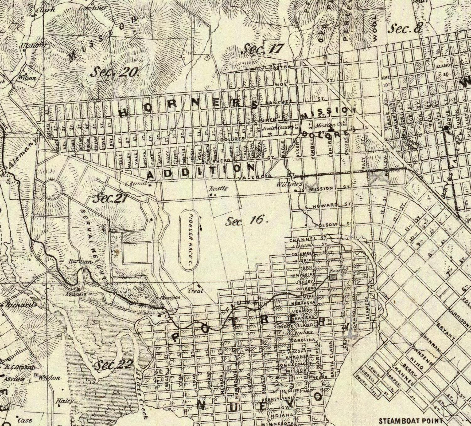
The Mission valley’s older waterways and contours help place Hill Street in the landscape that preceded the modern street grid.

1857 map showing Mission Dolores, Mission Creek marshes, hills and Union Race Course.
The Coast Survey maps the Mission valley and tidal marshUSGS reproduced part of the U.S. Coast Survey map with later streets and contours marked. The Hidden Nature SF viewer has the survey at Hill Street.Approximate vicinity near the lower edge of the reproduced map, measured southeast from Mission Dolores with the printed scale.

The slopes near the future Hill Street lot were still a visible feature of the valley in the nineteenth century.

1859 · U.S. Coast Survey with the present lot marked.
The Coast Survey charts the slopes around the future lotThe city’s georeferenced historical layer shows a road and hachures indicating slopes in the vicinity of the future lot.The dashed outline marks the vicinity of the present 50 × 114 ft lot. The original chart and its alignment support only an approximate location.

Rumsey catalog and full 1859 chart

1860s

The Mission takes shape

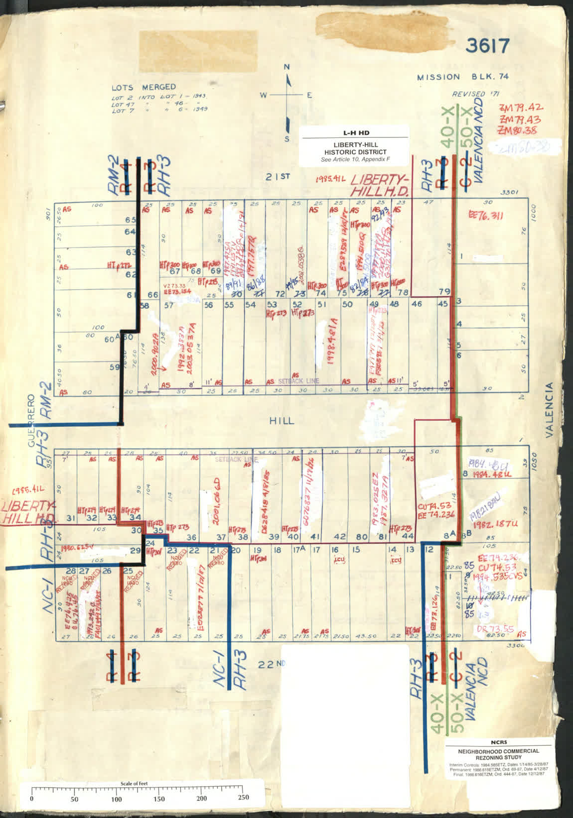
San Francisco’s first street railroad began service on Valencia in 1860. The Homestead Union reached Guerrero Street, west of the future lot, by 1864. The 1861 directory map already named Hill between Alta and John. The 1868 city map and 1869 Goddard map trace the old city charter line across the block.

San Francisco Planning, Liberty-Hill history 1861 street grid 1868 charter line 1869 city map

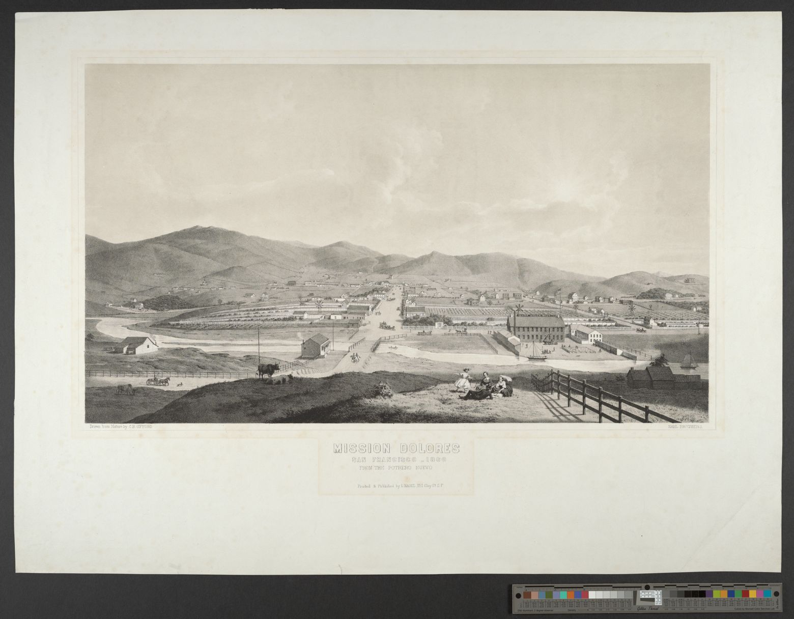
The valley north of Hill Street combined industry, waterways and cultivated land before the neighborhood filled with buildings.

An 1860 lithograph looks west across Mission Creek toward Mission Dolores, with fenced fields, livestock and the Central Woolen Mills.
Charles Gifford draws fields and a mill in the Mission valleyGifford looks west from the Potrero Nuevo along what is now 16th Street, near Bryant. A boat sits on Mission Creek beside the Central Woolen Mills. Cultivated rows and fenced fields occupy much of the valley. The view centers on the area north of Hill Street and gives no clear view of the future flats’ parcel.Charles B. Gifford, Mission Dolores, San Francisco, 1860, from the Potrero Nuevo. Printed and published by L. Nagel. Stanford University Libraries, Reid W. Dennis Collection, rd-310.

Full lithograph from Stanford Libraries Bancroft Library copy San Francisco Planning identifies the viewpoint See Hill Street on the 1861 map

Hill Street already appeared by name in Horner’s Addition, decades before the present building.

1861 directory map of Horner’s Addition and Mission Dolores, rotated with north to the right. A circle marks the vicinity of the building near Valencia.
Wackenreuder draws Hill Street between Alta and JohnThe map accompanying Henry G. Langley’s directory shows the Horner’s Addition grid reaching Valencia. It labels Hill between Alta and John, later 21st and 22nd. The Mission settlement, the Willows and the Pioneer Race Course are visible in the same detail.Approximate vicinity on the south side of the drawn Hill Street segment, just west of Valencia. North points to the right.

Full map 1874 directory documents the street names

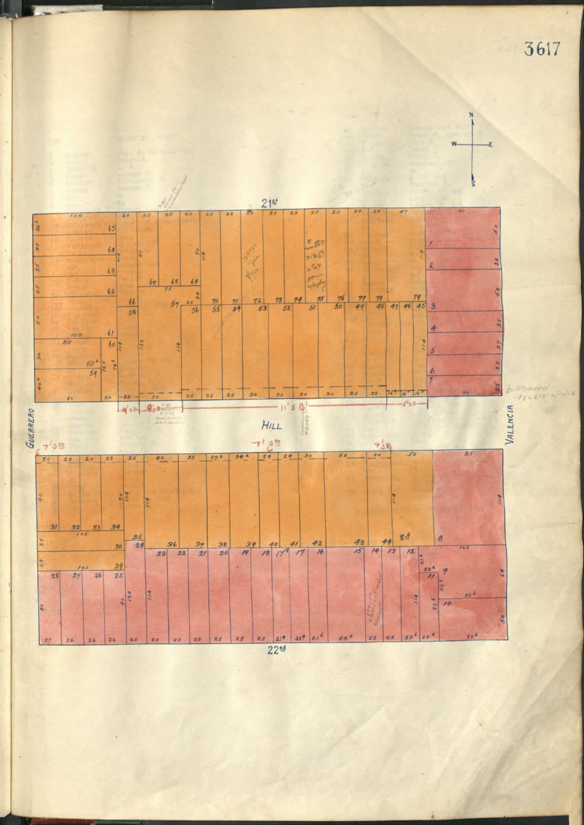
The recorded subdivision placed the future property in Block 14, south of the planned line of Hill Street.

City Recorder’s copy of the Horner subdivision with the future home site marked within Block 14.
The Recorder files a copy of the Horner subdivisionThe County Recorder filed this copy on November 11, 1863, at A. E. Thayer’s request. Block 14 lies east of the Guerrero-side blocks and south of the projected line of Hill.The dashed outline follows the estimated present location using the early street grid. The recorded lines show the subdivision plan.

County Recorder, Book C–D, pp. 144–145 San Francisco History Center map guide

The early street grid connected Horner’s Addition to rail routes and landmarks in the Mission valley.

James Butler’s 1864 color map of the Mission and Horner’s Addition, with the approximate site marked by the Valencia route.
Butler maps Horner’s Addition and the nearby rail linesJames Butler’s color map preserves the early names Alta, Hill and John and draws numbered subdivision blocks. The Willows and both racecourses are still landmarks on the sheet. The map shows street and rail routes around the future lot without recording individual houses there.Approximate position projected east from the printed Hill label and located west of the Valencia rail alignment.

Full map Alta and John in the 1874 directory

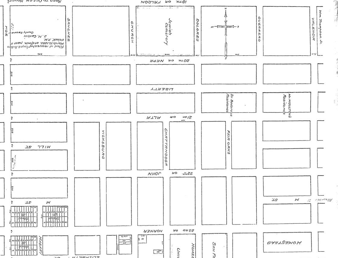
The auction map names Hill and Valencia but leaves the block containing the future property without individual lot lines.

North-up crop from the Mission Table Lands auction map. The future home site is marked in the half-block south of Hill.
A Mission Table Lands auction map shows Hill at ValenciaMaurice Dore & Co.’s auction map shows Hill between Guerrero and Valencia as well as farther west at Noe. The block south of Hill has no lot lines or building symbols on this sheet. It marks Mr. Moulton’s residence north of 21st.The dashed outline uses Hill and Valencia for the estimated site. The auction map draws individual parcels in other blocks.

County Recorder, Book E, p. 44 San Francisco History Center map guide

Scattered buildings, the Valencia rail line and nearby slopes shaped the area before the present property was developed.

A. W. Chase’s original 1867 survey with the hills west of Valencia, street and railroad lines, scattered buildings, and the present lot vicinity marked.
A. W. Chase surveys the land approaches to San FranciscoChase prepared this 1:10,000 Coast Survey sheet for the U.S. Army Engineer Department. Survey T-1059 shows the lower slopes meeting the Mission street grid, with houses scattered near roads and a rail line running along Valencia.Approximate vicinity estimated from Mission Dolores, the Valencia rail alignment and the surrounding blocks.

Full 1867 NOAA survey sheet 1869 peninsula chart

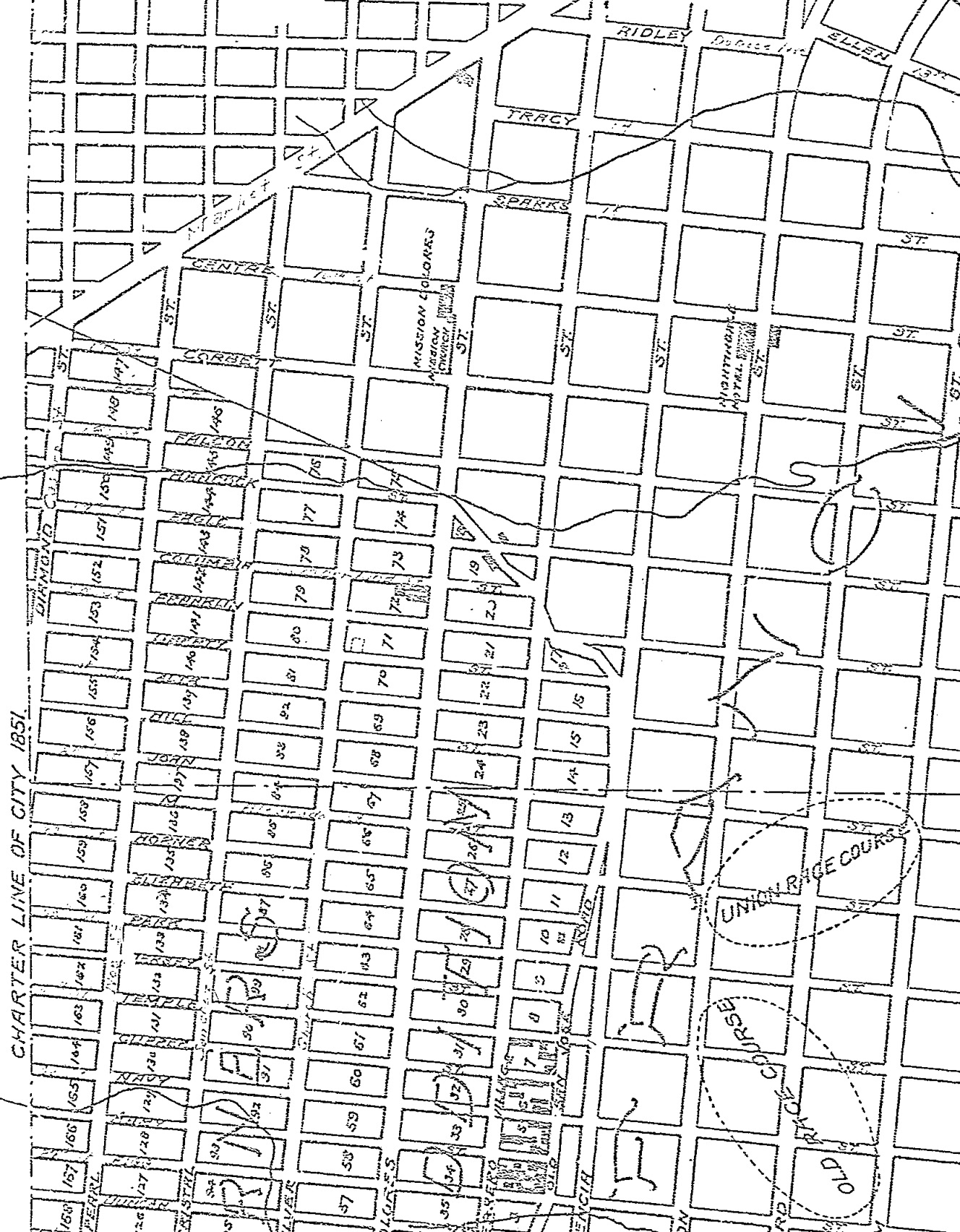
An old city charter boundary crossed the larger block containing today’s Hill Street property.

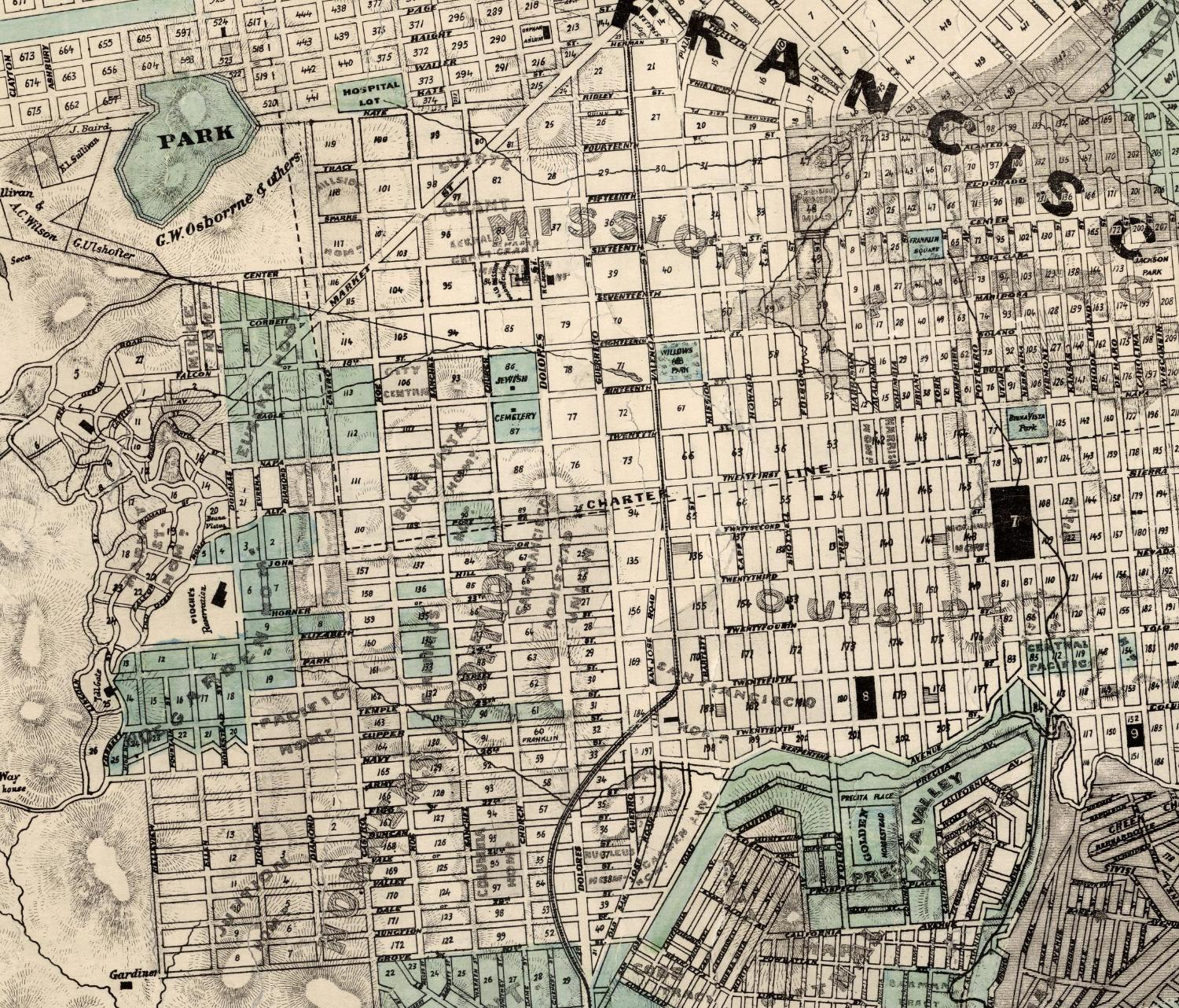
1868 Outside Lands map detail with numbered Mission blocks, the diagonal charter line, and the estimated location of the present lot.
The city plots the old charter line across the future blockThe Board of Supervisors’ Outside Lands map includes the Mission street grid as well as the public reservations it was made to document. The dashed 1851 charter line crosses the block between 21st, 22nd, Guerrero and Valencia. The short eastern stretch of Hill Street is absent from this view.Approximate position within the 21st-to-22nd Street block, based on the modern offset from Valencia and 21st Street.

Full map Compare the 1876 charter-line survey

The Mission’s street grid appeared on maps while the surrounding terrain and waterways remained prominent.

George Goddard’s 1869 Mission grid and hachured hills, with the vicinity of the present lot marked near Valencia.
George Goddard maps the street grid against the terrainGoddard draws the old charter line and the Valencia route across a Mission grid that still shares the page with creek channels and hill hachures. The plan shows Hill Street farther west. The present lot is along the eastern edge of the block between modern 21st and 22nd.Approximate position within the block, west of Valencia and about halfway from 21st to 22nd Street.

Full map Compare the terrain on the Coast Survey

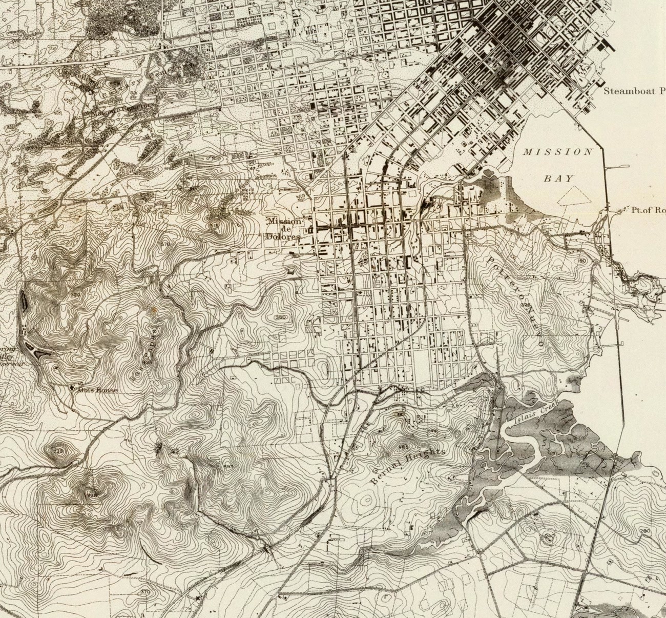
The Mission grid was much less densely represented than downtown San Francisco on this peninsula-wide chart.

1869 Coast Survey peninsula chart detail showing the Mission grid, Mission Bay, the surrounding hills and the present lot vicinity.
The Coast Survey charts the Mission at the scale of the peninsulaThe peninsula chart puts the newer Mission street grid between the contours of the western hills and the remaining shoreline of Mission Bay. Its scattered building symbols and the much denser downtown grid give a sense of how far development had reached.Approximate position from the georeferenced chart, checked against the Mission church and Valencia street alignment.

Full map Georeferenced chart Chart provenance

1870s

Hill Street at the old charter line

An 1871 subdivision map advertised land on the north side of Hill. In 1876, two atlas plates placed the 1851 charter line close to the future lot on the south side. In August 1879, a real estate circular reported that a tract extending 405 feet up Hill from Valencia had gone unsold. It included the future four-flat lot.

1871 subdivision record 1876 atlas August 1879 land listing

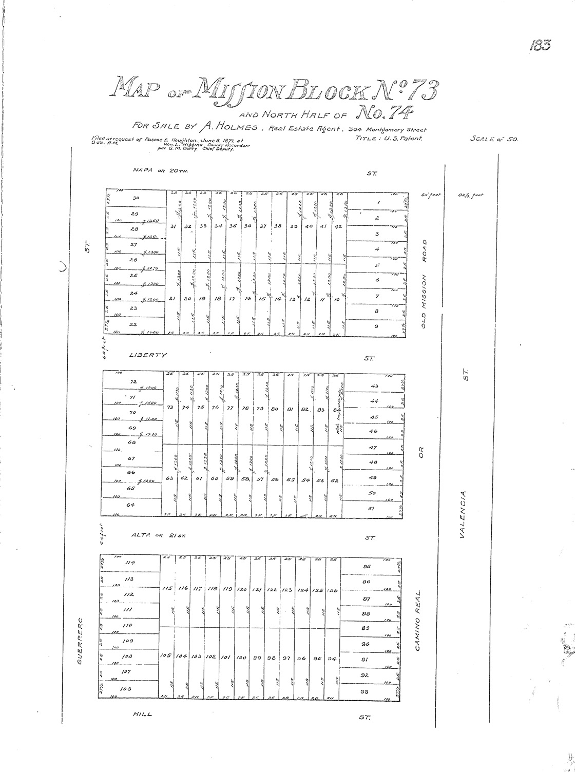
A. Holmes advertises lots north of Hill Street

Roscoe E. Houghton filed a plat advertising Mission Block 73 and the north half of Block 74. The lots on Hill face the site of the future flats from across the street. The map also names Camino Real, or Old Mission Road, immediately west of Valencia.

A. Holmes plat numbered 183, with Hill at the bottom and the future 15–21 Hill Street parcel marked across the street.
The sale plat numbers lots on the north side of HillThe city scan shows the printed page number 183. The map guide lists the plat as folio 87, and the National Register nomination cites page 163.The dashed outline projects the present site into the blank margin across Hill from the limits of the sale plat.

County Recorder, Book B, p. 183 San Francisco History Center map guide, folio 87 Liberty Street National Register nomination

The block west of Valencia appeared on city guide maps before the Irving Institute occupied the corner.

1873 Bancroft map showing the street grid and shaded blocks around Valencia. A circle marks the approximate site.
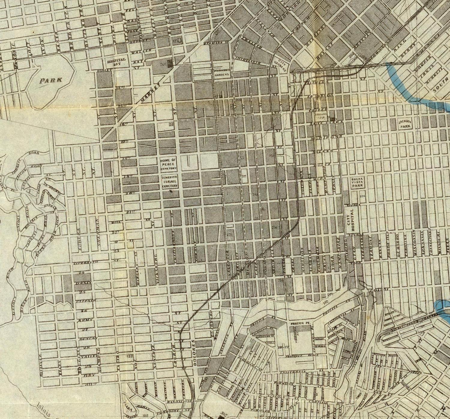
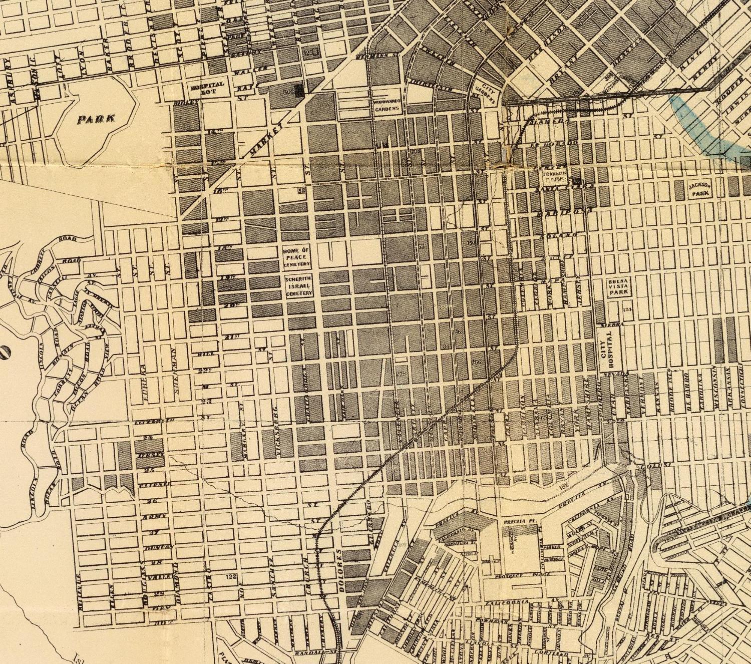
Bancroft’s guide shades the blocks beside ValenciaThe 1873 official guide map shows shaded blocks along Valencia and larger unshaded areas to the west. The same sheet locates Woodward’s Gardens to the north and the Jewish cemeteries west of Dolores. Its block shading cannot establish the occupancy of a particular lot.Approximate position inferred between Guerrero and Valencia, south of the estimated Hill Street continuation.

Full map

The former city charter line passed close to the south side of Hill Street, near the future property.

1876 · Hill Street and the 1851 charter line with the present lot marked.
An atlas traces the 1851 charter line near Hill StreetHumphreys & Co., Plat 35. The 1851 charter boundary crosses the sheet near the south edge of Hill Street. The atlas labels Guerrero, Hill and Valencia.The present lot is projected from the mapped Hill and Valencia corner using the block width.

David Rumsey Map Collection · Plat 35

The larger block between 21st and 22nd included the future building site near Valencia.

1876 · Mission Block 74 with the present lot marked.
An atlas maps Mission Block 74 between 21st and 22ndHumphreys & Co., Plat 40. The companion plate shows the full block between 21st and 22nd Streets and the charter line through its north half.The present lot is projected from 21st, 22nd and Valencia. Hill Street is drawn on the companion plate above.

David Rumsey Map Collection · Plat 40

A tract including the present lot goes unsold

Thomas Magee’s San Francisco Real Estate Circular marked a property at the southwest corner of Valencia and Hill as unsold. The description gives 114 feet south along Valencia and 405 feet west along Hill, with a 25 × 100 ft piece excluded at the rear. The present four-flat lot lies 85 to 135 feet west of the corner, within that larger tract. The listing gives no owner’s name.

August 1879 real estate circularAugust issue masthead1876 map of Mission Block 74

The Mission Addition sales table marks the southwest corner of Valencia and Hill as no sale.
Mission Addition sales, July 26–August 25, 1879. The Hill Street entry appears near the bottom.

1880s

Schoolrooms come to Hill Street

Valencia got the Mission District’s first cable car line in 1883. A boarding school was operating at Hill and Valencia by 1881, and the 1883 directory lists Irving Institute at that address. In 1885, John C. Gouldin leased the corner tract to the school’s principal, Edward B. Church. By 1889, schoolrooms extended onto the future four-flat lot.

Mission District history, Valencia cable cars 1885 construction notices 1889 school site

Edward and Frances Church run the Irving Institute

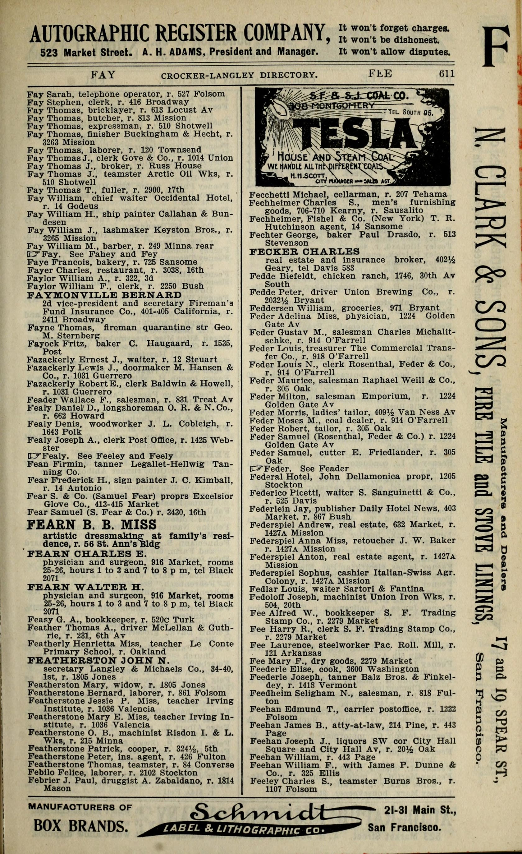
The 1896 directory records Edward as principal and Frances as vice-principal, both residing at the Valencia Street campus. It also names Edward assistant rector of St. John’s Episcopal Church. Born September 7, 1844, in Greenville, Mississippi, he studied at Washington University in St. Louis and earned degrees from Kenyon College in 1867 and 1870. In San Mateo, he headed St. Matthew’s School and Laurel Hall. His Kenyon entry also lists a year as editor of the Pacific Churchman. He retired from the school’s active management in 1902 and died in Pasadena in 1904, according to a 1913 family history.

Frances was born in Illinois in December in the 1840s. The two family histories and a genealogical compilation give different years or days for her birth. She married Edward on August 12, 1869, shared management of the school and was named vice-principal in the 1896 and 1898 directories. An 1892 Blue Book advertisement says she had studied fine art in Europe and supervised drawing and painting at the school. She died at Paso Robles in 1906. The Examiner published her death notice on September 2, page 2. The 1915 diocesan history credits Mr. and Mrs. George H. Kellogg with running the school after Edward retired, while local historian Woody LaBounty describes Frances as principal until 1906. George was Frances’s brother.

1896 home and school listingsKenyon Phi Beta Kappa catalogue, p. 511913 Church genealogy, p. 208Thompson family genealogyKellogg family and obituary citation1915 diocesan history, p. 1211892 school descriptionFamily portraits and school history1892 school description · scan1892 school description · original

1896 home and school listings

CHURCH EDWARD B. REV.,

Church Frances A. Mrs., vice-principal Irving Institute, r. 1036 Valencia

Directory transcription
Kenyon Phi Beta Kappa catalogue, p. 51, PDF page 55
1913 Church genealogy, p. 208
Kellogg family and obituary citation, PDF page 2
Kellogg family and obituary citation, PDF page 4

The map places the future property in the growing Mission district before the earliest detailed schoolroom plan found.

1881 Bancroft guide map showing blocks and rail routes in the Mission, with a circle near Hill and Valencia.
Bancroft republishes the Mission guide as the district growsThe 1881 edition again shades the block west of Valencia. Its view is useful alongside the 1876 atlas, which gives local property dimensions, and the 1889 Sanborn, which shows the Irving Institute schoolrooms.Approximate position in the shaded block near Valencia, using the street grid. The shading covers the block and gives no individual building footprints.

Full map 1876 lot dimensions 1889 building footprints

A boarding school operates at the Hill and Valencia corner

The 1881 city directory lists Mary B. Cochrane as principal of a boarding school at 1036 Valencia. The 1879 directory places Cochrane’s Boarding School at 24th and Shotwell. By 1883 the directory lists Irving Institute at 1036 Valencia, with Cochrane as associate principal under Edward B. Church. The listings show continuity at the corner campus. They leave open when the school took its new name and whether its rooms already reached the present 15–21 Hill lot. The 1889 Sanborn is the earliest map found that places schoolrooms on that ground.

1879 directory, p. 209 1881 directory, p. 235 1883 directory, p. 318 1883 school listing, p. 583 1889 schoolroom footprints

The 1881 directory lists Mary B. Cochrane as boarding school principal at 1036 Valencia.
1881 directory, p. 235
The 1883 directory lists Cochrane as Irving Institute’s associate principal at the same address.
1883 directory, p. 318

G. R. Lang completes the Geddes-Fuller house at No. 25

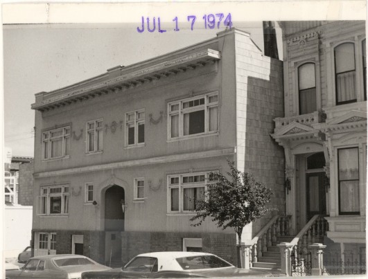
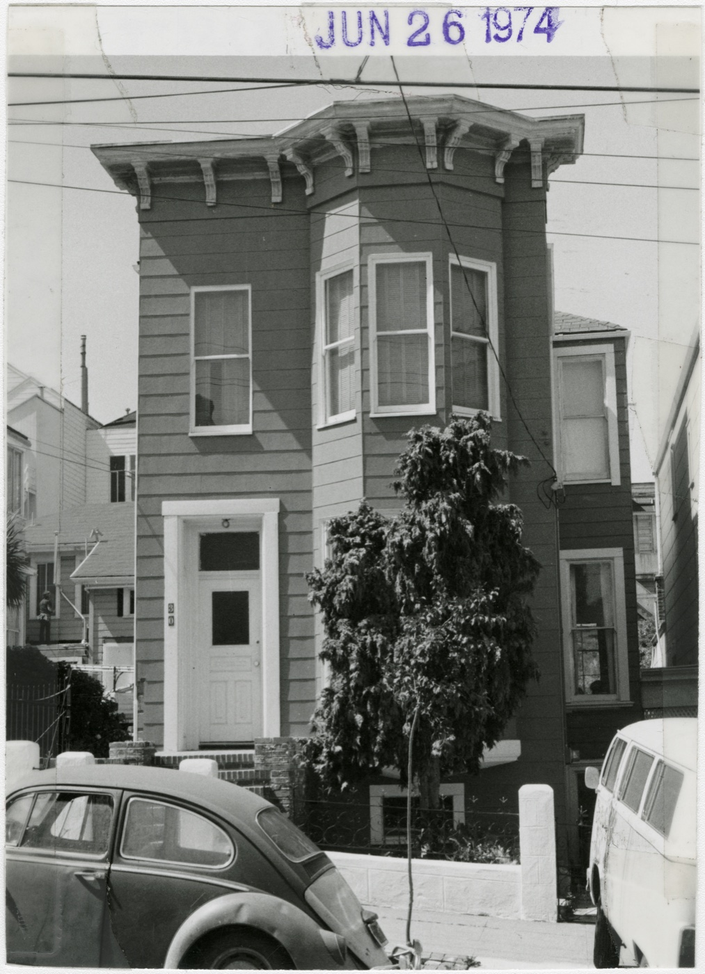
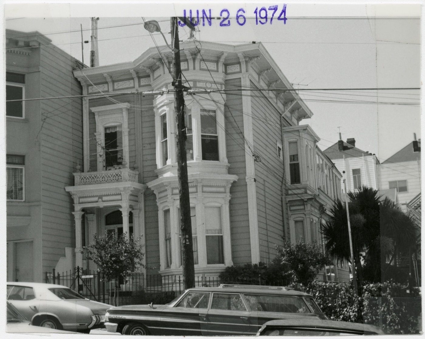
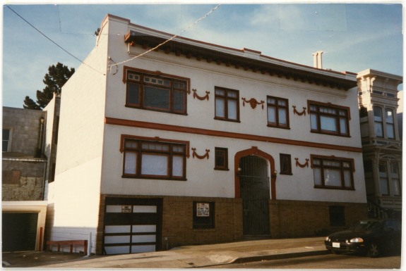
The Victorian at No. 25 stands directly west of the building and appears at the right edge of the 1974 assessor photograph. The Victorian Alliance credits Charles Geddes with the design and records that G. R. Lang built it for Sherwood W. Fuller for $4,000. Fuller lived across the street at the address then numbered 26, where the 1882 directory lists him as a clerk for Heywood Bros. & Co.

Victorian Alliance house history1882 city directory1974 assessor photograph

The 1974 assessor photograph of 15–21 Hill and the edge of No. 25.
1974 assessor photograph; No. 25 appears at the edge.

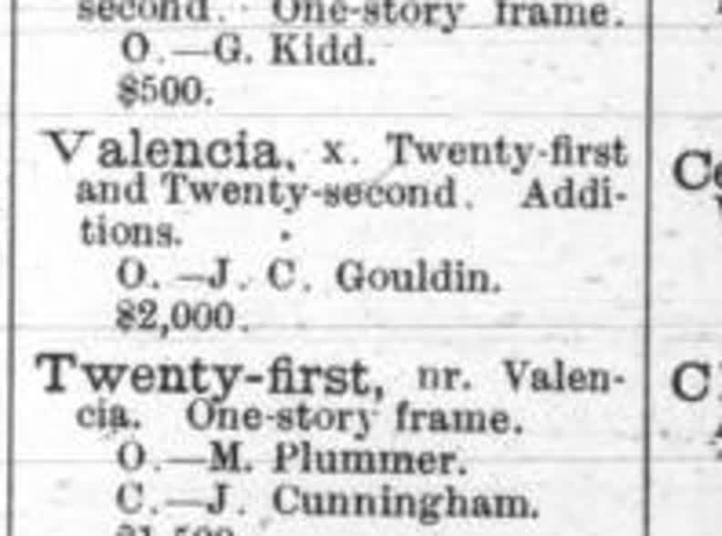
The building press reports Gouldin’s additions on Valencia

The California Architect and Building News lists $2,000 in additions on Valencia between 21st and 22nd and identifies J. C. Gouldin as owner. That stretch includes the later Irving Institute address. The notice gives neither an address number nor a side of Valencia.

June 1883 Building Intelligence, p. 1041885 work at Hill and Valencia

The journal lists J. C. Gouldin as owner of $2,000 in additions on Valencia between 21st and 22nd.
Building Intelligence, June 1883, p. 104.

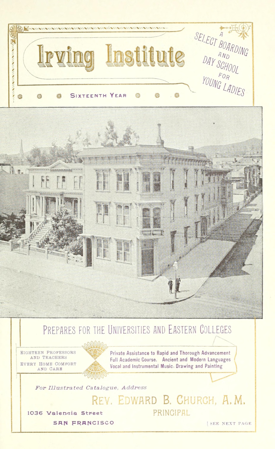
Irving Institute teaches and houses girls at Hill and Valencia

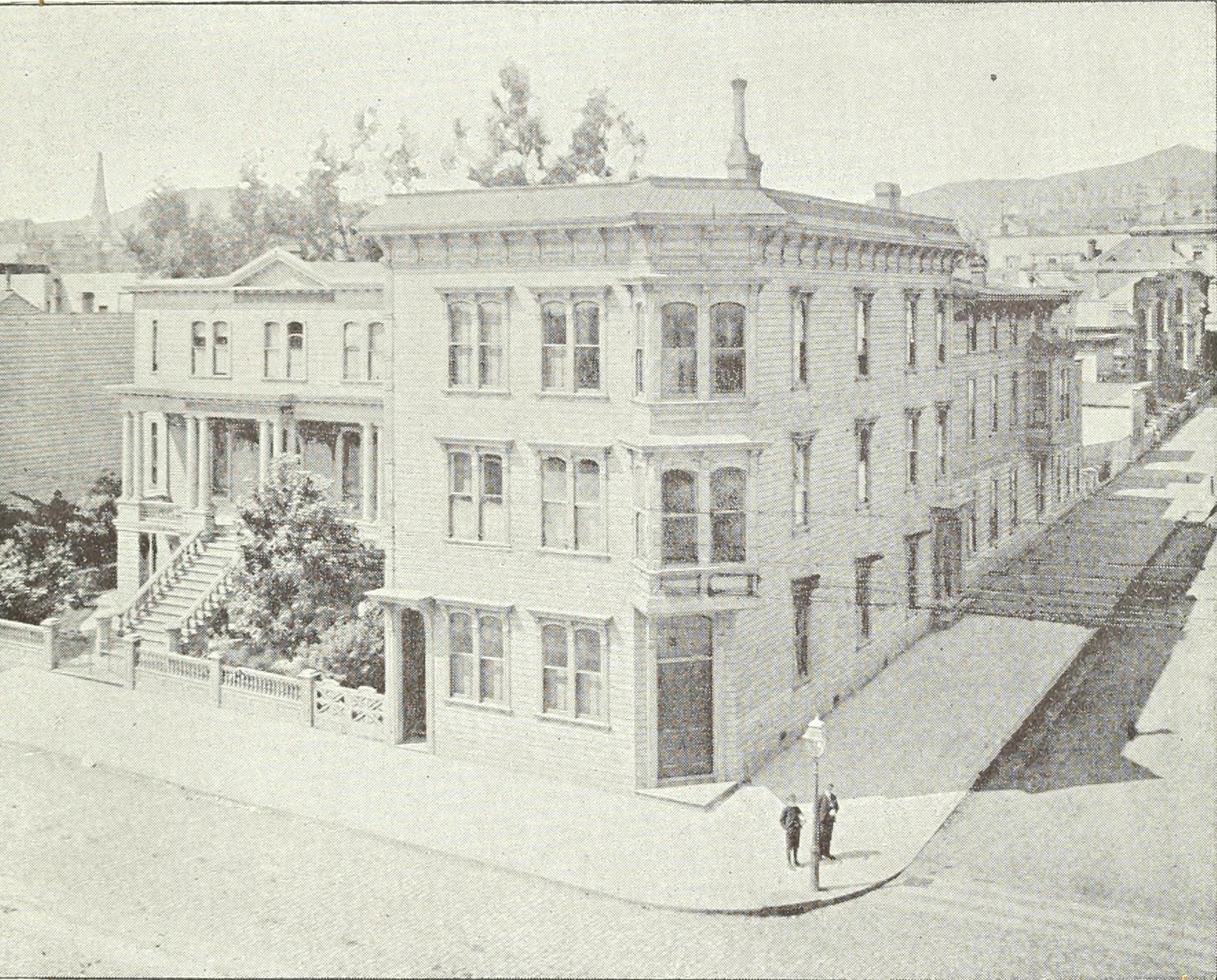
Irving Institute at Hill and Valencia, with its wing extending uphill along Hill Street.
Irving Institute at Hill and Valencia, 1892The school’s Hill Street wing extended toward the present lot. San Francisco Blue Book, 1892.

The 1884 directory places the girls’ boarding and day school at 1036 Valencia, on the southwest corner of Hill. The directories also name teachers and other residents at that address. The 1889 Sanborn shows that some schoolrooms along Hill stood on the future 15–21 Hill lot. The main building stood closer to Valencia. A March 1885 lease abstract links principal Edward B. Church to the exact corner tract. In December 1885, the building trade press reported two projects by J. C. Gouldin at and near the corner. In 1888 the directory reported more than 100 pupils and room for 60 boarders. In 1895 it reported more than 125 pupils, with 60 to 70 studying music. The school offered ancient and modern languages, drawing, painting, a college preparatory program and a kindergarten.

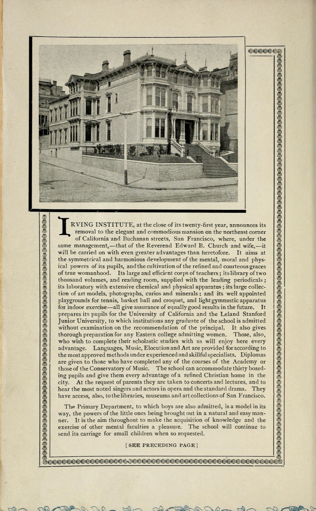
The school announced its move to 2126 California Street in the 1898 directory. The advertisement called it the end of the school’s twenty-first year. The 1915 Episcopal diocesan history gives 1882 as the year it took the Irving Institute name.

1884 city directory1889 Sanborn, plate 801888 city directory1895 city directory1898 move announcementEpiscopal diocesan history, p. 121People who lived at the school1889 Sanborn, plate 80 · scan1898 move announcement · scan

1884 city directory

Church Edward B. Rev., principal Irving Institute, r. 1036 Valencia

Directory transcription
1895 city directory

IRVING INSTITUTE .- A collegiate boarding and day school, located at 1036 Valencia, where young ladies are prepared for the universities, or graduated on completing its full academic course. The build- ings afford accommodations for fifty boarding pupils. The attendance of the past year exceeded one hun- dred and twenty-five. It is now in its eighteenth year, and has an alumnæ association of nearly one hun- dred. Its

Directory transcription

Teachers and staff lived at Irving Institute

The directories use 1036 Valencia for the school buildings at the southwest corner of Hill. The main building stood at the corner. The school wing ran west onto the present lot. The residential listings identify the campus and leave the individual rooms unlocated.

  • Mary B. Cochrane. Taught at Irving Institute. The 1889 directory lists her at Van Ness Seminary with a Hyde Street residence. 1884, 1889.
  • Nellie M. Downs. Worked as an operator for the Gold and Stock Telegraph Company. 1885.
  • Helen A. Handy. Taught at Irving Institute. 1885, 1886.
  • Mary P. Sumner. Taught at Irving Institute. She was still teaching there in 1893 while living on Turk Street. The 1894 directory lists her as a music teacher living on Vallejo Street. 1885, 1886, 1890, 1891, 1892, 1893, 1894.
  • F. E. Curtis. Worked as the school’s matron. 1886.
  • Isabella D. Rodgers. Taught and lived at the school in four consecutive editions. 1889, 1890, 1891, 1892.
  • Evelyn Sperry. Taught at the school. 1889.
  • Nellie Vaughan. Taught at the school. The same page separately lists a nurse named Nellie Vaughan. 1889.

Ella Maria Pinkham Elma D. Ludington and Regina Garel School footprint on the 1889 Sanborn

Elma D. Ludington and Regina Garel teach and live at Irving Institute

The 1885 directory lists Mrs. Elma D. Ludington as an Irving Institute teacher living at 1036 Valencia. The 1892 edition lists Miss Regina Garel with the same occupation and residence. The second name is sometimes transcribed as Garey.

1885 city directory, p. 7431892 city directory, p. 598

1885 city directory, p. 743

Ludington Elma D. Mrs., teacher Irving Institute, r. 1036 Valencia

Directory transcription

John C. Gouldin leases the corner tract to Irving Institute’s principal

The Daily Alta California lists a lease from J. C. Gouldin to E. B. Church for 114 × 135 feet at the southwest corner of Valencia and Hill. The lease ran for nine years and four months at $150 a month. Edward B. Church was principal of Irving Institute, already listed at the corner in 1884.

The dimensions match the tract in the later Hibernia release and include the full frontage of today’s 15–21 Hill Street. March 5 is the publication date. The original lease and its execution date have yet to be located.

Daily Alta California, March 5, 1885, p. 2 Directory naming Church as principal 1889 Sanborn school footprint John Gouldin’s biography

Gouldin commissions construction at Hill and Valencia

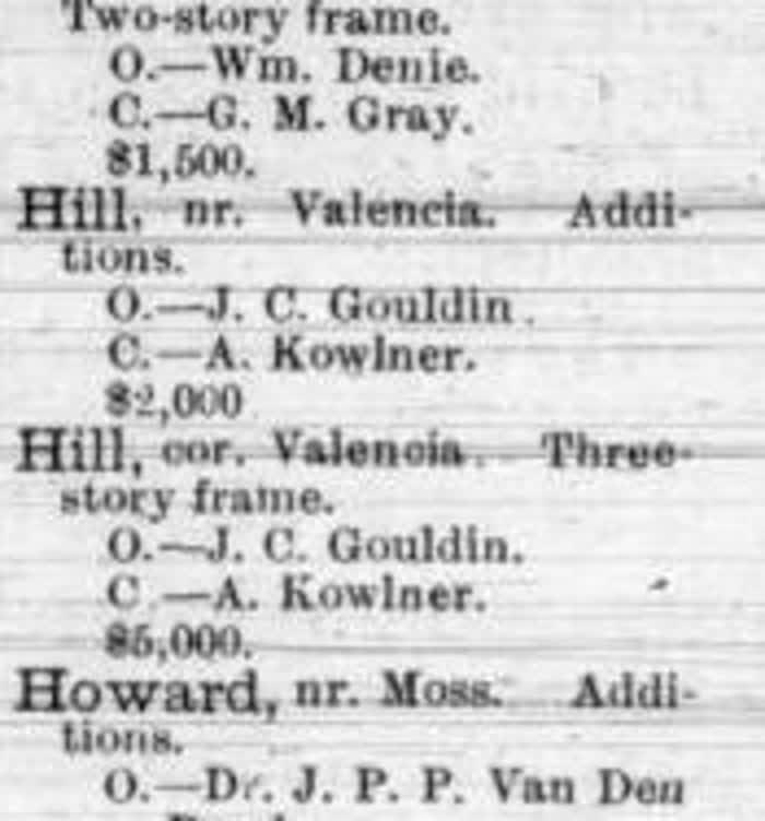
The California Architect and Building News lists a $5,000 three-story frame building at the corner and $2,000 in additions on Hill near Valencia. Both notices list J. C. Gouldin as owner and A. Kowlner as contractor. Irving Institute already used the southwest corner. The 1889 fire insurance map shows three-story frame sections and schoolrooms on the tract. The notices fit that development, although they give no house numbers or floor plans to match the individual jobs to the map.

December 15, 1885 Building Intelligence, p. 214Irving Institute at the corner1889 map1893 mortgage release

Two Hill Street building notices list J. C. Gouldin as owner and A. Kowlner as contractor.
Building Intelligence, December 15, 1885, p. 214.

Ella Maria Pinkham teaches on campus and later leads Irving Institute

Ella was born in Reading, Massachusetts, on March 9, 1848, to Peter Ebenezer Pinkham and Harriet Louisa Parker, according to Charles Nelson Sinnett’s 1908 family history. Her father worked in carpentry, trade and ranching and lived in Oakland and St. Helena. An Oakland directory lists Ella teaching at Mills Seminary in 1880–81. An earlier directory names an Ella Pinkham among the assistants at Oakland’s Durant School in 1877–78.

San Francisco directories place Ella at 1036 Valencia as an Irving Institute teacher from 1886 through the 1897 edition. Sinnett names English and history as her subjects. By 1907 she was principal at the California Street campus. The 1909 and 1911 school listings name her as principal at 147 Presidio Avenue. A later directory lists an Ella M. Pinkham teaching and living at 2402 California Street in 1922.

1886 residence 1892 residence 1897 residence 1908 Pinkham family history, p. 143 1877–78 Durant School staff 1880–81 Mills Seminary listing 1907 school listing 1909 Presidio Avenue listing 1911 school listing 1922 teacher listing

The 1886 directory lists Ella M. Pinkham as a teacher residing at 1036 Valencia.
Ella M. Pinkham at 1036 Valencia, 1886 city directory.

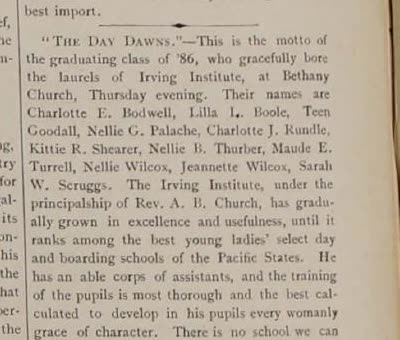
Eleven Irving Institute students graduate at Bethany Church

The Golden Gate names Charlotte E. Bodwell, Lilla L. Boole, Teen Goodall, Nellie G. Palache, Charlotte J. Rundle, Kittie R. Shearer, Nellie B. Thurber, Maude E. Turrell, Nellie Wilcox, Jeannette Wilcox and Sarah W. Scruggs. The report gives no boarding addresses. Nellie Wilcox appears to have been Jeannette’s sister Mary E. Wilcox, a pianist. The marriage index identifies Mary E. as Arba J. Padgham’s bride in 1889, and the Los Angeles Herald notice names the bride Nellie.

Four years later, the city directory lists Scruggs and Jeannette Wilcox as teachers living at the school at Hill and Valencia.

Golden Gate, May 22, 1886, p. 4 Wilcox family research and marriage citations

An 1886 newspaper clipping lists eleven graduates of Irving Institute, including Jeannette Wilcox and Sarah W. Scruggs.
Golden Gate, May 22, 1886, p. 4.

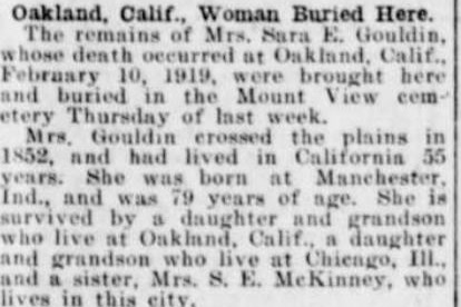
John and Sarah Gouldin record an agreement to live apart

The Daily Alta California reported that an agreement between J. C. and Sarah E. Gouldin, described as husband and wife, was placed on record with the Alameda County Recorder. John agreed to pay Sarah $50 a month for life and another $10 a month once a building on Valencia Street was finished. The paper reports that he made a will providing her one-third of his estate if she survived him.

The article gives no street number for the building. The 1887 and 1888 directories listed Sarah as a widow, although the funeral notice dates John’s death to 1891.

Daily Alta California, September 1, 1887, Oakland news Sarah Gouldin’s biography

John Gouldin borrows $6,000 from Hibernia on the corner tract

The Daily Alta California lists a two-year mortgage at six percent to Hibernia Savings and Loan Society. The 135 × 114 ft tract on the west side of Valencia began 114 feet north of 22nd Street and reached Hill. Hibernia’s later release lists two $6,000 mortgages on the same tract. The newspaper gives no book and page to distinguish which one it reported.

Daily Alta California mortgage list Hibernia’s 1893 release

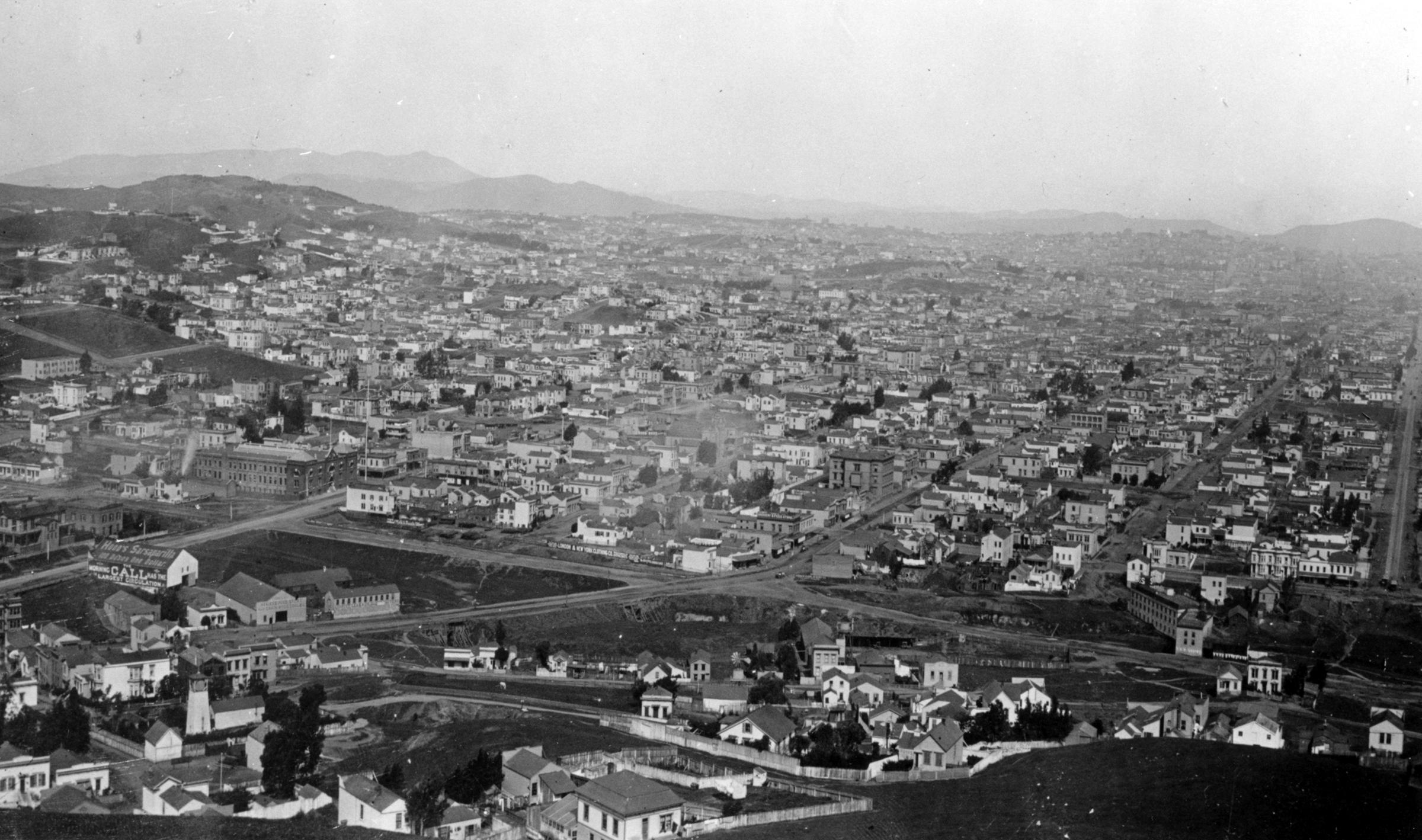
A photograph from Bernal Heights shows the Mission during the Irving Institute years

The view looks northwest over the street grid when Irving Institute occupied the Hill and Valencia tract. The Army Street bridge over Precita Creek, the old St. Luke’s Hospital campus, and the Bancroft Library building anchor the foreground. Houses and shops give way to open ground toward the hills. The individual Hill Street buildings remain unidentified in this view.

Full-resolution photograph Behrman collection copy · GOGA 35346 Scan shared by Todd Lappin, courtesy of the Bernal History Project · CC BY-NC 2.0 1889 map of the Hill Street schoolrooms

The Mission viewed northwest from Bernal Heights in 1888.
1888 Mission panorama. Scan shared by Todd Lappin, courtesy of the Bernal History Project, CC BY-NC 2.0.

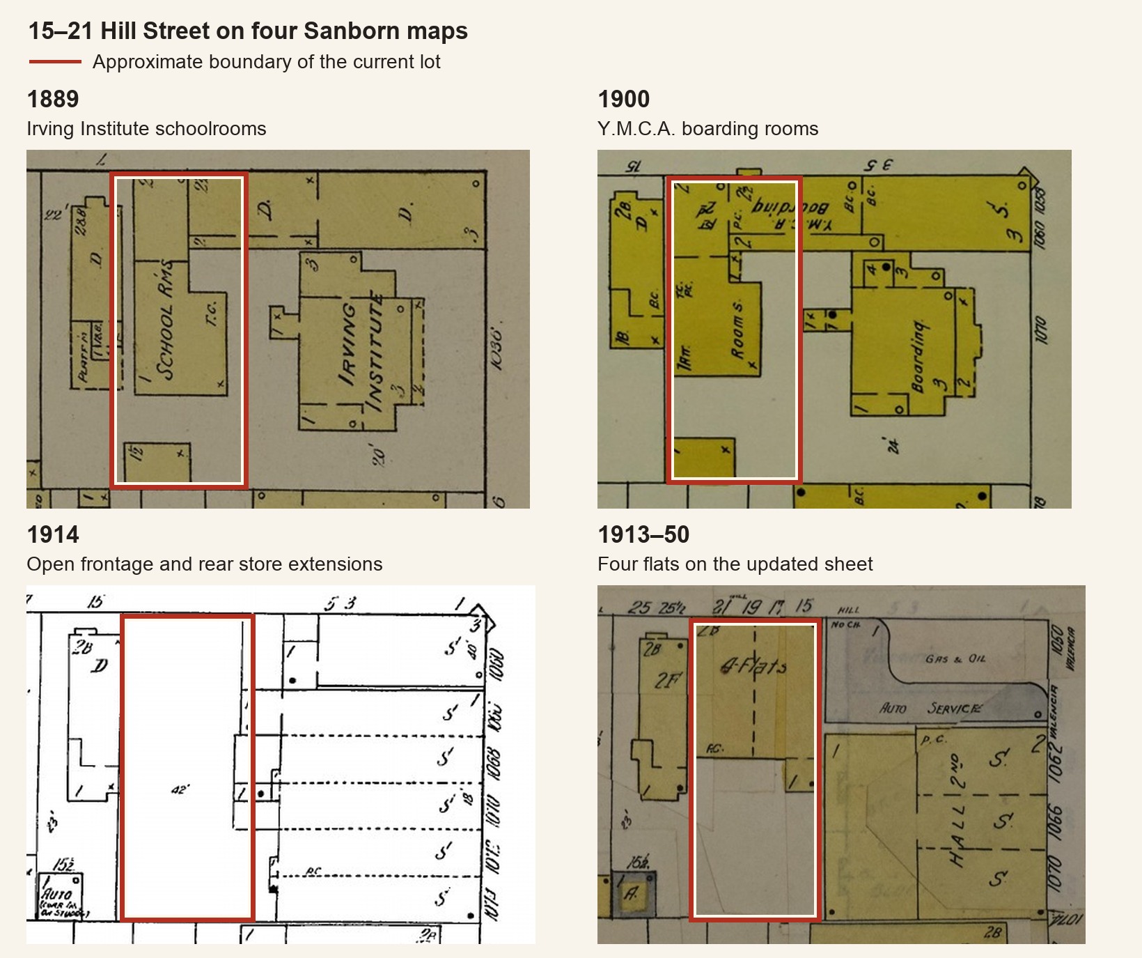
The lot changed from schoolrooms and boarding rooms to open frontage before the present building was completed.

Four fire insurance maps with approximate outlines of the present lot, showing schoolrooms in 1889, boarding rooms in 1900, open frontage in 1914 and four flats by 1950.
Four Sanborn maps trace the site from schoolrooms to flatsThe red rectangles estimate the modern lot using its 50-by-114-foot dimensions and the southwest Hill and Valencia corner on each sheet. The comparison shows schoolrooms in 1889, boarding rooms in 1900, the largely open lot in 1914, and the building on the updated sheet.

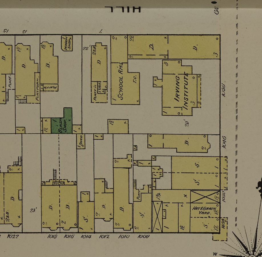
Irving Institute occupied part of the land where 15–21 Hill Street now stands.

1889 fire insurance map showing the Irving Institute and schoolrooms between Hill, Valencia and 22nd.
Irving Institute’s schoolrooms extend onto the future lotThe schoolrooms are at the center. Hill runs along the top and Valencia along the right. Sanborn plate 80, Library of Congress.The modern lot is projected from the Hill and Valencia street lines and the measured 50 × 114 ft boundary.

Sanborn maps the Irving Institute campus on plate 80

1890s

Irving Institute moves to California Street

Electric streetcars spread along Mission and Guerrero as the blocks around Hill filled with homes and shops. Irving Institute reported more than 125 pupils in 1895. In 1898, the school announced its move to California Street, leaving the Hill Street wing behind.

Mission District history, electric streetcars Irving Institute move

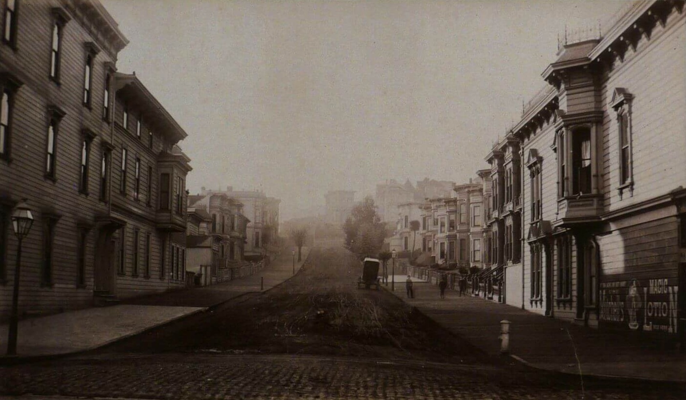
The view looks up the same stretch of Hill Street where the present building would later be constructed.

An albumen print looking west up Hill Street from Valencia, with the Irving Institute building on the left, a carriage in the road and houses on the right.
A photograph looks west up Hill Street from Valencia The streetlamp, carriage and buildings match the city’s Liberty-Hill district photograph, which the report dates to the 1890s and credits to Greg Garr. Globus Rare Books & Archives catalogs the Samuel Parsons album as circa 1880s and identifies the mount as Tobey & McCullough. The year of exposure is uncertain. Approximate frontage of the present lot, 85 to 135 feet west of Valencia. The 1889 Sanborn map places the Irving Institute’s Hill Street wing on this stretch. Samuel Parsons album, item PB61City district report1889 Sanborn map1892 school photograph

Sarah W. Scruggs and Jeannette Wilcox return as resident teachers

The 1890 city directory lists Sarah W. Scruggs as a teacher and Jeannette Wilcox as a music teacher. Both entries give their residence as the school’s address, 1036 Valencia. The 1890, 1891, 1892, 1893, 1894 and 1895 directories list Sarah at the school. Their rooms have yet to be located within the school complex.

Wilcox went on to teach vocal music from her residence on Pierce Street. The April 1896 California Musical Journal reported that the contralto drew encores at Richard J. Ferrer’s March 12 concert at Odd Fellows’ Hall.

Their 1886 graduation Sarah in the 1890 directory Jeannette in the 1890 directory Sarah in the 1892 directory Sarah in the 1893 directory Sarah in the 1894 directory Sarah in the 1895 directory Wilcox’s 1896 vocal teaching listing California Musical Journal, April 1896

Jessie Pier and Mary E. Featherstone teach at Irving Institute

The 1894 city directory lists both sisters as principals of Rose Terrace School and living at 1230 24th Street. The 1895 and 1897 directories list both sisters as Irving Institute teachers living at 1036 Valencia. The 1898 directory still uses that address for them in the year the school moved. By 1910 they shared a home in Los Angeles with their sister Sarah, where all three taught in private schools.

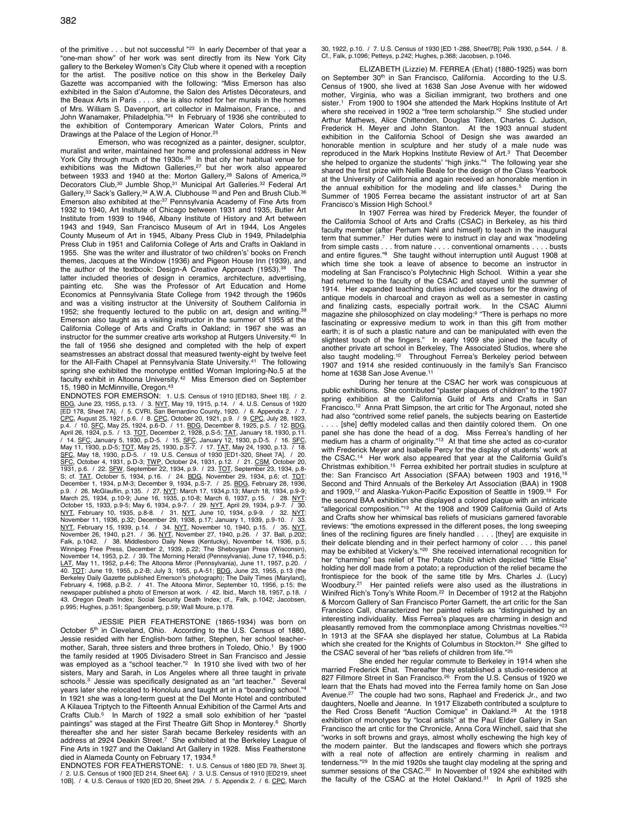
Jessie was born October 5, 1865, in Cleveland, Ohio, and grew up in Toledo, where her mother Sarah was a schoolteacher. She taught art in Los Angeles and at a Honolulu boarding school. Her Kilauea Triptych was entered in the federal copyright catalogue and displayed at the 1921 Carmel Arts and Crafts Club exhibition. The Carmel Pine Cone advertised a Monterey show of her pastels for April 3–8, 1922. She exhibited in Berkeley in 1927 and Oakland in 1928, and died in Alameda County on February 17, 1934.

Both sisters in the 1895 directory Both sisters in the 1897 directory Both sisters in the 1898 directory 1894 city directory, p. 5351898 city directory, p. 611Art historian Robert W. Edwards, p. 3821921 copyright catalogue, entry 15551922 Monterey exhibition notice

1898 city directory, p. 611
Art historian Robert W. Edwards, p. 382, PDF page 2

Teachers and matrons live at 1036 Valencia through the 1890s

These directory entries give 1036 Valencia as the person’s residence. Several list a subject or a job outside the school.

  • Maude M. Edwards. Taught art at Irving Institute. 1890.
  • Margaret Clayes. Taught at the school. 1891.
  • Julia Megguier. Taught at the school. 1893.
  • Eva Pogue. Taught at the school. 1893, 1894, 1895.
  • Katherine H. Waterman. Taught at the school. The 1893 entry spells her first name Catherine. 1893, 1895, 1896.
  • Sarah L. Dole. Taught at the school. 1894.
  • Kate B. Lake. Worked as the school’s matron. 1894.
  • Marian M. Froehlich. Taught drawing at the school. 1895.
  • Lois Hall. Taught music at the school. 1895, 1896.
  • K. C. Stone. Taught at the school. 1895.
  • Lettie A. McDonald. Taught at the school. 1896.
  • Florence A. Smart. Taught at the school. 1896.
  • Alice Ramsay. Was principal of the Noe Valley Kindergarten while residing at the Irving Institute address. 1896.
  • Louise Lucas and Maria L. Lucas. The directory lists Louise in 1896 and Maria L. in 1897, both as resident teachers. The names may belong to one person. 1896, 1897.

The directories associate four other staff members with 1036 Valencia and leave their residence unclear. Mary W. Newlands and Edith Lilia were listed as domestics, Ida Colby as matron and Ada Davies as nurse.

Mary W. Newlands, 1891 Ida Colby, 1892 Edith Lilia, 1894 Ada Davies, 1895

The 1894 directory lists Kate B. Lake as the matron and gives her residence as 1036 Valencia.
Kate B. Lake at 1036 Valencia, 1894 city directory.

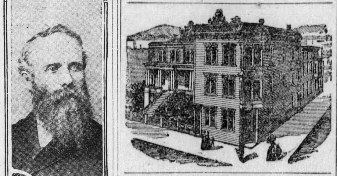
The school’s Hill Street wing extended toward the land occupied by the present building.

1890 newspaper illustration of Irving Institute at Hill and Valencia beside a portrait of its principal, Edward Bently Church.
An Examiner sketch shows the school wing uphill from ValenciaThe three-story corner block with its angled bay, the raised porch to the left, and the lower wing along Hill also appear in the 1892 photograph. The 1889 Sanborn puts part of the wing and the labelled schoolrooms on the future four-flat lot. San Francisco Examiner, August 31, p. 2, reproduced by San Francisco Story.

1889 schoolroom footprint 1892 photograph from the corner

John Copley Gouldin, the school’s landlord, dies in San Francisco

The San Francisco Call identifies John C. Gouldin as a native of Manchester, England, aged 71 years, four months and two days. The reported age places his birth in May 1820. His funeral was announced for September 8 at Trinity Church at Post and Powell. The notice gives no cemetery.

The Society of California Pioneers lists a John C. Gouldin who arrived in California July 15, 1849. In 1877–78, the Oakland directory puts John C. Gouldin on Fruit Vale Avenue near East 13th Street. The 1880–81 directory calls him a commercial agent. In February 1891, the Alta reported that he had lived on a roughly ten-acre tract by Fruitvale station for nearly twenty years and had sold it to the Bassett brothers for $25,000. In her 1948 note on a painting of the family’s Fruitvale house, Sarah’s daughter Carrie Wilson called him her father and supplied his middle name.

John leased the Hill and Valencia tract to Irving Institute’s principal. The 1891 report on his will identifies the tract as the principal asset in his estate. A later newspaper abstract reports a November 13, 1891 decree distributing interests in separate Millbrae Villa land from his estate to T. W. Gouldin and Sarah E. Gouldin. The published Millbrae abstract gives no disposition of the Hill tract. The 1894 block book names Sarah there.

The Call identifies Thomas Gouldin, an England-born man who died in 1901, as John’s brother. Thomas is a plausible match for the T. W. in the Millbrae abstract. In 1905 the Sacramento Star identified Sarah as executrix of Thomas’s estate and Edward B. Church as its previous executor.

Call death and funeral notice, September 8, 1891 Society of California Pioneers roll 1877–78 Oakland directory 1880–81 Oakland directory 1891 report on his Fruitvale home Carrie Wilson’s note and the painting Millbrae probate abstract, May 19, 1894 Thomas Gouldin’s 1901 death notice Sarah and Church in the 1905 probate report

John Gouldin’s will puts the Hill and Valencia property at the center of his estate

The San Francisco Call reported that John C. Gouldin’s will had been filed for probate. The property at Hill and Valencia was the main asset and brought in $300 in monthly rent. The value of $37,780 covered the entire estate, including real estate, bank deposits and notes.

The paper reported that the will divided the estate into thirds for Sarah, his widow, his brother Thomas, and the children of his sister Hannah Hill. It named Thomas and Edward B. Church, the school principal who leased the tract, as executors. By 1894 the block book showed Sarah on the corner tract. The final probate or deed record showing how she acquired the tract has yet to surface.

San Francisco Call, September 20, 1891 · “John C. Gouldin’s Will” 1887 agreement Mortgage release on the same tract

Irving Institute projects glass slides for pupils and their families

The school’s pupils, their parents and friends gathered in the hall at Hill and Valencia for a stereopticon show. Richard Hays McDonald provided the views. Amelia Johnson played piano, Alice Davis sang, and a trio played mandolin, mandola and guitar between projections.

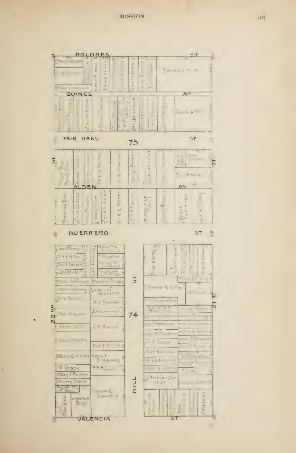
The 1892 Blue Book describes the assembly hall as 28 by 63 feet and says the school used it for gymnastics, dancing, recitals and lectures. The map shows schoolrooms overlapping the present lot. The sources give no confirmed location of the hall within the campus or subject for the slides.

San Francisco Call, October 3, 1891 · school entertainment 1889 campus map 1892 school photograph

Clara Crumpton goes home for Thanksgiving from Irving Institute

The Sausalito News reported that Clara was spending her school vacation with her parents. That suggests she boarded at the San Francisco campus at 1036 Valencia. Her room and length of residence are unknown.

Clara was born May 28, 1880, to Dr. Hezekiah John and Mattie Jane Jack Crumpton. A Lake County newspaper recorded the birth of Dr. Crumpton’s daughter on the same date. Clara graduated from San Rafael High School in 1900 and taught primary pupils in Sausalito by 1904. In 1905, she and Eva A. Levy published Action Reading, a teaching manual. The title page lists both authors as assistants supervising primary reading at the San Francisco State Normal School. In 1913, the Alameda County directory named her principal of the Piedmont School. The 1931 yearbook of San Francisco State Teachers College lists her as registrar and a graduate of the San Francisco State Normal School. Her regional professional association named her an honorary member in 1940.

1891 Sausalito News holiday notice Lake County birth notice index Tiffany family genealogy, p. 71 1900 high school graduation 1904 teachers’ institute 1905 reading manual 1913 Piedmont School listing 1931 college yearbook transcript Professional association roll

The school campus extended uphill along Hill Street before the present building existed.

An elevated historic photograph looking southwest from Valencia Street at the three-story Irving Institute and its wing extending west along Hill Street.
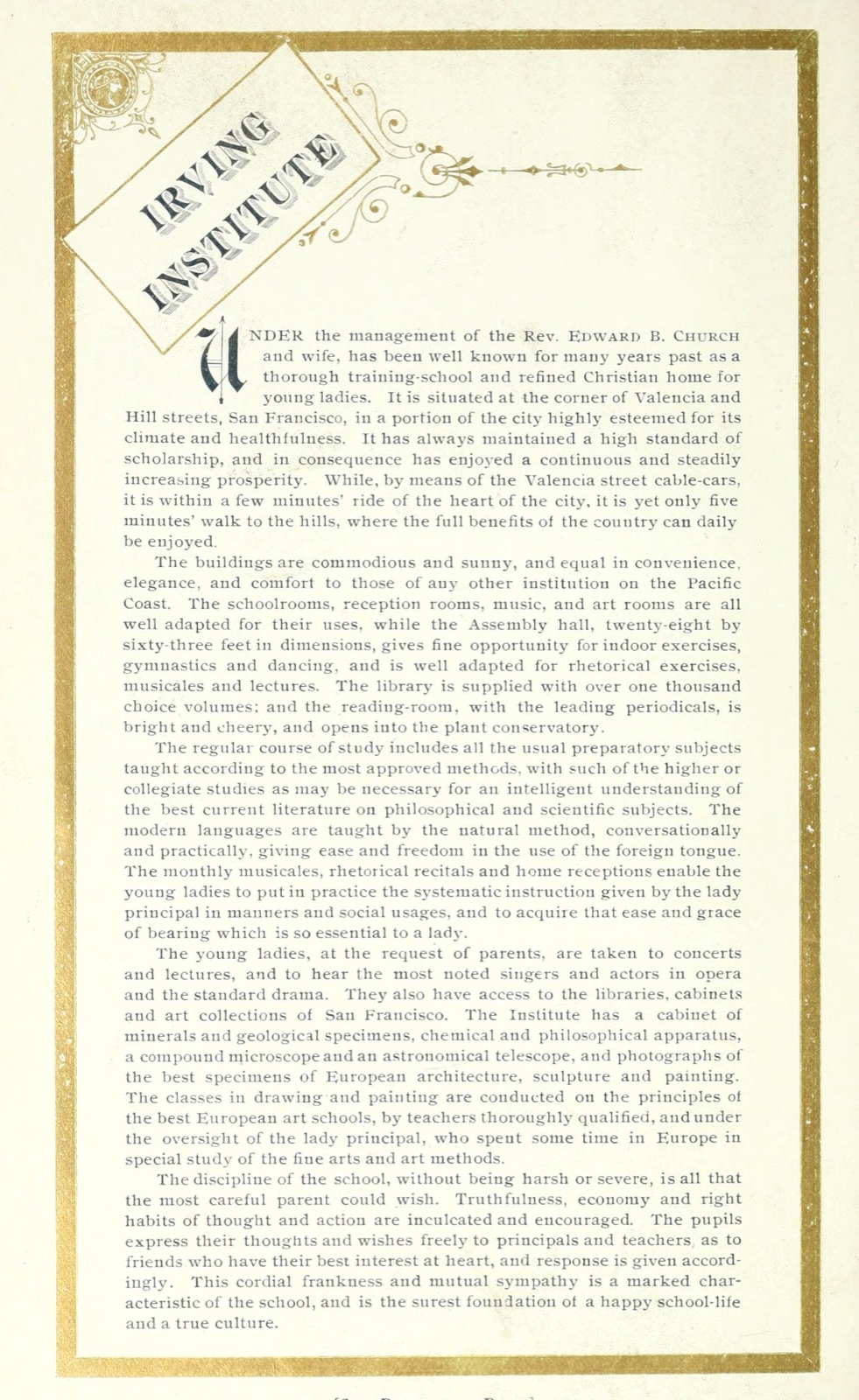
Irving Institute’s rear wing extends uphill from ValenciaValencia crosses the foreground. Hill climbs along the right side of the building. The present four-flat lot begins 85 feet up Hill from the corner, along the stretch where the rear section of the campus appears in the photo. The Blue Book gives the school’s address as 1036 Valencia. It describes a 28-by-63-foot assembly hall equipped for dancing, recitations, concerts and lectures. The descriptions leave the hall’s position within the school complex uncertain.Full advertisementSchoolrooms and curriculumInternet Archive scan

Internet Archive scan · scan

Full advertisement
Full advertisement
Schoolrooms and curriculum

Sophie Nis Herrera teaches and lives at Irving Institute

The 1889 directory lists Sophie Nis-Herrera teaching at Irving Institute and living at 1227 Pine Street. The 1893, 1894, 1895 and 1897 directories give her home as 1036 Valencia. The 1898 and 1899 editions still list her as a teacher at the school.

A likely earlier listing appears in the 1874 business directory under teachers of languages. It places a Mrs. Sophie Nis at 109 Montgomery Street and also lists her under teachers of music.

1874 listing for Sophie Nis 1889 teaching and residence 1893 residence 1894 residence 1895 residence 1897 residence 1898 teaching listing

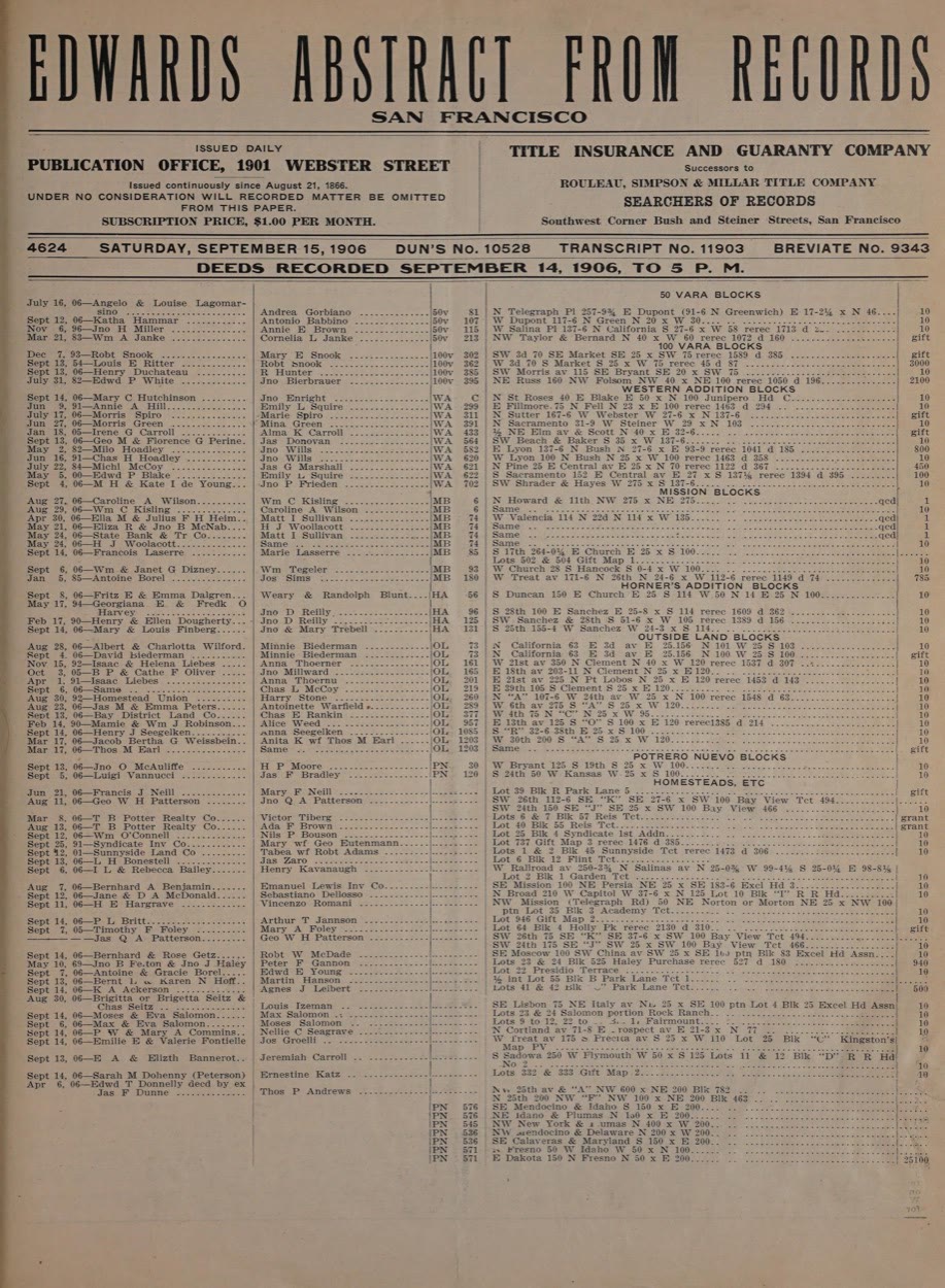
Hibernia releases four mortgages originally made to John C. Gouldin

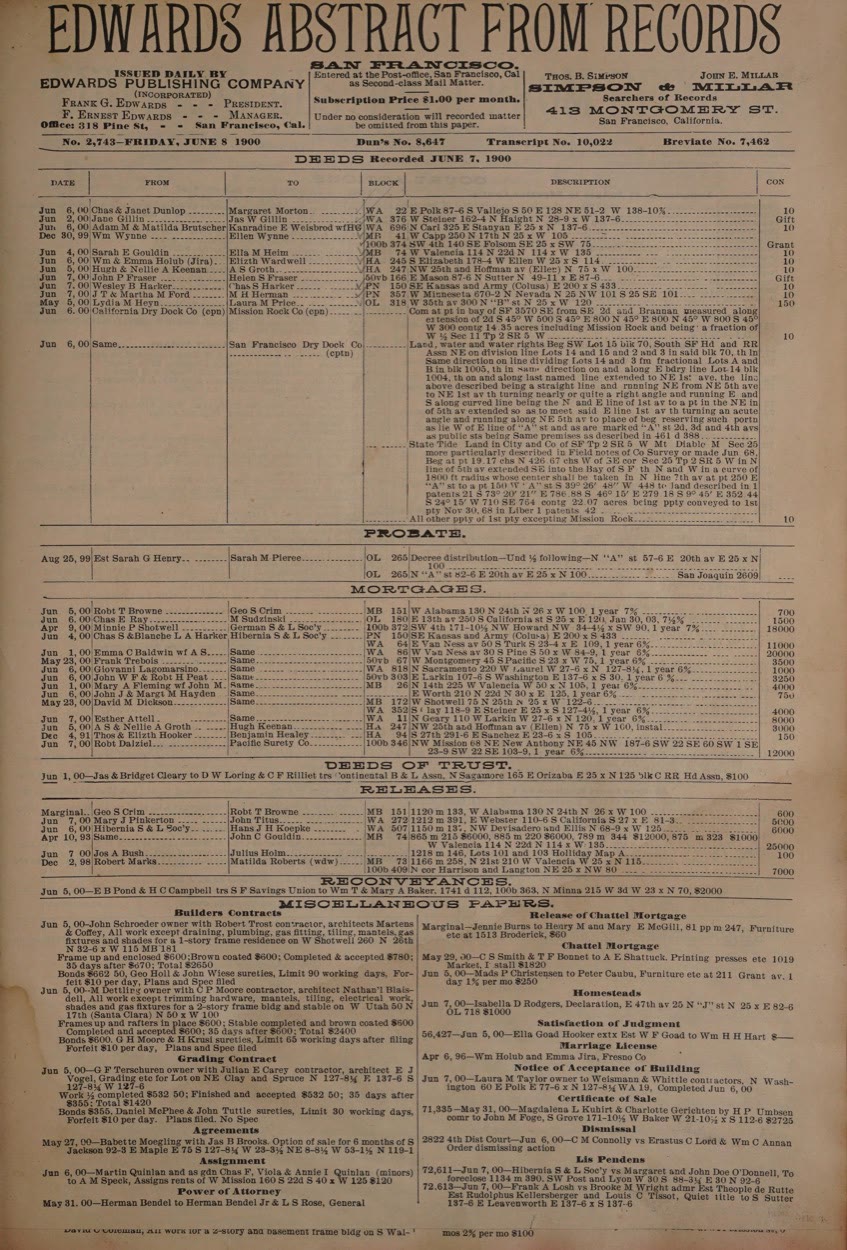
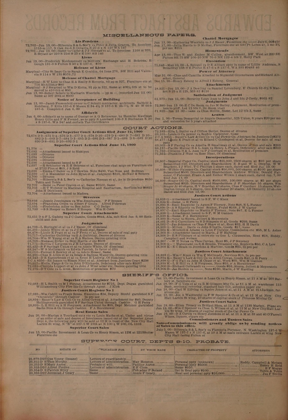
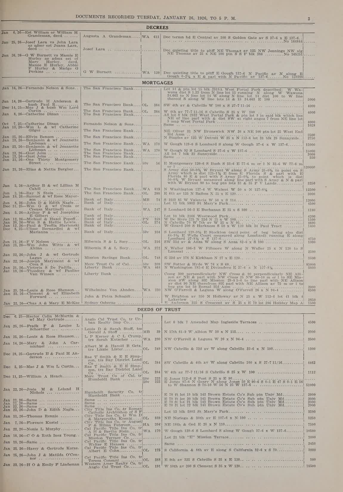
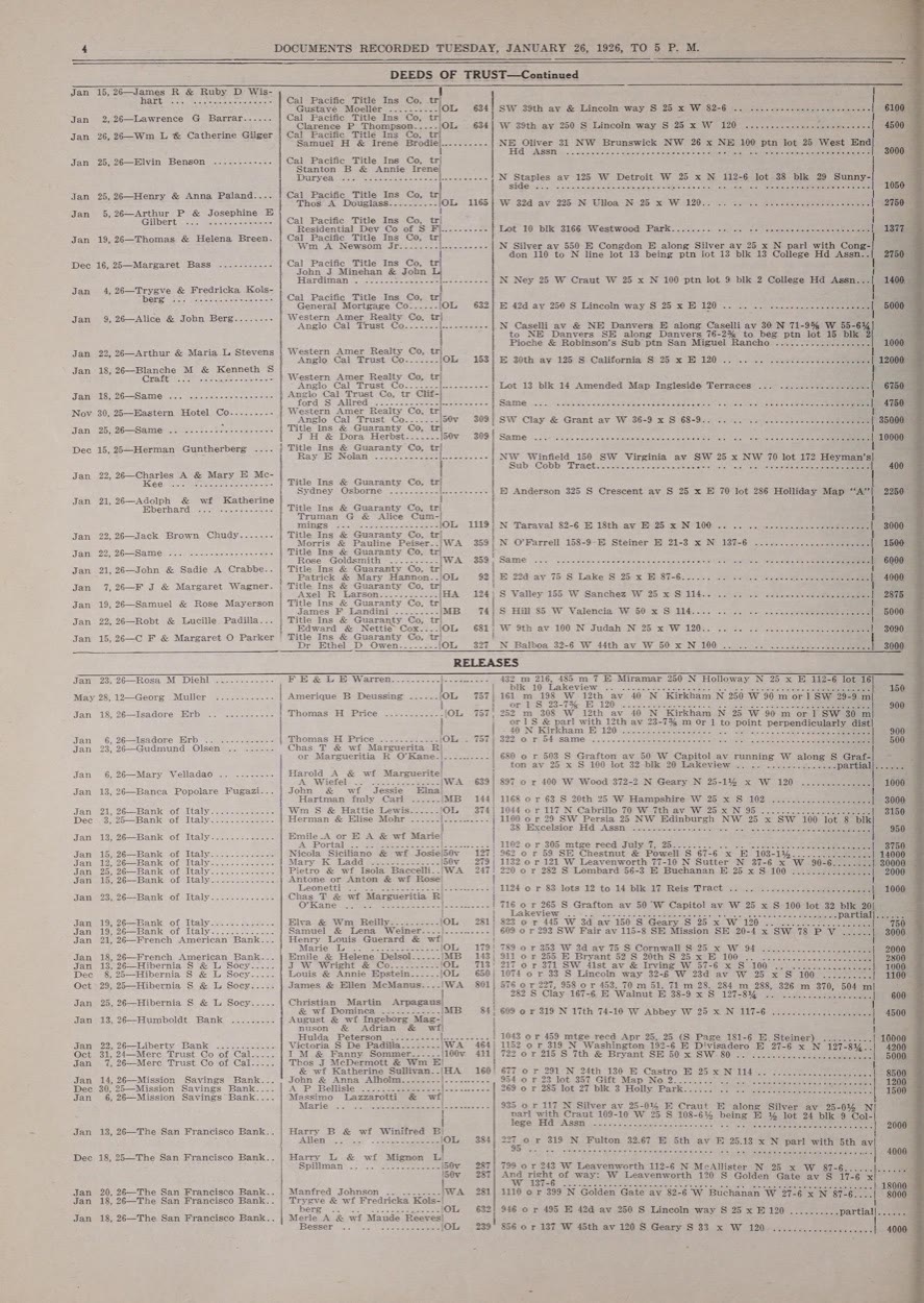
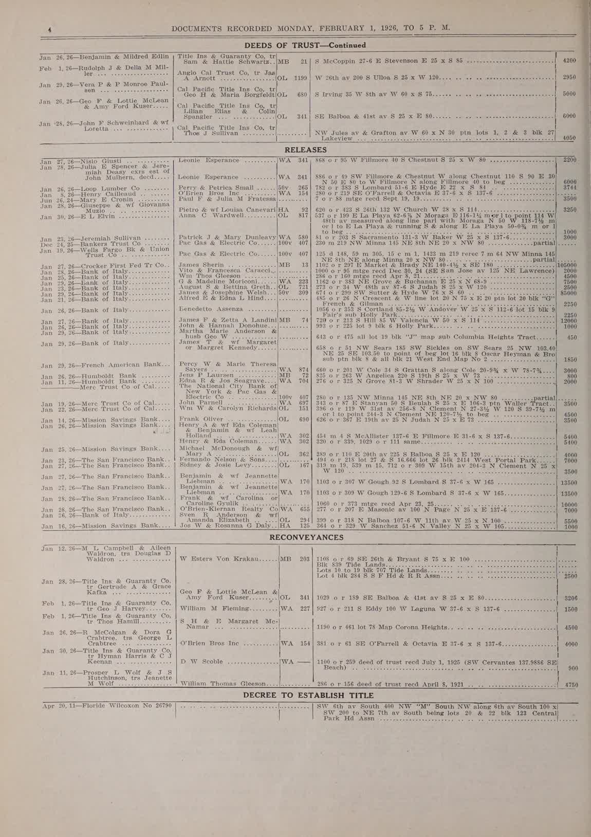
The release covers the 135 × 114 ft southwest corner tract in Mission Block 74, including the present lot. The four mortgages total $25,000. The abstract locates the tract on the west side of Valencia, 114 feet north of 22nd, extending 114 feet north and 135 feet west. The abstract lists $6,000 each in book 865, page 215 and book 885, page 220, $12,000 in book 789, page 344, and $1,000 in book 875, page 323. The release is dated after John’s death in 1891. The recorder entered it on June 7, 1900, the same day as Sarah E. Gouldin’s deed to Ella M. Heim.

Edwards Abstract from Records, June 8, 1900Deed and release scanSarah E. Gouldin’s records

A visiting English writer plays violin and recalls Tennyson at Irving Institute

Hugh Reginald Haweis spoke at 1036 Valencia after musical performances by teachers and pupils. The Call reported that Haweis borrowed spectacles, broke a violin string, and carried on with his performance before speaking about meetings with Alfred Tennyson and reading from his work.

Haweis was a Church of England clergyman and writer on music. The National Portrait Gallery holds a photograph that dates to three years before his appearance at the school.

San Francisco Call, October 7, 1893 · “A Friend of Tennyson” 1890 portrait of Haweis

Sarah E. Gouldin holds the corner tract

The 1894 block book names Gouldin on the tract that included the four-flat site. Her husband, John Copley Gouldin, had leased the tract to Irving Institute’s principal and died in 1891. The published report on John’s will says it allotted her one-third of his estate. A decree dated November 1891 names her as a beneficiary of separate land in Millbrae. The conveyance that put the Hill tract in her name remains unidentified. The 1897 directory lists her as a widow on Leavenworth Street. By the 1899 edition she lived at 1070 Valencia, the boarding house on the larger tract known as The Irving. She conveyed the tract to Ella M. Heim in June 1900. The 1902 directory still lists Gouldin at The Irving, and the 1903 edition places her on Cole Street. The 1906 Berkeley directory lists her on Bancroft Way. The 1900 census identifies the household at The Irving under its proprietor, Isabell O’Brien, whose name also appears in that year’s directory.

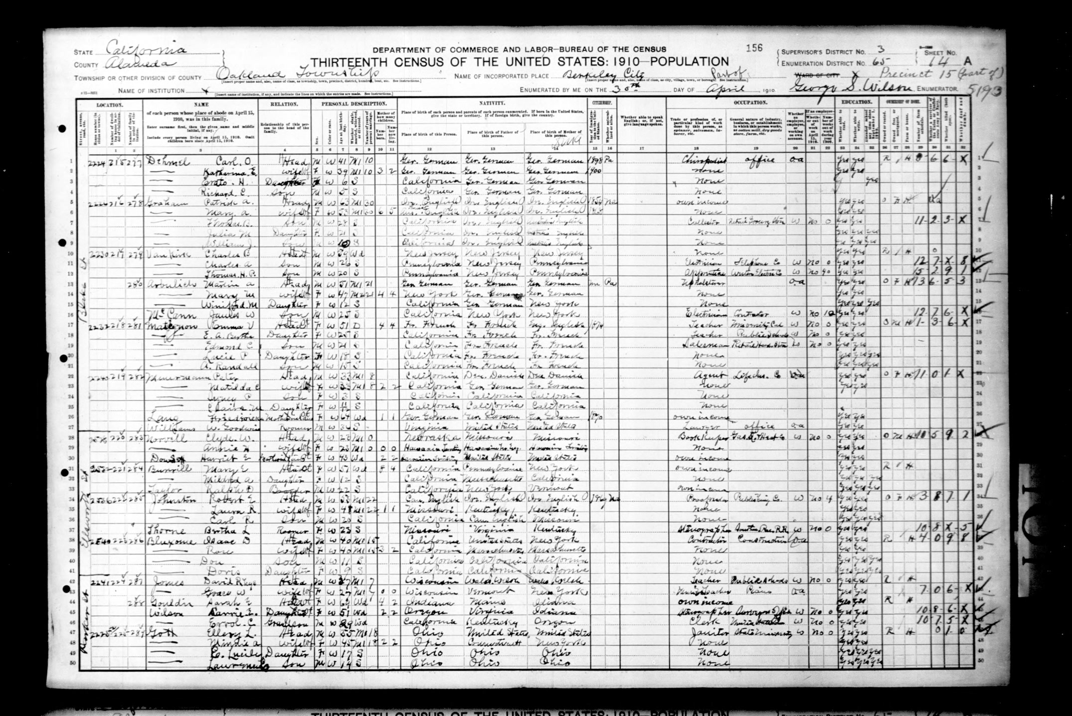
Errol C. Wilson, a clerk for the U.S. Army Subsistence Department, appears at Gouldin’s Leavenworth address in 1897 and at her Cole Street address in 1903. Between those years Errol and his wife Blanche lodged on the former school tract. The 1910 census identifies Carrie E. Wilson as Sarah’s daughter and Errol as Sarah’s grandson. In a signed 1948 note on the back of a painting of her childhood home in Fruitvale, Carrie named John Copley Gouldin as her father. The 1880–81 directory lists John C. Gouldin as a commercial agent at Fruit Vale Crossing. Carrie also named her sister Lucile Aida Taylor.

The 1885 directory lists Aida L. Gouldin as a typist on Pine Street living in Fruit Vale. In 1886 she worked in sales for photographer Isaiah West Taber and shared a McAllister Street address with J. C. Gouldin, whom the directory lists as a capitalist. In 1887, Aida shared 25 Birch Avenue with Mrs. J. C. Gouldin, listed as a widow. In 1888, Aida shared 228 Waller Street with S. E. Gouldin, also listed as a widow. The two listings suggest that Sarah was the Mrs. J. C. Gouldin listed the previous year. The 1887 separation agreement confirms John and Sarah were married and agreed to live apart. The directory descriptions of Sarah as a widow precede John’s documented death in 1891. The pioneer roster identifies Sarah as Sarah Emily Tibbetts and lists John Pickett Ladd and J. C. Gouldin as her husbands. It names Carrie as a child of the first marriage. The 1910 census gives Carrie a Virginia-born father, and her later signed note calls Gouldin her father. This is consistent with Gouldin raising Carrie as a stepdaughter. The original marriage record and Aida’s parentage remain unverified.

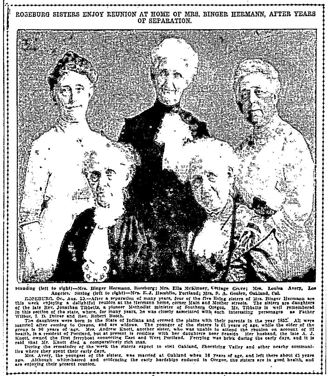
Sarah appears in an Oregon newspaper photograph with her sisters and died in Oakland in 1919.

1894 block book1900 deed and releases1900 directory listing1897 Leavenworth directory1899 Valencia directory1902 Valencia directory1903 Cole directoryWilson at the Leavenworth addressWilson at the Cole address1910 Berkeley directory1880–81 Oakland directory1885 directory · Aida in Fruit Vale1886 directory · Aida and J. C.1887 directory · Birch Avenue1888 directory · Waller Street1890 directory · John C.1891 directory · John C.Taber photography collection1893 bank release to John C.Carrie Wilson’s signed notePainting of the Fruitvale homeThe Irving household in the censusCorner tract lien release1894 block book · scan1900 deed and releases · scan 1906 Berkeley directory Tibbetts family roster

1900 directory listing

Gouldin Sarah E., widow, r. 1070 Valencia Goulding Lawrence, coalpasser str. Colon, r. 45 Zoe

Directory transcription

Sarah Gouldin’s corner tract included the land that later became the 15–21 Hill Street parcel.

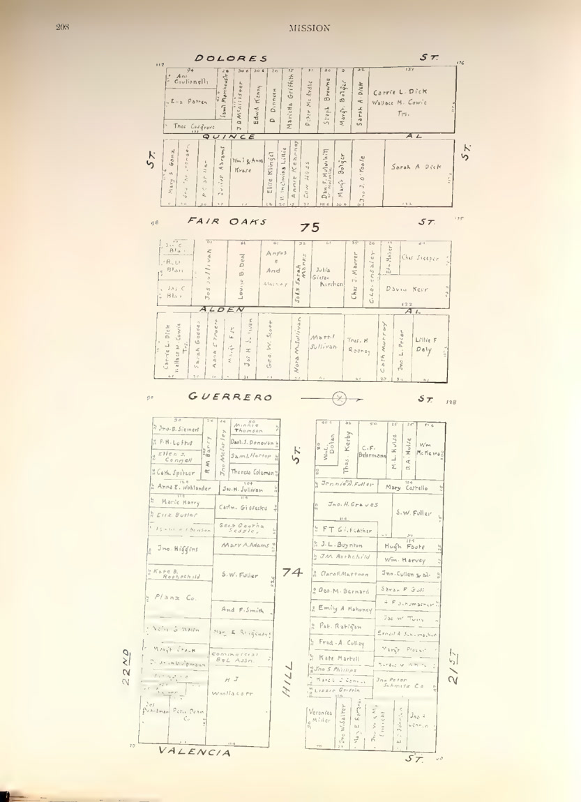
1894 block book showing Mission Block 74 between Guerrero and Valencia.
The block book names Sarah E. Gouldin on the corner tractSan Francisco Handy Block Book, p. 409.The outlined area sits within Sarah E. Gouldin’s larger corner tract. The map is rotated from modern north-up orientation.

Louise Humphrey-Smith teaches elocution at Irving Institute

The 1895 directory lists a teacher named Louise H. Smith residing at 1036 Valencia. A biographical sketch by a childhood friend in Representative Women of New England identifies Louise Humphrey-Smith as the school’s elocution teacher for twelve years and says she taught at California College in Oakland for seventeen years.

Louise grew up in Turner, Maine, in the Bradford Village neighborhood. Her parents were Henry White Humphrey and Laura Ann Turner. She trained in dramatic expression after her husband died and gave recitals that included Browning and Shakespeare. In 1896 she and Edna Snell-Poulsen advertised their Lyceum of Expression at 32 O’Farrell Street.

By 1913 Louise was living in Berkeley. The Oregon Supreme Court’s account of her estate says she moved to Portland in June of that year and lived with a longtime friend whom she had helped raise. Louise died February 5, 1920. A Portland newspaper’s probate report names her sister Temple T. Snell and two other relatives.

1895 residence Contemporary biography, pp. 53–57 Lyceum of Expression advertisement Oregon Supreme Court opinion, Franklin v. Northrup, 107 Or. 537 1920 Portland probate report

The 1895 directory lists Louise H. Smith as a teacher residing at 1036 Valencia.
Louise H. Smith at 1036 Valencia, 1895 city directory.

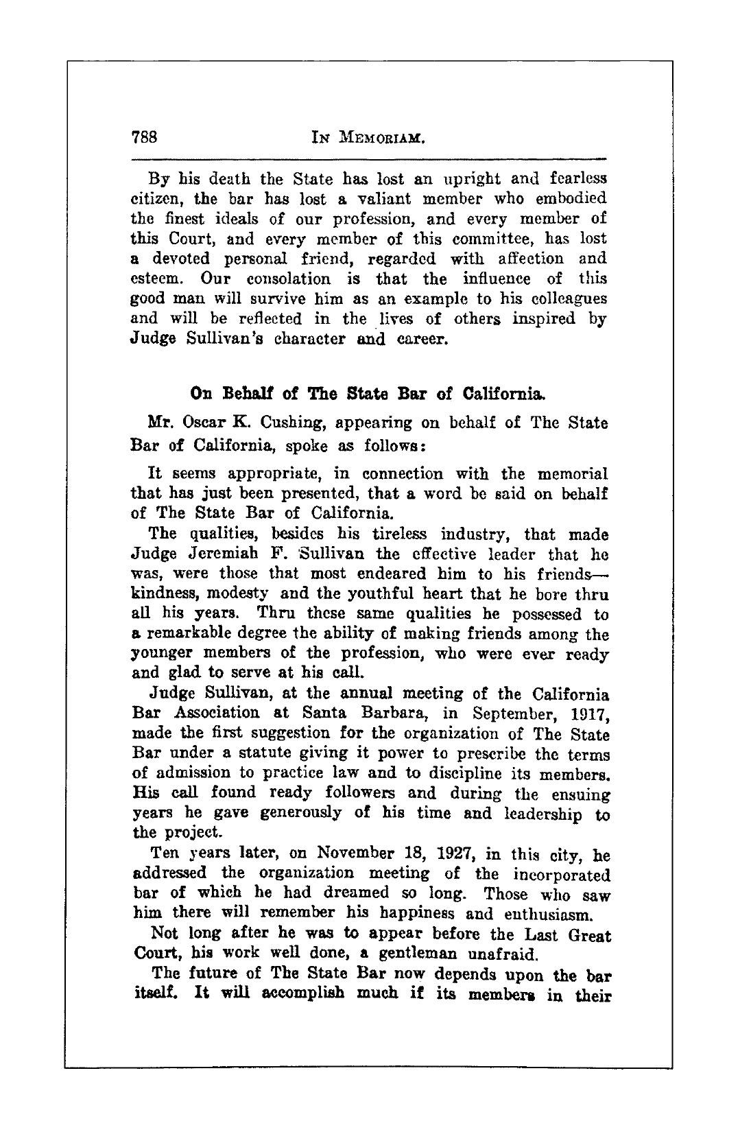
Jeremiah Sullivan was connected to the ownership history of the larger Hill and Valencia corner tract.

Newspaper illustration of Judge Jeremiah F. Sullivan with sideburns and a mustache.
The San Francisco Call publishes Jeremiah F. Sullivan’s likenessThe San Francisco Call published the illustration from a Bradley & Rulofson photograph of the original Superior Court. The 1909–10 block book lists Jere Sullivan as owner of the corner lot.

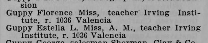
Estella and Florence Guppy teach and live at the Hill Street campus

The 1897 directory identifies Estella L. Guppy, who held an A.M. degree, and Florence Guppy as Irving Institute teachers living at 1036 Valencia. A San José parish history names Estella Lois and Florence Belle Guppy among those confirmed at Trinity Church. Both women still taught at Irving Institute in 1903, and in 1905 both are listed living at its later address, 2126 California Street.

The Astronomical Society of the Pacific listed Estella as a member from San José in 1895. She translated fragments of the Greek poet Archilochus for the Overland Monthly and published The Story of the Monterey Pine in 1924. Her sorority’s December 1942 journal records her death at her home in Monterey.

1897 residence for both teachers Trinity Church records 1895 Astronomical Society membership 1903 teaching listings 1905 residence Fragments of Archilochus The Story of the Monterey Pine 1942 notice of Estella’s death

The 1897 directory lists Florence and Estella L. Guppy as teachers residing at 1036 Valencia.
Florence and Estella Guppy at 1036 Valencia, 1897 city directory.

Irving Institute’s departure ended its years at the Hill and Valencia campus.

A reproduction of the 1898 directory advertisement announcing the school’s move to California and Buchanan streets.
Irving Institute announces its move to California StreetThe notice announces the move and illustrates the new California Street campus. Crocker-Langley city directory, advertising section.

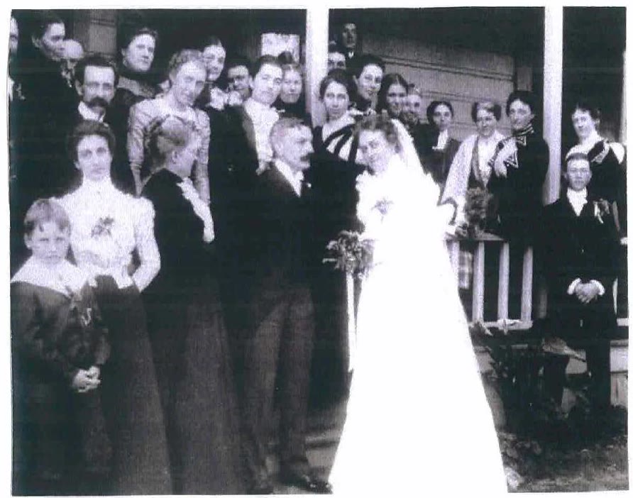
Jeannette Wilcox and Adolph Kraft marry in Tustin

Jeannette, an Irving Institute graduate and resident music teacher, married Adolph Kraft. Their wedding photograph was taken at the Wilcox family home in Tustin. The city’s preservation packet reproduces the photograph and credits historical images to Orange County Public Library.

The Orange County California Genealogical Society traces Jeannette to Indiana, where she was born July 28, 1868, to Charles Wheaton Wilcox and Sarah E. Judson. It records her as a San Francisco contralto and member of the Treble Clef Quartette, says she studied in France in 1897–98, and cites a state index for her death on June 14, 1948, in Los Angeles County.

1899 wedding photograph, City of Tustin packet Wilcox family records and source notes 1890 school residence and 1896 concert

Jeannette Wilcox in a white wedding gown beside Adolph Kraft, with guests around them at the Wilcox family home.
Jeannette Wilcox and Adolph Kraft at the Wilcox House, Tustin, February 11, 1899. City of Tustin packet, p. 7.

1900s

Boarding rooms after Irving Institute

The Mission YMCA used part of the former school wing for boarding. By the 1902 directory the branch had moved to Mission Street. In the atlas revised through 1905 the first floor of part of the wing is marked as a shirt factory. The 1900 census recorded the McDonald and Emerson households in the building. Sarah E. Gouldin sold the corner tract that year. In April 1906, after the fire stopped near 20th Street, neighbors cooked in makeshift kitchens on Hill. A few blocks away, Dolores Park sheltered more than 1,600 people displaced by the earthquake and fire.

Boarding rooms YMCA moves Shirt factory 1900 households Hill Street after the earthquake Recreation and Park, Dolores Park history

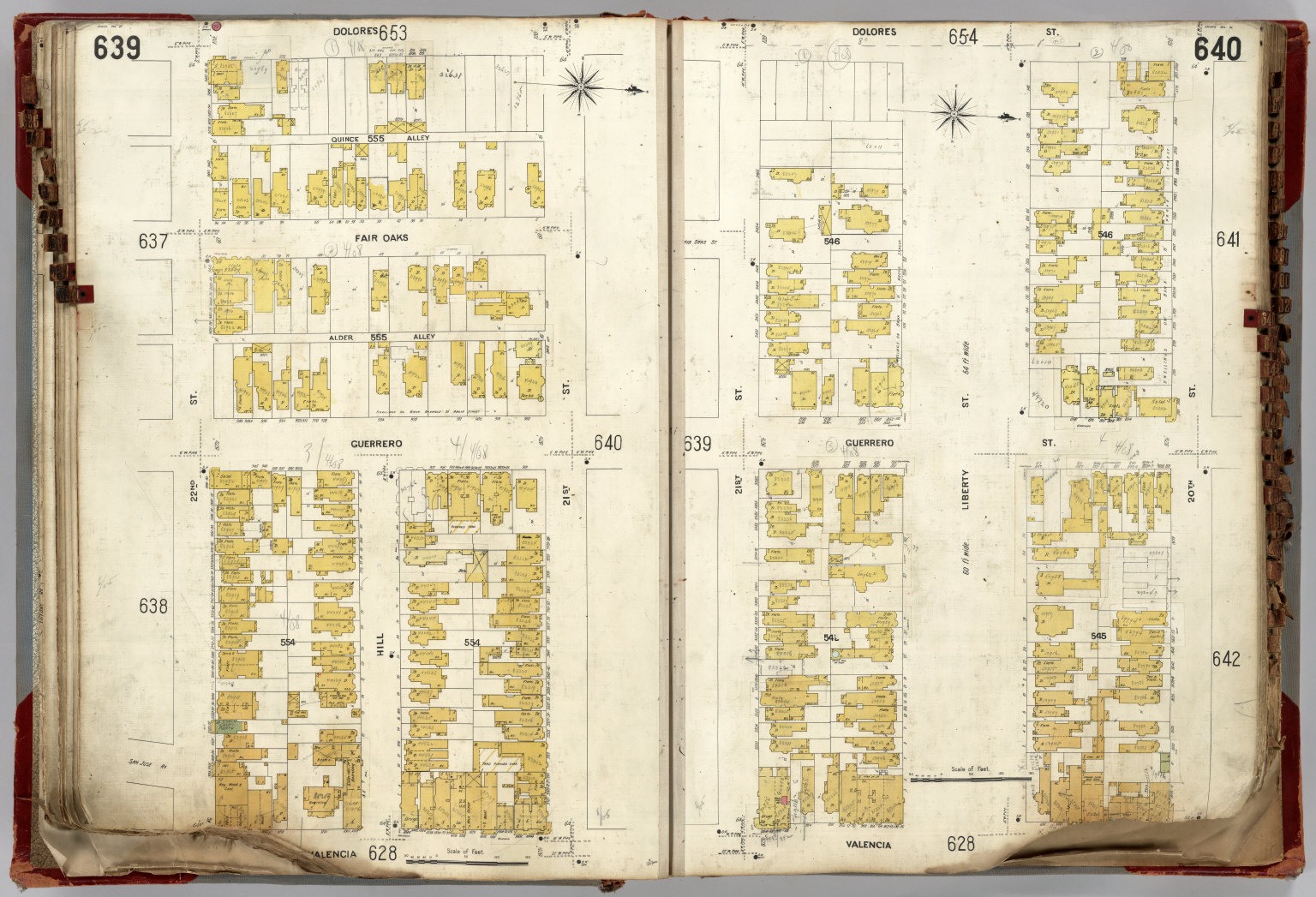
Sanborn records boarding rooms after the school leaves

The Sanborn sheet cataloged as 1900 labels the long structure along Hill “Y. M. C. A. Boarding.” It also shows a detached boarding house at 1070 Valencia. Measured from the corner, the long structure and rooms along Hill overlap the future four-flat lot. Compare the parcel across four maps.

Sanborn, plate 639Sanborn, plate 639 · scan

1900 fire insurance map showing former boarding rooms at the future building site.
Sanborn labels the Hill Street wing as YMCA boarding roomsThe sheet labels part of the Hill Street frontage “Y. M. C. A. Boarding.” Sanborn plate 639, Library of Congress.The modern lot is measured from the southwest corner of Hill and Valencia.

Sanborn charts boarding houses on the corner tract

Households lived on the former school grounds

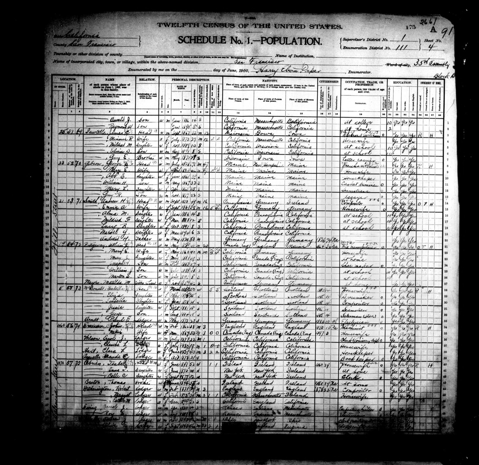
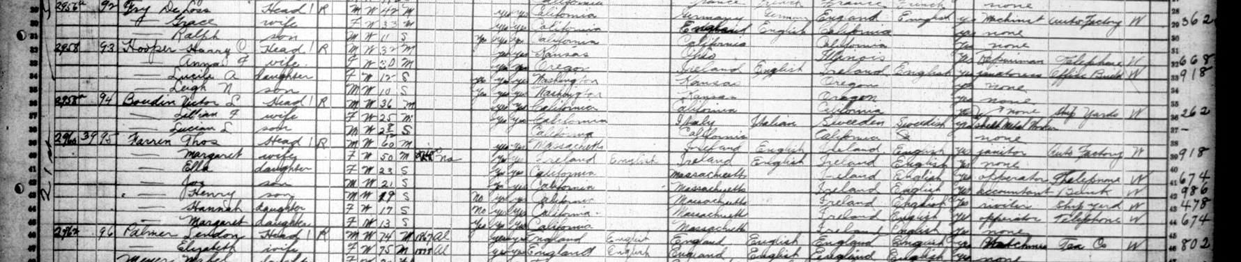
Old No. 5 Hill. The 1899 directory lists Isabella McDonald, a widow, and Lizzie McDonald, a dressmaker, here. The census records Isabella and four Scotland-born children. Eliza made dresses, younger Isabella set type as a compositor, Jessie worked as a seamstress, and George was a store salesman. The 1899 directory lists George as a clerk at Le Count Bros. and the 1900 edition names American Tea Co. The family’s lodger, Paul E. Arndt, was a German-born electrician. The city directory names Union Iron Works as his employer. The Sanborn map places old No. 5 in the former school building, whose wing extended onto the future lot.

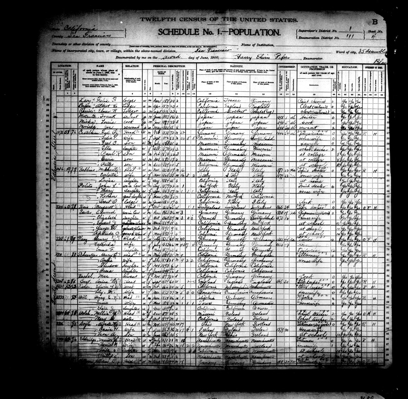
1060 Valencia. At the corner end of the same building, the census lists John Emerson, an English-born machinist, and his Canadian-born wife Nettie. Their lodgers included Errol Wilson, a clerk in the U.S. Army Subsistence Department, his wife Blanche Wilson, Clara L. Hart, a housekeeper, and Maude C. Arguello, a bookkeeper. The Wilsons, Hart and Arguello were born in California. The records give addresses for the two households in the building. Their individual rooms are unlocated.

1070 Valencia. The detached boarding house on the corner tract was called The Irving. The directory names Ireland-born widow Isabell O’Brien as proprietor, and the census lists her New York-born daughters Anna and Belle and an Irish-born brother. The enumerator recorded 17 people in all, including lodgers and three workers from Japan. Their recorded names are Frank Matsuta, a waiter, Louis Mioka, a cook, and Joe Morioka. Gouldin appears at this address in city directories.

1900 census, ED 111 · sheet 4A1900 census, ED 111 · sheet 4B1899 directory · Isabella and George McDonald1900 directory · George McDonald1899 directory · Lizzie McDonald1900 directory · Lizzie McDonald1900 directory · Paul Arndt1900 directory · Maude Arguello1900 directory · Errol Wilson1900 directory · The Irving’s proprietor1900 fire insurance map

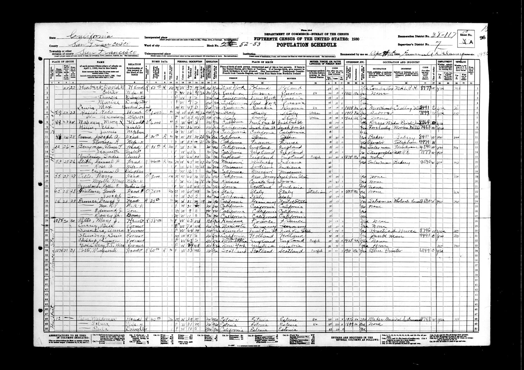
1900 census, sheet 4A. Lines 28–50 cover old No. 5 Hill and the start of the Valencia households.
1900 census, sheet 4B. Lines 51–56 finish The Irving’s household at 1070 Valencia.

Errol and Blanche Wilson lodge in the former school building

The 1900 census records Errol, 22, and Blanche Wilson, 19, living with the Emersons at 1060 Valencia. Both were born in California, Errol in July 1877 and Blanche in July 1880. They reported one year of marriage. The city directories identify Errol as Errol C. Wilson of the U.S. Army Subsistence Department and place him at the same address in 1900 and 1901.

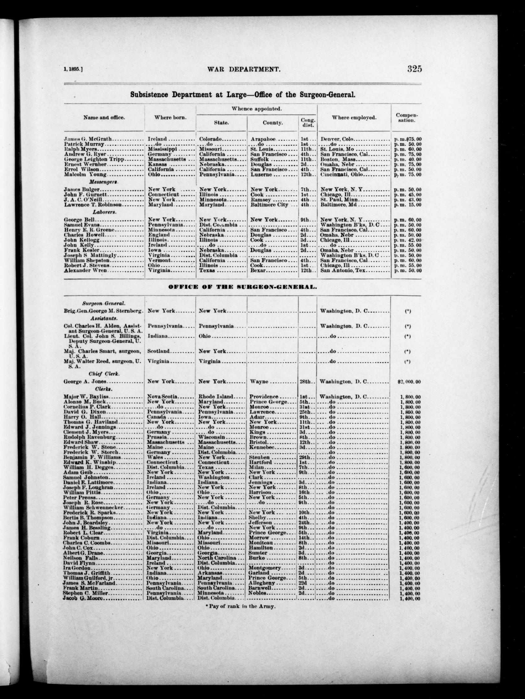
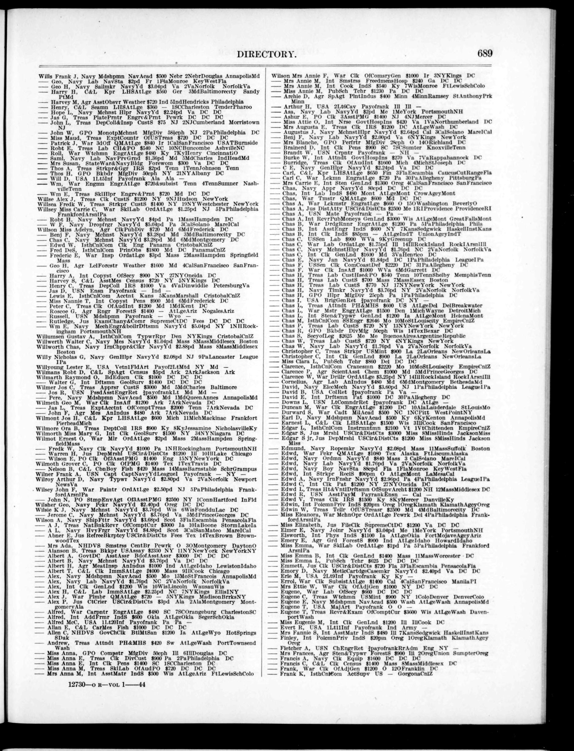
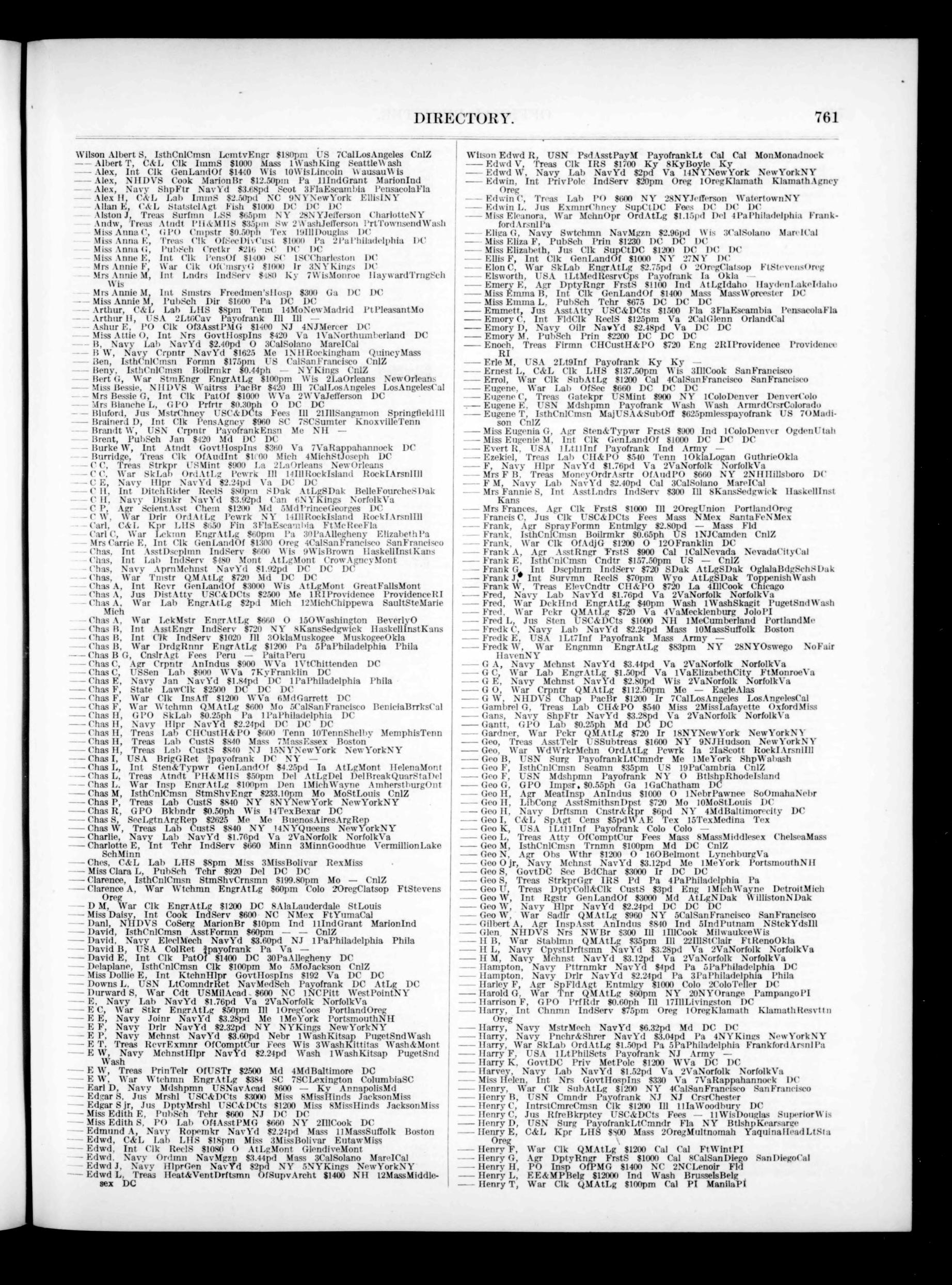
The federal payroll lists Errol earning $50 a month in San Francisco in 1895. In 1907 he was a civilian Army clerk in Manila, earning $1,400 a year. The 1909 and 1911 registers place him back in San Francisco at $1,200 a year.

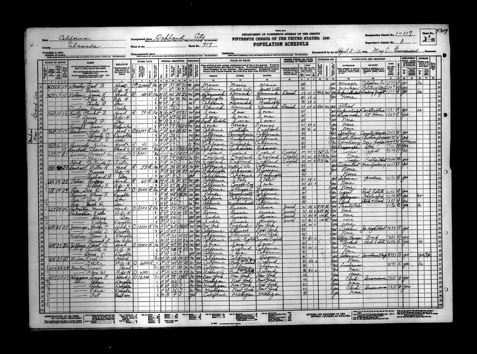
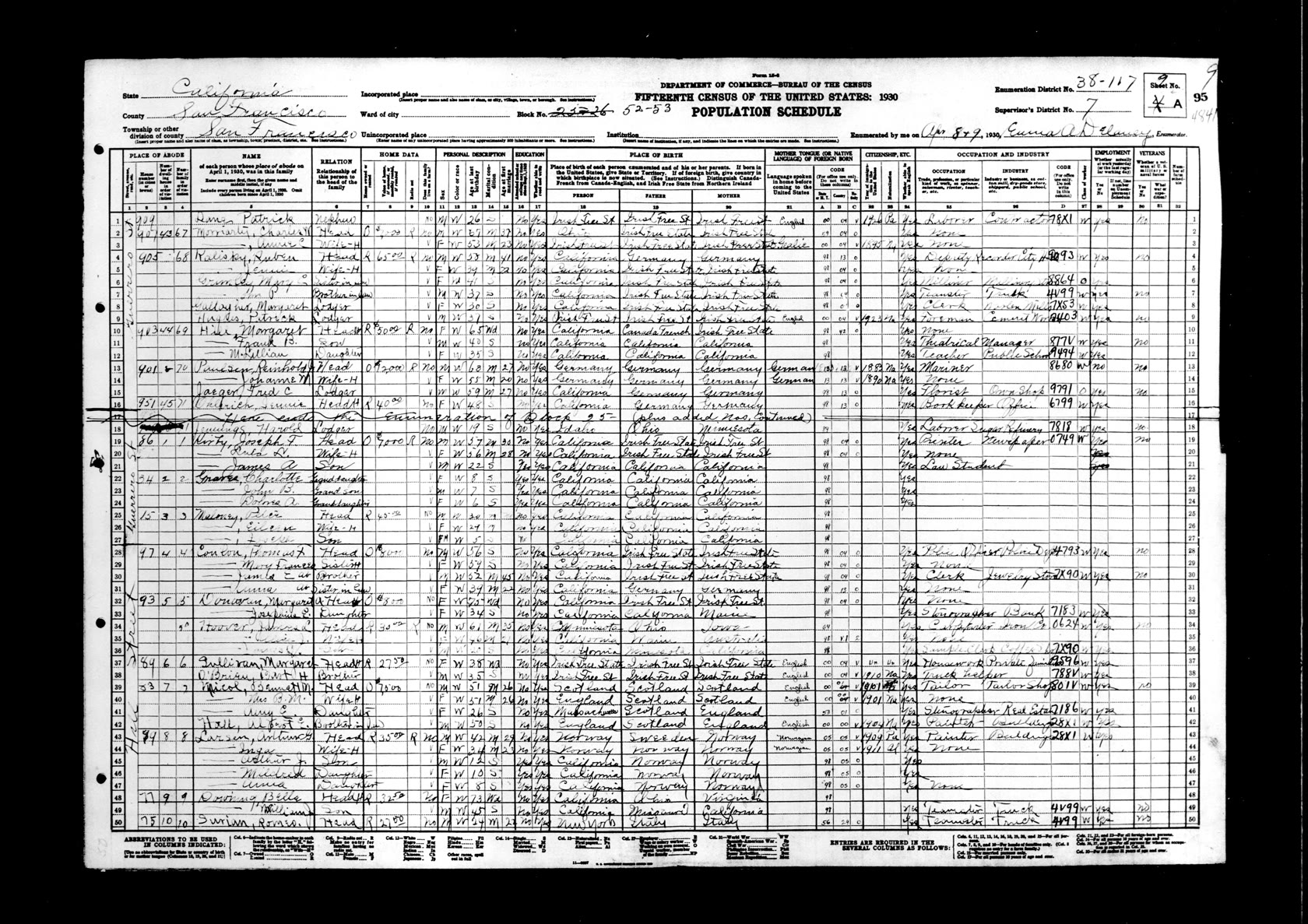
The 1930 Oakland census records Errol C. Wilson, age 52, at 431 Sunnyslope Avenue with his wife Letitia. He sold investments and reported Spanish–American War service. His age, birthplace and full name agree with the 1900 lodger’s census and city directory records. The 1940 census identifies his birthplace as Fruitvale and records his work as an Internal Revenue field deputy. It gives his age as 60, two years younger than the earlier records would predict. The 1944 telephone directory still lists him at the same address.

The 1910 Berkeley census records Errol in his grandmother Sarah Gouldin’s household alongside his mother Carrie E. Wilson. Errol was listed as widowed, placing Blanche’s likely death between the two censuses. Her death record and Errol’s military unit remain open.

1900 census, lines 36–37 1900 San Francisco directory 1901 San Francisco directory 1911 federal register, p. 836 1910 Berkeley directory 1930 Oakland census, lines 89–90 1940 Oakland census, lines 33–34 1930 Oakland directory 1935 Oakland directory 1944 Oakland telephone directory Sarah E. Gouldin’s records

Federal register page showing Errol Wilson and his $50 monthly salary
1895 federal register, p. 325. Wilson appears near the top.
Federal register page showing Errol Wilson’s assignment to Manila
1907 federal register, p. 689. Wilson appears near the bottom of the right column.
Federal register page showing Errol Wilson’s return to San Francisco
1909 federal register, p. 761. Wilson appears near the top of the right column.
1930 Oakland census, sheet 6B. Errol C. and Letitia Wilson are on lines 89–90.
1930 Oakland census, ED 1-117, sheet 6B. Lines 89–90 name Errol and Letitia. The veteran column marks his service “Sp.”
1940 Oakland census, sheet 2A. Errol C. and Letitia Wilson are on lines 33–34.
1940 Oakland census, ED 61-141, sheet 2A. Lines 33–34 record the Wilson household, Errol’s Fruitvale birthplace and his Internal Revenue job.

Ella M. Heim acquires the corner tract

Ella received the corner tract from Sarah E. Gouldin in 1900. The 1901 block book puts it in her name, and she and Julius later quitclaimed it to Matt I. Sullivan. In 1910 the Oakland directory lists Julius as a traveling agent living on Orange Avenue in Fruitvale. The telephone directory gives the same house number for Mrs. Ella M. Heim.

1900 deed1906 quitclaim1910 Oakland directory1910 telephone directory1900 deed · scan1906 quitclaim · scan

1910 Oakland directory

Heim Julius F, trav agt, r 5 Orange av, Fitvl.

Directory transcription
The 1900 conveyance

The 1894 block book names Gouldin. The deed, recorded June 7, covers the corner tract in Mission Block 74 and gives the same dimensions as the later deed abstracts. The same issue records Hibernia’s 1893 release of John C. Gouldin’s mortgages on the same tract. The 1901 block book names Heim.

Edwards, deeds and releases recorded June 71894 block book1901 block book1894 block book · scan1901 block book · scan

Edwards, deeds and releases recorded June 7

A street improvement company releases a lien on Gouldin’s corner tract

Edwards Abstract from Records reports a $576.72 lien release by City Street Improvement Co. to Sarah E. Gouldin for the southwest corner of Hill and Valencia. It gives the lien reference as book 64, page 276, and repeats the tract’s dimensions of 114 feet south and 135 feet west from the corner.

June 14 issue · lien releaseJune 14 issue · date and mastheadJune 4 conveyance

Edwards, June 14, 1900. The lien release appears in the upper left.

Ella Heim held the larger corner tract that included the site of the present building.

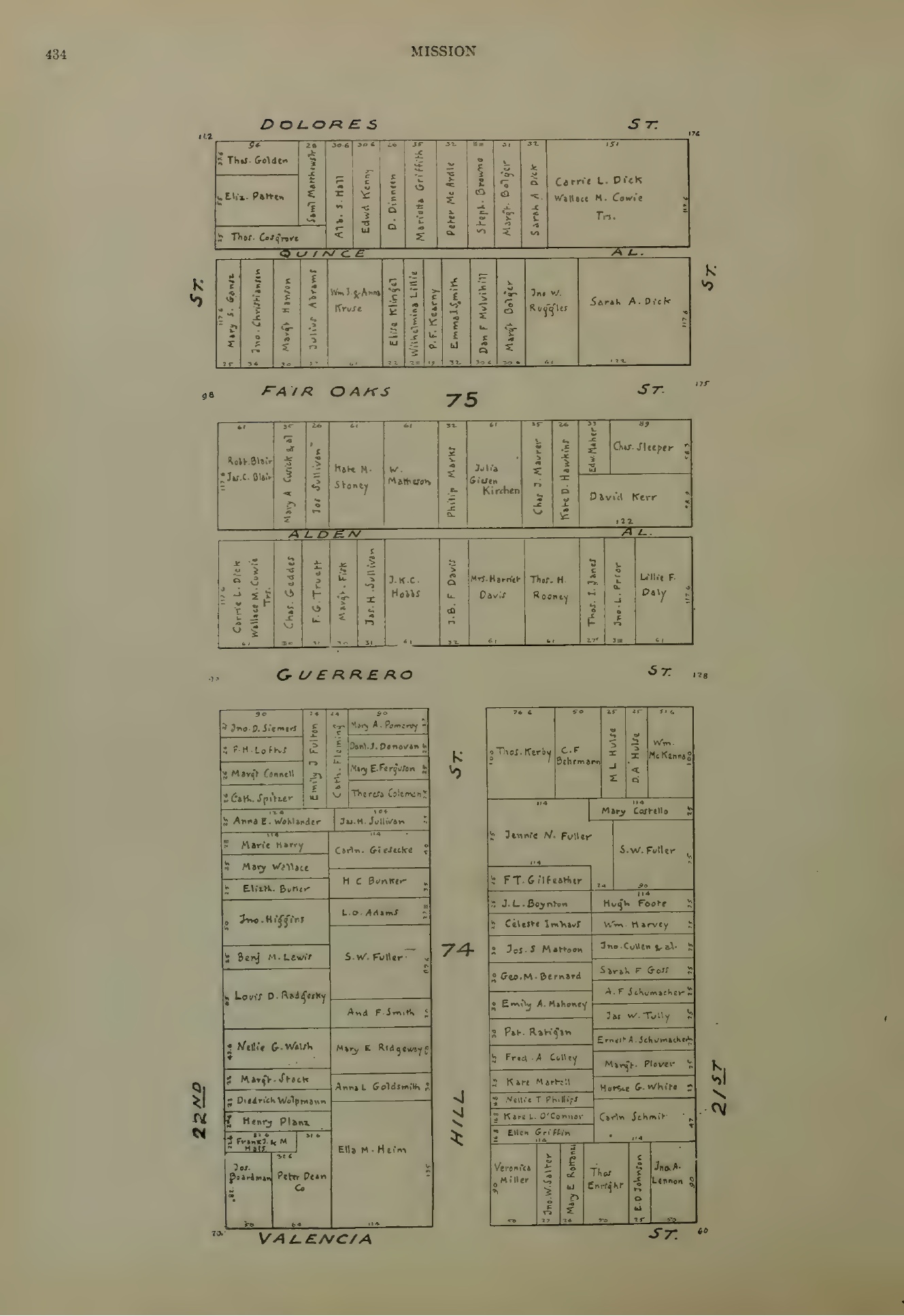
1901 block book showing the Ella M. Heim tract at Hill and Valencia.
The block book puts the corner tract in Ella M. Heim’s nameSan Francisco Block Book, p. 434.The outlined area sits within the 135 × 114 ft tract labeled Ella M. Heim. The map is rotated from modern north-up orientation.

The Mission YMCA moves from Hill Street to Mission Street

The 1900 and 1901 city directories give 11–13 Hill under the numbering in use then. The Central YMCA’s National Register nomination independently places the branch at the Hill and Valencia corner and records that it rejoined the city association in 1899. The Sanborn mapped its boarding wing across part of the present parcel. By the 1902 directory the branch was at 2715 Mission.

1900 directory, p. 1842 1901 directory, p. 1259 1902 directory, p. 1914 Central YMCA nomination, section 8 p. 38

1901 directory gives the Mission YMCA’s Hill Street address.
1901 city directory, Hill Street
1902 directory lists the YMCA branch at 2715 Mission Street.
1902 city directory, Mission Street

The Wilsons convey land to Ella Heim, who later deeds it to H. J. Woollacott

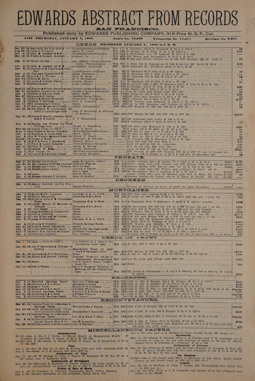
The January 5, 1905 issue lists a December 26, 1902 deed from A. S. and J. L. Wilson to Ella M. Heim and an April 12, 1904 deed from Heim to H. J. Woollacott. Both use the 135 × 114 ft description. Woollacott appears in the January 1906 block book.

Edwards, deeds recorded January 4, 1905January 1906 block book

Edwards, deeds recorded January 4, 1905
January 1906 block book
January 1906 block bookOutline of the present 50 × 114 ft lot.
H. J. Woollacott and the tract

Woollacott received a deed from Ella Heim in 1904 and appears as the owner on the January 1906 block book. He conveyed the same tract to Matt I. Sullivan in May 1906. The H. J. Woollacott named in the deed abstracts may have been Henry John Woollacott (1858–1910). He was born in Salt Lake City to English immigrants, moved to Los Angeles at 18, and opened his own wine and liquor business in 1880. He helped found the State Loan and Trust Company in 1889 and became its president in 1896. His 1892 mail-order wine catalogue is preserved at the Homestead Museum.

1904 deed recorded in 19051906 deedHenry John Woollacott biography and 1892 catalogueMen of Achievement in the Great Southwest, p. 1241904 deed recorded in 1905 · scan1906 deed · scan

Part of the former school wing on the future lot had become manufacturing and boarding space before the 1906 earthquake.

1905 fire insurance atlas spread showing the two blocks around Hill Street.
Sanborn maps the block before the earthquakeThe pre-earthquake fire insurance atlas. North points right on the scan.Outline on plate 639, measured from Valencia up Hill using the atlas scale. The page fold and scan affect precision.
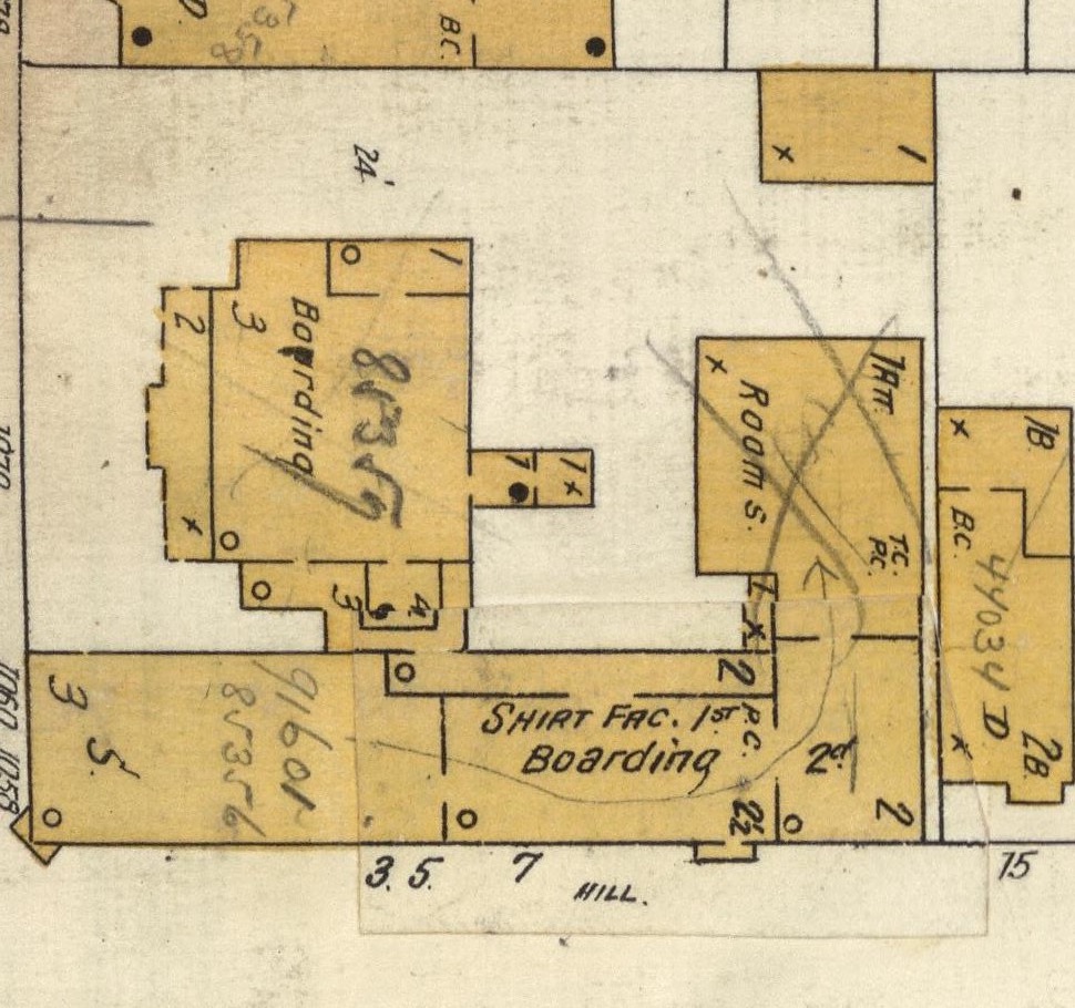
Detail of the Sanborn sheet revised through 1905 shows a shirt factory on the first floor and boarding on the second of the former school wing.
A shirt factory takes part of the former school wingThe updated sheet marks shirt manufacturing on the first floor and boarding on the second. Part of the labeled space lies inside the present lot. The map gives no factory name or date for the change in use.Hill runs along the bottom and Valencia along the left. The lot is measured 85 to 135 feet west of Valencia, with its rear line 114 feet from Hill.

Sanborn atlas, volume 6, plate 639, revised through September 1905 YMCA move City diagram of the cleared frontage in 1910

The great fire stops north of Hill Street

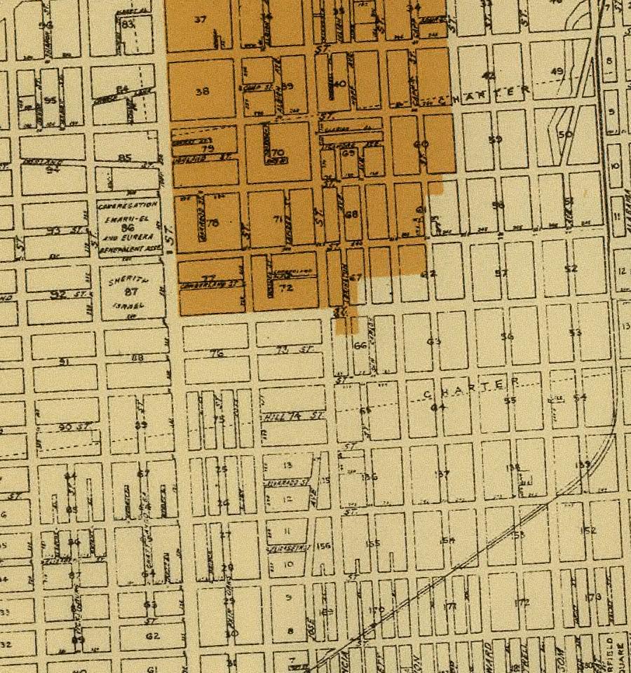
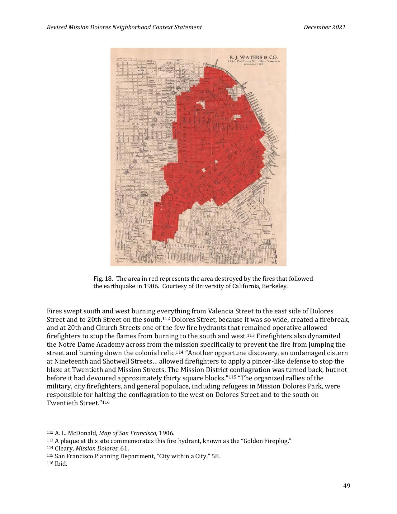
The State Earthquake Investigation Commission’s map places the future four-flat lot outside the area burned by the main fire. On this side of Valencia the shaded area ends at 20th Street. The Fire Department reported a separate fire at 22nd and Mission Street, extinguished with water from hydrants at Valencia and a cistern at Shotwell.

The former school wing appears on the 1905 Sanborn. By July 1910 the city surveyed an open yard here. The fire perimeter helps narrow the causes, while the wing’s fate in the earthquake and its removal date remain unknown.

Orange shading shows the great fire’s southern edge at 20th Street, north of the approximate Hill Street lot marked in red.
The commission maps the 1906 burned area in orangeDetail from plate 20 of the commission’s 1908 atlas, engraved by Britton & Rey. David Rumsey Map Collection, 2130.020.The dashed mark locates the present lot approximately, just west of Valencia on the south side of Hill.

Commission’s full map Fire Department report, August 1, 1906 1905 map of the wing 1910 survey of the yard

Neighbors set up outdoor kitchens after the earthquake

The great fire stopped around 20th Street in this part of the Mission, north of Hill Street. An archival photograph looking west up this block shows people cooking in makeshift kitchens in the roadway with Victorian houses standing on either side. The view predates the current four-flat building.

OpenSFHistory / wnp27.79151906 burned-area mapMission Dolores context statementOpenSFHistory / wnp27.7915 · scan

Mission Dolores context statement, PDF page 49
Residents cook in temporary curbside kitchens in the 1906 photograph looking west up Hill Street.
Neighbors cook in the roadway on Hill StreetLooking west on Hill between Valencia and Guerrero after the earthquake. OpenSFHistory / wnp27.7915.

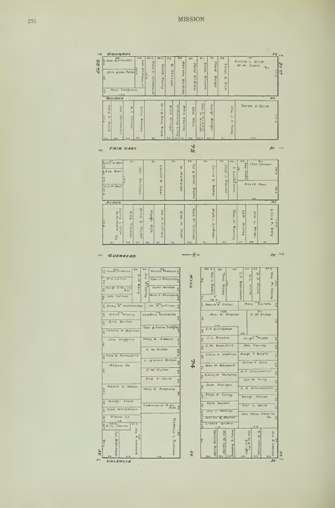
The block books name Matthew and Jeremiah Sullivan on the corner tract

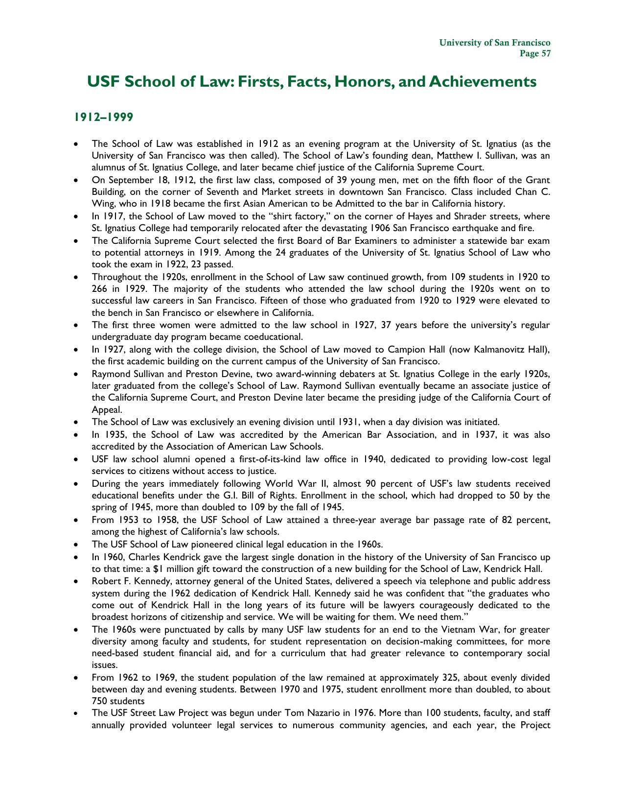
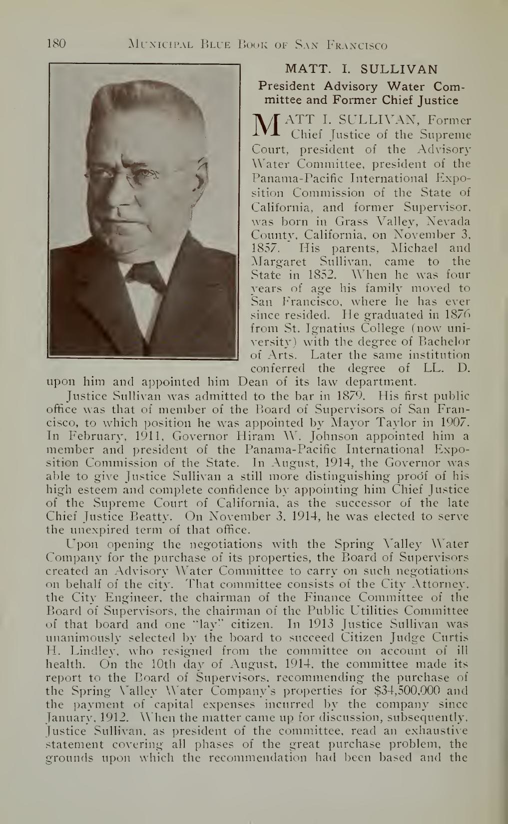
The October 1906 map names Matthew I. Sullivan. He was born in Grass Valley in 1857 to Michael and Margaret Sullivan and grew up in San Francisco. He graduated from St. Ignatius College in 1876, joined the bar in 1879, and became the founding dean of what is now the University of San Francisco School of Law. He served on the San Francisco Board of Supervisors from 1907, chaired California’s commission for the Panama-Pacific International Exposition, and served as California chief justice in 1914–15.

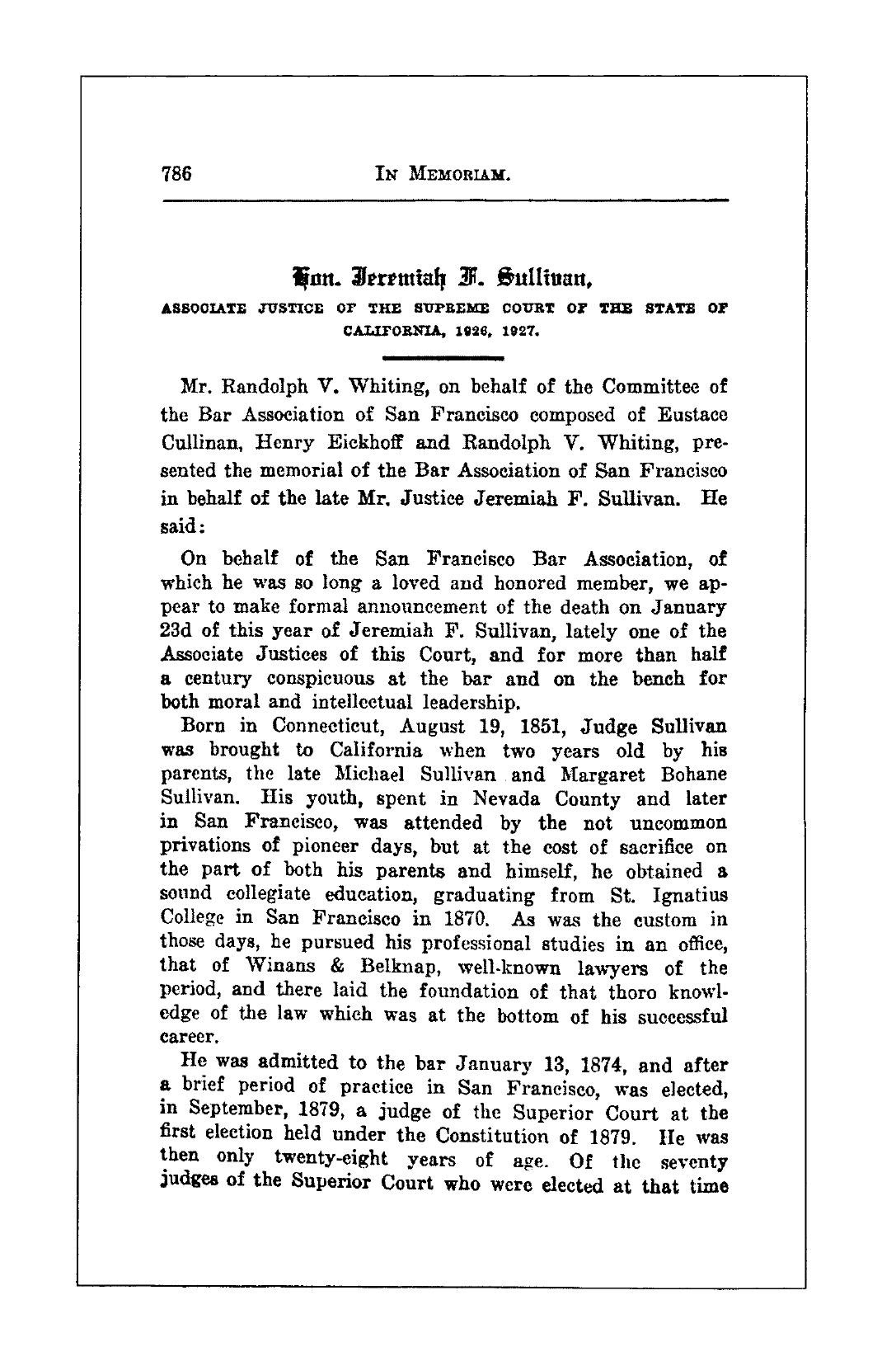
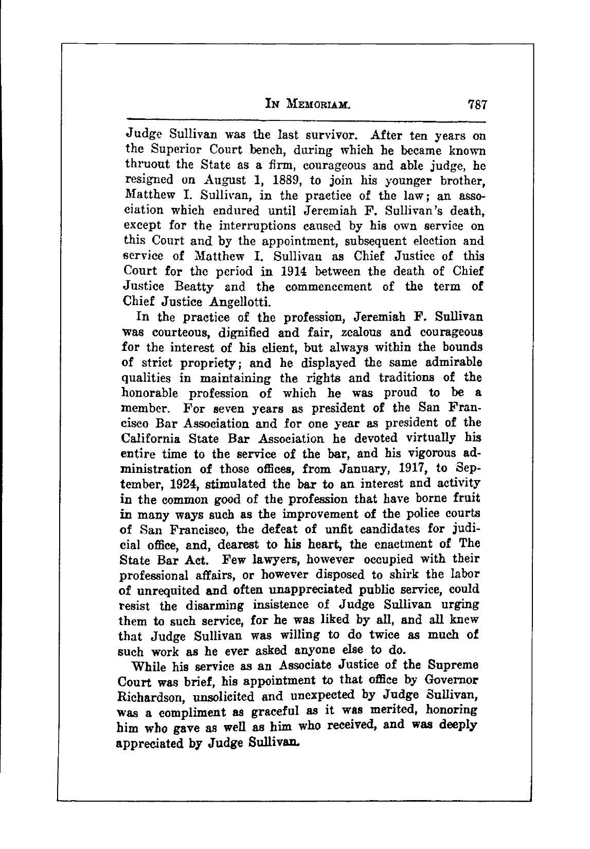
The 1909–10 block book names Jere Sullivan. In the 1907 directory, Matthew practiced law with his brother Jeremiah F. Sullivan and Theodore J. Roche. Jeremiah was born in Connecticut in 1851, grew up in Nevada County and San Francisco, and graduated from St. Ignatius in 1870. He studied law in the office of Winans & Belknap, joined the bar in 1874, and won election to the new San Francisco Superior Court at 28. He served on California’s Supreme Court in 1926–27.

The 1907 deed names Jeremiah F., Helen and Matthew I. Sullivan as grantors. The 1909–10 block book uses the shorter name Jere Sullivan.

1907 deed abstractOctober 1906 block book1909–10 block bookSullivan law firm in 1907University historyCalifornia Supreme Court rosterMatthew’s 1915 portrait and biographyJeremiah’s 1928 court memorialJeremiah’s portrait in the 1895 Call1907 deed abstract · scanOctober 1906 block book · scan1909–10 block book · scanJeremiah’s portrait in the 1895 Call · scan

Sullivan law firm in 1907

Sullivan Jeremiah F (Sullivan & Sulli- van and Theo J Roche) atty-at-law, r 2007 Pacific Av

Sullivan Matthew, cementwkr, 225, 1st Sullivan Matthew I (Sullivan & Sullivan and Theo J Roche) atty and Super- visor, r 920 Guerrero

Directory transcription
University history, PDF page 59
Matthew’s 1915 portrait and biography
Jeremiah’s 1928 court memorial

Four deeds trace how Matthew I. Sullivan acquires the corner tract

Four deeds recorded on September 14 describe the same 135 × 114 ft tract. Ella M. and Julius F. H. Heim made an April 30 quitclaim to Matt I. Sullivan. Eliza R. and John B. McNab made a May 21 quitclaim to H. J. Woollacott. Both Woollacott and the State Bank & Trust Co. conveyed interests to Sullivan on May 24. The October block book lists Sullivan.

Edwards, deeds recorded September 14October 1906 block book

Edwards, deeds recorded September 14
October 1906 block book
October 1906 block bookOutline of the present 50 × 114 ft lot.

The Heymans buy the tract and later sell the four-flat lot

The 1909 directory lists Oscar as president and Alvin as secretary of the Jacob Heyman Co. It separately lists Oscar Heyman & Bro. at the same Montgomery Street address under the brothers’ names. Their father Jacob appears as a real estate agent in the 1890 directory, and Oscar as his bookkeeper.

The city’s historic survey describes their development work in the Outer Sunset, Outer Richmond and Outer Mission, including Craftsman rowhouses on 46th Avenue. The firm bought the corner tract under the Jacob Heyman name in 1907. Oscar Heyman & Bro. sold the 50-foot Hill Street portion to the Landinis in 1922.

The 1915 directory lists Oscar and his wife Bertha on Washington Street and Alvin on Jackson Street. The firm later developed Laurel Village. The 1957 directory names Alvin president of Heyman Homes, Oscar treasurer, and Alvin Jr. secretary. Oscar lived in San Mateo by then.

1907 purchase1922 sale1890 directory1909 directorySan Francisco Planning’s builder biographies1915 directoryLaurel Village and the firm1957 directory1907 purchase · scan1922 sale · scan

1909 directory

HEYMAN JACOB CO, Oscar Heyman pres, Alvin Heyman sec, real estate, 113 Montgomery

HEYMAN OSCAR & BRO (Oscar and Alvin) real estate, 113 Montgomery Heyman Max, salesman, r 626a Clayton Heyman Ralph, salesman, r 260 Noe

Directory transcription
San Francisco Planning’s builder biographies, PDF page 32
The 1907 conveyance

Jeremiah F., Helen and Matthew I. Sullivan conveyed the 135 × 114 ft tract at the southwest corner of Hill and Valencia. The deed was recorded April 22. The later 1909–10 block book still labels the tract Jere Sullivan.

Edwards, deeds recorded April 221909–10 block book

Edwards, deeds recorded April 22
1909–10 block book
1909–10 block bookOutline of the present 50 × 114 ft lot.

Two photographs show the Denniston Hotel during earthquake relief and the streetcar strike

In 1906, a photographer looked southeast along Valencia from near Liberty and caught people lining up by outdoor kitchens near the Denniston Hotel. The hotel stood at 991 Valencia, on the northeast corner of 21st. In 1907, another photographer looked northeast across the intersection and caught a horse-drawn wagon full of passengers during the streetcar strike. Both views face the east side of Valencia, north of Hill Street.

1906 relief photograph · OpenSFHistory wnp37.10126 1907 wagon photograph · OpenSFHistory wnp14.0534 Hotel address in the 1907 directory Outdoor kitchens on Hill itself

People queue at relief kitchens outside the Denniston Hotel in 1906.
1906 relief kitchens by the Denniston Hotel. OpenSFHistory / wnp37.10126.

Spring Valley Water Company records a tap on the corner tract

The ledger names O. Heyman & Bro. and records a service on the south side of Hill, 50 feet west of Valencia. The facing page puts the tap itself 58 feet west of the intersection. Both measurements fall east of the future flats’ eastern boundary, 85 feet west of Valencia.

The water connection shows work on the larger tract after the 1906 earthquake. The ledger gives no building address or use for this service. The next mapped observation of the present lot is the city’s July 1910 survey, which marks a vacant yard along Hill.

Spring Valley Water Tap Records, vol. 3, p. 958 Facing page with tap locations July 1910 city survey

A court decree reestablishes title to the corner tract

The title decree for H. J. Woollacott, case No. 54, describes land beginning on the west side of Valencia 114 feet north of 22nd Street, extending north 114 feet to Hill and west 135 feet. The abstract prints “WA 74” in the block column. Those bounds match Mission Block 74 and the corner tract in the 1906 and 1907 deeds, including the future 50-foot Hill Street lot.

California’s 1906 law required an affidavit explaining how and when the claimant took possession. The published abstract gives the boundaries. The full case file, indexed with 1906 cases 33–71 on FamilySearch film 1292568, may contain earlier descriptions of the property.

On January 30, Jacob Heyman Co. mortgaged the same 135 × 114 ft tract to the German Savings & Loan Society for $23,000. That lender separately released an earlier mortgage from Ella M. and J. F. Heim on February 8. The abstracts give no purpose for the new loan.

January 17 abstract, decree in case No. 54 California Statutes, 1906 extra session, chapter 59, § 5 FamilySearch court records catalog April 1907 deed

Edwards Abstract page listing a January 16 decree for H. J. Woollacott, case No. 54.
Decree reported January 17
Edwards Abstract page listing a $23,000 mortgage from Jacob Heyman Co. for a tract on the west side of Valencia.
Mortgage reported February 4
Edwards Abstract page listing the release of an earlier mortgage on the same Valencia Street tract.
Release reported February 15

The city authorizes $15,000 for land at the older Horace Mann school site

The board approved paying the Moore Investment Company for land and improvements on the east side of Valencia, 205 feet south of 22nd. The lot measured 37 feet 6 inches by 125 feet. The older school stood between 22nd and 23rd on the block that now houses City College’s Mission Center. The school later moved to 23rd and Valencia.

Board journal, Resolution 3171, p. 28 Historic resource evaluation, pp. 16–17

1910s

Open ground behind Valencia Street

Shops lined Valencia, with mostly open ground behind them on the stretch of Hill where the building would rise. Across Valencia, Black Hawk Stables sought permission to keep up to 70 horses. In 1917, crowds gathered at Dolores Park to see the first J Church streetcars, which linked the neighborhood to downtown and Noe Valley.

1910 Public Works diagram 1919 fire insurance map Black Hawk Stables SFMTA, opening of the J Church

Sarah Gouldin lives with her daughter and grandson

On April 30, the census taker listed Sarah E. Gouldin, 69, as head of a Parker Street household in Berkeley. Sarah was an Indiana-born widow living on her own income. She reported four children, two living. Her daughter Carrie E. Wilson, 51, was an Oregon-born widow and a stenographer. Her grandson Errol C. Wilson, a clerk, was also recorded as widowed. His wife Blanche had appeared with him on the Hill and Valencia tract in 1900.

The Berkeley directory puts Carrie and Errol at 2239 Parker. The census groups their household under 2241 Parker, the paired address shown on the 1911 Sanborn map.

1910 census, ED 65, sheet 14A 1910 Berkeley directory 1911 Sanborn map of Parker Street

The 1910 Berkeley census lists Sarah E. Gouldin, Carrie E. Wilson and Errol C. Wilson together on lines 44 to 46.
1910 census, NARA T624 roll 72, ED 65, sheet 14A, lines 44–46. Sarah is the head of household, Carrie her daughter, and Errol her grandson.

A vacant yard occupied the Hill Street frontage where the current building would be constructed.

City diagram of the southwest corner of Hill and Valencia showing a vacant yard behind the Valencia buildings.
The city maps a vacant yard behind the Valencia buildingsA. W. Garbarino’s diagram of Mission Block 74 marks a vacant yard along Hill, near the back of a three-story building, and one-story stores facing Valencia. The yard falls along the frontage where the building would rise in 1923.The dashed outline estimates the present lot from the diagram’s corner dimensions. The city diagram gives approximate positions for improvements.

Public Works block diagrams · Block 3617Full city diagram · Book 40, pp. 66–671914 fire insurance map

The Oregonian publishes a portrait of Sarah Gouldin and her sisters

Sarah joined four of her sisters at Flora Tibbetts Hermann’s home in Roseburg, Oregon. The Oregonian published a group portrait. The caption gives Sarah’s name as Mrs. S. A. Goulen of Oakland. The Roseburg Review and Oregon Daily Journal identify Mrs. Gouldin as Flora and Elizabeth’s sister. The family roster identifies her as Sarah Emily Tibbetts, a daughter of Jonathan Snow and Mary Redding Tibbetts.

The Oregonian reunion clippings, August 1912 Roseburg Review, October 5, 1910 Oregon Daily Journal, August 1, 1915 Tibbetts family roster Sarah’s ownership and residence

A 1912 newspaper photograph of the Tibbetts sisters with Sarah Gouldin seated at right.
Sarah Gouldin sits at lower right in this August 30, 1912 Oregonian photograph. The caption misspells her surname. Two separate newspaper reports name Gouldin as Mrs. Hermann’s sister.

The frontage behind the Valencia shops stays mostly open

Fire insurance sheets from 1914 and 1919 show the future Hill Street frontage largely open. Extensions at the backs of the Valencia shops reach the eastern edge of the future lot, which starts 85 feet west of Valencia on the south side of Hill.

1914 Sanborn1919 Sanborn1914 Sanborn · scan1919 Sanborn · scan

Detail of the 1914 Sanborn map showing open ground behind Valencia Street.
Sanborn shows open ground along Hill StreetThe Hill Street frontage behind the Valencia stores was largely open. Valencia runs along the right edge.The outline follows the modern dimensions measured from the corner.
1919 Sanborn map with the present lot shown over mostly open land beside shops facing Valencia.
Sanborn still shows open frontage on the future lotSanborn sheet 706 shows the mostly open frontage and the backs of the Valencia shops.The modern lot is measured from the southwest corner of Hill and Valencia.

Sanborn maps the shops and open lot on sheet 706

Matthew Sullivan held an interest in the larger corner tract before the present building was constructed.

1915 photograph of Matthew I. Sullivan in the Municipal Blue Book.
The Municipal Blue Book publishes Matthew I. Sullivan’s portraitSullivan appears on the 1906 block map as an owner of the corner lot that included the future building site. Municipal Blue Book, p. 180.

Public Works photographs the old Horace Mann School block

In 1915, Horace Chaffee photographed a house with two projecting bays and ornamented gables next to the school. In 1917, he photographed the three-story school itself, looking east across Valencia between 22nd and 23rd. A third Public Works view from 22nd and Bartlett shows Agassiz Primary School and identifies Horace Mann in the background.

The old Horace Mann and Irving Institute appear on the same 1889 Sanborn plate. The public school was south of 22nd on the east side of Valencia. Irving Institute’s campus was on the west side of Valencia at Hill. Horace Mann moved to its new campus at 23rd in 1924. In 1927 the supervisors authorized auctioning two wooden buildings at the old site, 1125 and 1147 Valencia. The house in Chaffee’s 1915 view still needs an address match.

1915 house photograph · Public Works negative 2658 1917 school photograph · Public Works negative 4790 View from Bartlett · Public Works negative 2662 1889 Sanborn plate 80 August 1, 1927 auction authorization, p. 1431 1909 site purchase and school history

A house beside the old Horace Mann School in 1915.
1915 house by the old Horace Mann School. OpenSFHistory / wnp36.00944.

The supervisors consider a 70-horse stable permit near Hill

Black Hawk Stables operated at 1025 Valencia, on the east side of the street near Hill. The supervisors passed for printing a resolution that would let president Walter R. Pease keep up to 70 horses there. The proposed permit and lease would expire July 1, 1917. The resolution also records an agreement with the Board of Health to tear down the existing structures and clear the ground on that date.

A 1907 directory gave the stables as 1009–1011 Valencia. The 1916 directory named Edwin R. Pease as vice president and gave 1025 Valencia. The recorded capacity describes the proposed permit. The number of horses actually kept and the date the structures came down remain unknown.

Board journal, April 3, 1916, p. 315 1907 directory 1916 directory

Sarah Gouldin dies in Oakland

The Cottage Grove Sentinel reported that Sara E. Gouldin died in Oakland on February 10 and was buried at Mount View Cemetery in Cottage Grove, Oregon. She was born in Manchester, Indiana, crossed the plains in 1852 and had lived in California for 55 years. The notice mentions a daughter and grandson in Oakland and a daughter and grandson in Chicago.

Cottage Grove Sentinel, February 28, 1919 Sarah’s family photograph Sarah’s ownership and residence

A 1919 newspaper notice reports the death and burial of Sara E. Gouldin.
The Cottage Grove Sentinel, February 28, 1919, p. 1. Notice of Sarah Gouldin’s death and burial.

1920s

Four flats rise on Hill Street

James and Zetta Landini bought the 50-foot frontage in 1922. The building was completed the following April. The 1924 directory lists the couple at No. 21. They sold to Samuel and Rose Mayerson in 1926. A photograph from that year shows shops and streetcar tracks at Hill and Valencia.

April 1923 completion 1926 sale 1926 corner photograph

The city requires a separate entrance for each flat

The 1921 building law defined a flat as a self-contained dwelling with its own entrance at street level or off an outside first-floor vestibule. The state’s definition for buildings with up to four flats also required separate stairs where needed and barred shared halls, kitchens and bathrooms. The 1922 permit names four flats, so these rules give a basis for reconstructing the entrances. The central arch in the 1974 photo could have sheltered a vestibule. The photograph leaves the doors and stairs behind it out of view.

Sections 205 and 206 of the city law limited a four-family building on an interior lot to 80 percent lot coverage and called for rooms to have windows opening to the street, a yard or an open court. The 1950 Sanborn and the 2010 drawing show open space behind the building.

Page 18 of the 1921 building law defines flats as separate dwellings with independent entrances.
San Francisco Building Laws, 1921, p. 18

State Housing Manual, p. 17 City building law, § 205 City building law, § 206 Four-flat permit 1974 front photograph 2010 exterior outline

The 1921 zoning map shows the Hill Street lot near the edge of the commercial strip along Valencia.
The first zoning map puts the future lot at Valencia’s commercial edgeSection 7 shades the Valencia frontage commercial and leaves most of Block 3617 white for Second Residential. The ordinance explicitly allows flats in Second Residential.The dashed outline estimates the lot from its offset west of Valencia. The printed zoning line alone cannot fix the exact boundary within the lot.

Section 16 required every new permit application to show the building’s position on the lot at 16 feet to one inch. That makes the original November 1922 application a lead for a scaled site plan of the building.

City zoning scans, 1921 PDF pp. 3, 5 and 13 November 1922 application notice

Section 16 of Ordinance No. 5464 requires a building permit application to show the building on the lot at a scale of 16 feet to one inch.
1921 Building Zone Ordinance No. 5464, section 16

The city permits repairs to a shop beside the future lot

Oscar Heyman & Brother applied to add a parapet, paint and repair the roof of a one-story wooden store on the west side of Valencia, 75 feet south of Hill. The Board of Public Works issued the permit the same day. The notice estimates the work at $500 and names A. J. Stern as architect for the store repairs.

Measuring 75 feet south of Hill on the Sanborn sheet puts the shop approximately at 1070 Valencia. The same map draws a rear extension into the eastern edge of the future four-flat lot. The permit gives no street number or drawing, so the match is approximate and does not establish when the extension came down.

1914 insurance map showing the present lot next to the row of Valencia shops, with a rear extension at 1070 reaching its eastern edge.
The Valencia shops back onto the Hill Street frontageDetail of the 1914 Sanborn, sheet 706. Hill runs across the top and Valencia down the right. The outlined lot begins 85 feet west of Valencia.
Edwards Building News of April 27, 1922 lists the shop repairs under applications and issued permits.
Edwards Abstract, April 27, 1922, p. 5. The application is in the first column and the issued permit in the third.

1914 lot and shops 1919 lot and shops September sale of the Hill frontage

The first application proposes a single dwelling

Edwards lists an application for a one-story frame dwelling with a basement on the south side of Hill, 85 feet west of Valencia. The estimate was $4,000. Six days later, the sale of the 50-foot parcel to the Landinis was recorded. The application leaves open whether a permit was issued or any work started on this proposal.

September 23, 1922 Building News column with the application for a single dwelling on Hill Street.
Edwards Abstract, September 23, p. 3. The application is near the top of the second column under Building News.

James F. and Zetta A. Landini buy the 50 × 114 ft lot

Edwards reports the recorded deed from Oscar Heyman & Bro. The description measures from Valencia west along the south side of Hill to the same lot the building occupies today. This is the earliest deed found so far for the 50-foot frontage as a separate tract.

In March, the seller mortgaged the larger 135 × 114 ft corner tract for $20,000. The lender released the Hill Street portion from that mortgage in September and recorded a new $6,000 mortgage on the exact 50 × 114 ft parcel the day the deed was recorded.

March corner mortgage, p. 2 September lot mortgage, p. 3 Partial release, p. 4 Edwards, deeds recorded September 29

Edwards, deeds recorded September 29
James and Zetta Landini

The September 1922 deed names both James and Zetta as buyers. They conveyed the property to Samuel and Rose Mayerson in January 1926. James was an electrician. The 1915 directory records him and Zetta together in San Francisco, seven years before he commissioned the building. The 1921 directory lists James with National Electric Company and places the couple at 271 Fair Oaks. The 1924 and 1925 directories record them at No. 21.

By 1933, James had an electrical contracting business at 1080 Howard Street. The 1940 directory listed his business at 763 Tehama. In the 1950 census, James, 61, and Zetta, 60, lived upstairs at 2230 Ocean Avenue with their son James J., 38. All three were born in California. Father and son both worked as electricians in electrical contracting. A family tree gives Zetta’s maiden name as Bini, a detail that still awaits a primary record.

Grant deed abstract, recorded January 261922 deed abstract1915 directory1922 directory1925 directory1933 directoryFamily tree lead1921 directory1940 electrical contractors1950 censusGrant deed abstract, recorded January 26 · scan1922 deed abstract · scan1925 directory · scan

Close-up of the 1950 census showing James, Zetta and their son James J. Landini.
1950 census, enumeration district 38-1215, sheet 79, lines 9–11.
1933 directory

" Jas F (Zetta Al elec contr 1080 Howard h3651 Mission

Directory transcription

A new application calls for four flats

The application for the same Hill Street site specifies four wood-frame flats, two stories and a basement. It names E. Wiander as contractor and lists no architect. The $12,000 estimate was three times the amount in the September application.

November 21, 1922 Building News column with the application for four frame flats on Hill Street.
Edwards Abstract, November 21, p. 5. The application is near the top of the second column.
The $12,000 construction contract

Building and Engineering News records a $12,000 contract for four wood-frame flats with two stories and a basement on the south side of Hill, 85 feet west of Valencia. That offset, the side of the street, and the four units match today’s 15–21 Hill. The notice lists J. Landini as owner, E. Wiander as contractor, and “None” for architect. The 1922 directory identifies him as James F. Landini, an electrician, and lists carpenter Emile V. Wiander at the contractor’s address. A September 30 entry had described a $4,000 single dwelling for Landini at the same location. The two notices establish that a different project was reported there before the contract for four flats.

November contract, entry 4122September notice, entry 3535Landini’s 1922 listingWiander’s 1922 listingProperty overview and surveyNovember contract, entry 4122 · scan

September notice, entry 3535
November 25, 1922 trade journal page with the Landini and Wiander four-flat contract in the lower right column.
Building and Engineering News prints the $12,000 contractEntry 4122 near the lower right identifies the four-flat project 85 feet west of Valencia. Building and Engineering News, November 25, p. 21.
The building permit and plans

Edwards’s issued-permit list gives the same location, two-story frame construction and $12,000 estimate as the November 21 application. It prints the owner’s name as “James Landier” and omits the permit number. The November 27 date now anchors the search for the city’s permit and plans.

The building law required two sets of approved construction drawings, including a plan of each floor. The Board of Public Works indexed and kept one set. It returned the set drawn on cloth to the permit holder for inspectors to use on site. Where either copy ended up is still unknown.

November 21 application April 10, 1923 completion Building law, § 6 on plan copies Building law, § 9 on final inspection and occupancy

November 27, 1922 Board of Public Works issued-permit list, including the two-story frame flats on Hill Street.
Edwards Abstract, November 27, p. 5. See the fourth item under Building Permits, in the second column.
Page 6 of the 1921 San Francisco building law calls for two plan sets, one on cloth.
San Francisco Building Laws, 1921, p. 6

Carpenter Emile V. Wiander completes construction

The city directory identifies Wiander as a carpenter living with Sophia on Coleridge Street in Bernal Heights. The 1914 and 1916 editions list him in the same trade. The 1933 directory lists the couple on Brunswick Street, with another Emil Wiander, a carpenter recorded with the middle initial E, in the same household.

1914 directory1922 directory1933 directoryAcceptance of Wiander’s workAcceptance of Wiander’s work · scan

1914 directory

Wiander Emile (Sophia) carp, h 39 Cole- ridge

Directory transcription

Spring Valley Water Company records a tap for the new flats

The service ledger dates the entry January 2 and gives January 6 in the installation notes. It names J. F. Landini, records water account 98062 and lists a ¾-inch tap. The location reads south side of Hill, 85 feet west of Valencia, matching the start of the 50-foot frontage in the deed. The facing page places the tap itself 96 feet west of Valencia, 11 feet inside the frontage from its eastern edge.

The record puts water work on the construction timeline between the November permit and April completion. The ledger leaves the street number blank and gives no date of occupancy or details about the plumbing inside the building.

Spring Valley Water Tap Records, vol. 3, p. 958, Hill Street The deed locates the lot April 1923 completion

Hill Street water company ledger with the January 1923 entry for J. F. Landini near the lower third of the page.
Service entry, water account 98062
Facing page of the water ledger, with the tap direction recorded as 96 feet west of Valencia.
Facing ledger page with the measured tap location

James Landini accepts the completed flats

James F. Landini’s acceptance of Emil Wiander’s work gives April 10 as the completion date. The entry was recorded April 17 and describes the 50 × 114 ft lot on the south side of Hill, 85 feet west of Valencia. The assessor’s roll gives 1922, the year the construction contract was published.

January 1923 water connection Edwards, acceptances recorded April 17, p. 6City parcel report

Edwards, acceptances recorded April 17, p. 6

A lumber supplier files a $1,012.65 lien

The Greater City Lumber Company filed the lien against James Landini after the building’s completion. The company dated its release May 21, and the recorder logged it June 2. The 1931 directory places the company on Mission Street.

J. H. Kruse, listed as a Mission lumber and hardware dealer and planing mill, separately attached the Hill Street property on May 24 for a $45 claim for goods. Kruse signed a release on May 29. The notices give no description of the goods or their use in the building.

Kruse claim for goods, case 54350 Kruse release Kruse lumber and mill listing Lien recorded May 16, p. 5Release recorded June 2, p. 51931 lumber company listing

Lien recorded May 16, p. 5
Release recorded June 2, p. 5
May 24, 1923 abstract with the attachment for a $45 claim in the lower left column.
Kruse attachment recorded May 24, p. 5
1931 lumber company listing

GREATER CITY LUMBER CO, 3111-3129 Mis- sian, Tels MI ssion 4210-4211-4212

Directory transcription

The Bank of Italy releases the Landinis’ $11,000 mortgage

The Bank of Italy’s release identifies the $11,000 loan in Official Records book 608, page 273. On June 2, the recorder logged that release and a new $12,000 Bank of Italy mortgage dated May 23. Both records use the exact Hill Street lot dimensions.

New mortgage recorded June 2, p. 2 Edwards, releases recorded June 2, p. 3

Edwards, releases recorded June 2, p. 3

The Landinis live at No. 21 in the building they commissioned

1924–25, the Landinis. In 1922, electrician James F. Landini and his wife Zetta lived nearby on Fair Oaks. They lived at No. 21 in 1924 and 1925, in the building James commissioned. By the 1926 directory, they were on Chestnut Street and Samuel Mayerson was at No. 21.

1924 Landini entry1925 Landini entry1926 Landini entry

1924 Landini entry
1924 Landini entry
1925 Landini entry
1925 Landini entry
1926 Landini entry

" Jas F (Zetta A) electn h1587 Chestnut

Directory transcription

Four households lived in the newly completed building

1924, the earliest listings for all four flats. The directory lists Woolworth manager Lester Wilson and Pauline at No. 15, knit-goods merchant Joseph J. Marx and Rose at No. 17, baker Otto Martens and Johanna at No. 19, and electrician James F. Landini and Zetta at No. 21.

Wilson at No. 15Marx at No. 17Martens at No. 19Landini at No. 21Landini at No · scan

Wilson at No. 15
Wilson at No. 15
Marx at No. 17
Marx at No. 17
Martens at No. 19
Martens at No. 19

Residents changed at Nos. 15 and 19

Sidney and Anna Rackusin lived at No. 15 in 1926. Sidney was associated with the Sweater Shop. In 1927, watchmaker William P. Bourne and Alice lived there. Leo H. Steinau was listed at No. 15 from 1928 through 1930, working in real estate in 1928 and selling uniforms by 1930. They give his wife’s name as Agnes in 1928 and Marie in 1929 and 1930.

No. 19 housed Harold W. Metz, an assistant cashier with Liberty Bank in 1926 and a banker with Bank of Italy in 1927. The 1927 through 1929 directories also list Christian Science practitioner Lemuel A. Moss and Johanna D. at No. 19. The 1910 San Francisco directory lists a Lemuel A. Moss as a bookbinder.

1926 directory1927 directory1928 directory1929 directory1930 directory1910 Moss entry

1910 Moss entry

Moss John H, seaman, r 917 Sanchez Moss Lemuel A, bookbdr, r 144 College Av

Directory transcription

Samuel and Rose Mayerson’s son Irving drowns in the Russian River

The 1923 and 1924 city directories list Irving Mayerson as a clerk for his father Samuel. The 1923 edition places both men at 2960 21st Street, the family’s address before Hill Street. The 1924 edition prints 2900 for Irving and 2960 for Samuel. The Richmond Record-Herald gives Irving’s address as 2960 and reports that he and James Licht drowned when their canoe capsized near Guerneville on July 20. The Glendale Evening News also reported the drownings, spelling Irving’s surname “Meyerson.”

The July 25 death notice in Emanu-El names Samuel and Rose as Irving’s parents and William, Annie and Pearl as his siblings. It says he was born in New York and was 18. The accident reports put his age at 21. Samuel and Rose bought the Hill Street flats two years later.

Emanu-El death notices, July 25, 1924, p. 181922 city directory1923 city directory1924 city directoryRichmond Record-Herald, July 22, 1924Glendale Evening News, July 21, 1924The Mayerson family on Hill Street

The 1923 directory lists Irving as a clerk for S. Mayerson at 2960 21st Street.
1923 city directory, p. 1128.
The 1924 directory lists Irving as a clerk for S. Mayerson and gives the two men different house numbers.
1924 city directory, p. 981.
The Richmond Record-Herald names Irving’s father Samuel and their 21st Street address.
Richmond Record-Herald, July 22, 1924, p. 4.
The Glendale Evening News reports the drownings and spells Irving’s surname Meyerson.
Glendale Evening News, July 21, 1924, p. 5.

Bakewell & Brown design the Mission’s Hibernia Bank

The bank at 1098 Valencia dates to 1924, a year after the building was completed. Arthur Brown Jr.’s building occupies the northwest corner of 22nd and Valencia. California’s 1933 banking report lists the branch at that intersection.

Historic black-and-white photograph showing the bank’s clipped corner entrance, tall arched windows and overhead streetcar wires.
A historic photograph shows the Hibernia Bank at 22nd and ValenciaThe original print is undated. The view looks northwest across the intersection and shows the engraved Hibernia Savings and Loan Society name and wires above the streetcar tracks. San Francisco History Center, SFPL, AAC-4544.

In a separate undated library photograph, a crowd stands outside the same bank beneath a rooftop sign. A note on the back identifies the subject as a holdup. The date remains unverified.

Construction date and architects California Superintendent of Banks, 1933 Bank exterior, SFPL AAC-4544 Crowd outside the bank, SFPL AAC-4543

A view one block north shows the commercial street that served the newly built Hill Street homes.

Black-and-white photograph of Valencia Street at 21st, with rails, storefronts and cars.
A 1925 photograph shows Valencia at 21st StreetOne block north of Hill, storefronts and overhead electric wires line Valencia. San Francisco History Center, SFPL, AAB-5635, negative 6559.

The Mayersons buy the building and live on Hill Street

Samuel and Rose bought the building from James and Zetta Landini in 1926. City directories list Samuel and Rose at 2960 21st Street, between Folsom and Treat, from 1920 through 1925. The January 1920 census lists Thomas and Margaret Farren’s household at that address. The Mayersons’ exact move-in date there is unknown. Samuel’s son Irving also appears there in 1922. He worked for his father and died in 1924. The 1926 directory places Samuel at No. 21 on Hill, and the 1927 edition lists both of them there. The 1930 census gives Russia as the birthplace of both parents, New York as Anne’s and California as Pearl’s.

The 1920 directory names Samuel, S. Hoffman and C. E. Phillips as the partners in Reliable Junk Company at 907–909 Bryant Street. In 1922, Samuel advertised his wholesale scrap business at 617–619 Seventh Street as a dealer in rags, bottles and metals. By 1926, he and Bernard Milenbach were partners in the Mayerson Junk Company. A July 1926 sale notice gives No. 21 as Samuel’s address and lists a sewing machine and a picker his company was buying from the Greendale Mattress Company at 621 Seventh Street. A September 1927 filing names Samuel and Emanuel Nedovich as partners in the Mayerson Junk Company. The 1935 directory still lists Samuel as a scrap dealer at 617 Seventh Street.

A Pearl Mayerson appears on the roster in Mission High School’s spring 1928 yearbook. Her name and school year fit the 17-year-old Pearl in the family’s 1930 census household. In 1930, Anne worked as a stenographer for A. Carlisle & Co. The 1931 directory calls her a registrar at the Eureka Benevolent Society, a San Francisco Jewish relief organization founded in 1850. By 1933, the directory lists both daughters at No. 19 with their parents. The 1938 and 1939 editions still list Rose with Samuel at No. 19. Rose died on March 20, 1940. The April 1940 census records Samuel there as a 61-year-old widower and gives his rent as $25. The 1935 assessor’s block book and the 1940 census describe his ownership and rental status at different dates.

A likely match in the 1950 census lived in San Jose.

Irving Mayerson, 1922–1924Rose’s 1940 death recordGrant deed abstract, recorded January 261926 business listing1930 census1930 directoryAnne’s 1931 occupationEureka Benevolent Society records1933 household listings1940 census1922 household listing1922 scrap business advertisement1925 household directory1927 household listing1935 junk dealersSpring 1928 Mission High yearbook1920 household directory1920 Reliable Junk Company listingJanuary 1920 census of the 21st Street address1921 household directory1938 household directory1939 household directoryGrant deed abstract, recorded January 26 · scan1930 census · scan1940 census · scanJuly 1926 equipment sale noticeSeptember 1927 partnership filing

A July 1926 notice lists Samuel Mayerson at 21 Hill Street and the mattress equipment at 621 Seventh Street.
Edwards Abstracts, July 23, 1926, p. 5.
Filing 11681 names Samuel Mayerson and Emanuel Nedovich as partners.
Edwards Abstracts, September 1, 1927, p. 5.
Samuel and Rose Mayerson’s listing at 2960 21st Street.
1920 city directory, p. 1083.
Reliable Junk Company’s listing naming S. Hoffman, S. Mayerson and C. E. Phillips.
1920 city directory, p. 1330.
The January 1920 census lists the Farren household at 2960 21st Street.
1920 census, district 60, sheet 5A, lines 39–45.
1922 scrap business advertisement

MAYERSON S, wholesale junk, dealer in rags, bottles, metals, etc, 617-619 7th

Crocker-Langley city directory
Mission High School, spring 1928

Mr. L. A. Phillips Registry · Mayerson, Pearl

The Mission, p. 110
1926 business listing

= Saml (Mayerson Junk Co) r21 Hill

Directory transcription
Anne’s 1931 occupation

# Anne registrar Eureka Benevolent Society r19 Hill

" Saml (Rose) h19 Hill

Directory transcription
1933 household listings

# Anne sten Eureka Benevolent Society r19 Hill

" Pearl r19 Hill

" Saml (Rose) junk h19 Hill

Directory transcription

The Landinis convey the building to the Mayersons

James F. and Zetta A. Landini granted the 50 × 114 ft property to Samuel and Rose Mayerson. The deed was recorded January 26 and abstracted January 27. The abstract reports $26 in federal revenue stamps.

Grant deed abstract, recorded January 26Grant deed abstract, recorded January 26 · scan

Financing the purchase

Four days after the grant deed date, Samuel and Rose Mayerson signed a $12,000 mortgage with the Bank of Italy and a separate $5,000 deed of trust naming James F. Landini and Title Insurance and Guaranty Company as trustee. The recorder logged both on January 26 against the same 50 × 114 ft lot.

Bank of Italy mortgage, p. 3Edwards, deeds of trust recorded January 26, p. 4

Bank of Italy mortgage, p. 3
Edwards, deeds of trust recorded January 26, p. 4
Release of the Landinis’ mortgage

The Bank of Italy released the Landinis’ mortgage on the Hill Street lot, cited as Official Records book 720, page 213. The release is dated January 27 and was recorded February 1, after the grant to the Mayersons.

Edwards, releases recorded February 1, p. 4

Edwards, releases recorded February 1, p. 4
January 27, 1926 cover of Edwards Abstract from Records with the Landini to Mayerson deed under Mission Blocks.
A deed records the sale of the building to the MayersonsThe first line under Mission Blocks identifies the 50 × 114 ft tract on the south side of Hill, 85 feet west of Valencia.
Valencia at Hill in 1926, looking north along streetcar rails toward blocks of shops. Griffin’s wallpaper sign appears at right.
A photographer looks north on Valencia at HillHill opens to the left of Valencia between the nearest lamppost and the corner building. The building stands farther west along Hill, outside the frame. San Francisco History Center, SFPL, AAB-5628, negative 11476.

The vertical “Wall Paper” sign at right belongs to Griffin & Sons. The 1923 city directory locates the shop at 1051 Valencia, on the east side. Its position and the intersection at left fix the camera direction.

The 1922 directory lists Frank and Marion Griffin living at the same address. In 1928 the Board of Supervisors passed for printing a resolution for a 1,500-gallon oil tank at the shop. The 1944 directory still lists the business there under Marion’s name.

1922 city directory Proposed tank permit, February 6, 1928 1944 Griffin & Sons listing

Library record and original scan 1923 wallpaper directory The same storefront in 2012

1930s

Families stay on Hill Street

The Fairchild aerial and census both recorded Hill Street in 1930, seven years after the building opened. David Shubert of No. 17 conducted streetcars for the Market Street Railway, which rebuilt the 14 Mission tracks between 16th and 24th in the mid-1930s. The 1935 block book names Samuel and Rose Mayerson as owners and records the property as lot 8A. Federal appraisers gave the neighborhood their lowest grade in 1937. The 1939 directory still lists the Mayersons at No. 19.

1930 Fairchild aerial 1930 households 1935 assessor record 1937 residential security map SFMTA, Mission Street tracks and photos 1939 Mayerson directory listing

David and Esther Shubert live at No. 17 with their daughters

David W. Shubert reported a New York birthplace and Polish-born parents in 1930. Esther Lewis Shubert was born in the Russian Empire and reported arriving in the United States in 1910. The census records her as naturalized by 1930. That year David conducted streetcars for the privately owned Market Street Railway and the family rented the flat for $55 a month. His 1948–49 directory listing and the 1950 census show him working for the municipal railway after the two systems consolidated in 1944.

The California birth index records Frances M. Shubert on October 31, 1920, and Muriel Shubert on May 22, 1922, both in San Francisco County. Both entries give Lewis as their mother’s maiden name. In 1940 both daughters were in school. Muriel edited Mission High School’s yearbook that spring.

Esther’s brother Max Lewis lived with them in 1930. He was 47, born in the Russian Empire, and a clothing merchant. He reported arriving in 1905 and was already naturalized. The June 1933 telephone directory still lists him at No. 17.

In 1940 the rent was $35 a month. Salvador La Rue, a 25-year-old Oregon-born laundry driver, lodged with them. He reported 52 weeks of work and $960 in wages for 1939. The 1950 census records a different lodger, Philip H., age 58, born in Russia and naturalized. His surname appears to read Carver.

Esther worked as a garment seamstress in 1950. The 1958 directory still places her at No. 17 and names her employer. The California death index gives a likely match for Esther, born February 25, 1892, and deceased December 20, 1965, in San Francisco County. A David W. Shubert who died in the city on December 25, 1954 is a possible match. His death index lists Illinois as his birthplace, while the Hill Street censuses give New York.

1930 census, lines 1–5 June 1933 telephone directory 1935 directory 1940 census, household lines 77–80 1940 census, lodger line 1 1948–49 directory 1950 census, sheet 73, lines 28–30 1955–56 directory 1944 street railway consolidation

Frances’s birth index entry Muriel’s birth index entry Esther death index candidate David death index candidate

1930 census · scan 1940 household · scan 1940 lodger · scan 1950 census · scan
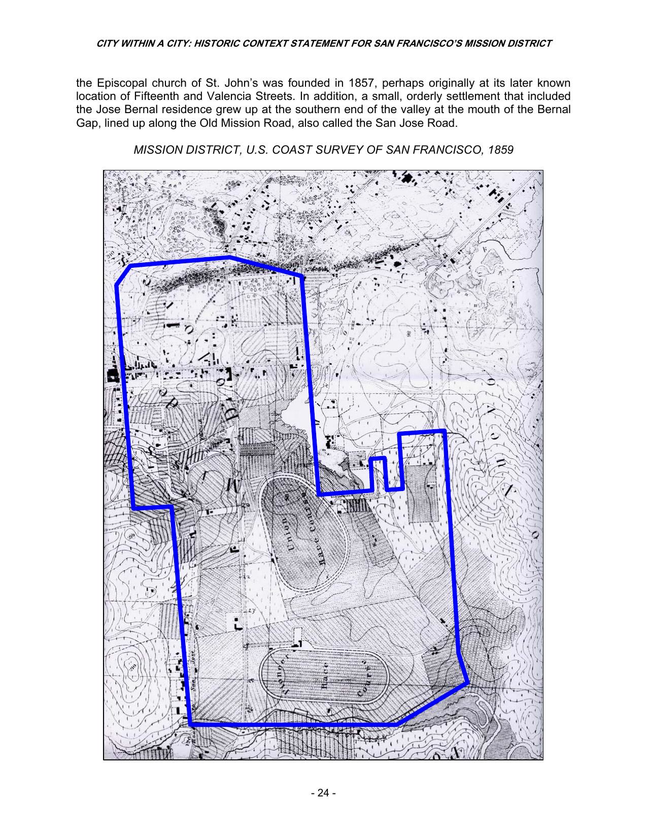
Peter and Eileen Maloney live at No. 15 with their son Joseph

The 1940 census lists all three as California-born. Peter operated Atlas Pharmacy on Valencia, and by 1939 the city directory listed him and D. B. Bell as its proprietors at 220 Stockton, opposite Union Square. Joseph W. Maloney became a technical sergeant and served as a B-24 radio operator and gunner in the Pacific during World War II. In an oral history, his crewmate Robert Raven recalls Peter and Eileen hosting the crew while it was stationed at Hamilton Field in 1944. In the October 1944 crew photo, Joseph is second from the left in the front row. He contributed that photograph to the oral history and joined Raven for a 1999 interview.

1940 census1939 pharmacy listingBancroft Library oral history, pp. 38–39Photograph of Joseph’s B-24 crewJoseph’s interview, p. 451940 census · scanPhotograph of Joseph’s B-24 crew · scan

1939 pharmacy listing

ATLAS PHARMACY (P W Maloney, D 31 Belli) Preseriptions Carefully Compounded, 220 Stockton, Tel GA rfietd 0565

Directory transcription
Bancroft Library oral history, pp. 38–39
Joseph’s interview, p. 45

The Sinclairs and the Wise family lived at No. 19

The 1930 census identifies California-born Harold R. Sinclair as a manager in fire insurance. Clara and their son Richard were also born in California. The same entry lists four relatives in the household at No. 19. Robert S. Wise, a California-born teamster for a produce company, lived with his wife Marjorie and their children Robert and Shirley.

1930 census, lines 94–1001930 directory1930 census, lines 94–100 · scan

Seven years after completion, the building stood immediately west of the Valencia Street commercial frontage.

1930 Fairchild aerial of Hill Street and the surrounding blocks with the present lot marked.
An aerial photograph shows the building seven years after constructionThe four-flat roof is visible just south of Hill Street, with the commercial frontage along Valencia to the east. UC Santa Barbara Library, Fairchild flight C-888X, frame 1, cataloged in March 1930.The outline follows the modern lot, aligned to Hill and the intersections on Valencia and Guerrero.

Four households lived on Hill Street

No. 15. Peter and Eileen Maloney lived with their five-year-old son Joseph and paid $45 a month. The enumerator wrote the household at No. 15 in a run labeled Guerrero Street, immediately before other Hill Street households. The 1930 city directory still lists them on Ashbury Street. The 1931 directory and 1940 census both place the family at 15 Hill, supporting the Hill Street identification. Peter ran Atlas Pharmacy at 1199 Valencia. The 1941 directory lists Gordon H. and Claire Duncan at No. 15.

No. 17. David W. and Esther Shubert lived with their daughters Frances and Muriel and David’s brother-in-law Max Lewis. They paid $55 a month. David was a Market Street Railway conductor and Max was a clothing merchant. The number column is blank on the final census entry. The 1930 directory gives the Shuberts’ address as 17 Hill.

No. 19. Harold R. and Clara Sinclair lived with their son Richard and the Wise family, who were related by marriage. The household paid $50 a month. Harold worked in fire insurance. The census leaves the house number blank after No. 21. The 1930 directory supplies No. 19 and spells the family name Sinclair.

No. 21. Owner Samuel Mayerson and his wife Rose lived with their daughters Anne and Pearl. Samuel dealt in scrap, and Anne worked as a stenographer. The 1931 directory places Samuel and Rose at No. 19.

1930 census · Maloney, lines 25–271930 census · Mayerson and Sinclair, lines 86–1001930 census · Shubert and Lewis, lines 1–51930 city directory1931 Maloney entry1931 Mayerson entryAtlas Pharmacy1941 Duncan entry

1930 census · Maloney, lines 25–27
1930 census · Mayerson and Sinclair, lines 86–100
1930 census · Shubert and Lewis, lines 1–5
1931 Maloney entry

" Peter W (Eileen) (Atlas Pharmacy) h15 Hill

Directory transcription
Atlas Pharmacy

ATLAS PHARMACY (Peter W Maloney) | ATTINGER

Directory transcription

The Maloneys, Shuberts, Mayersons and Antoniolis lived in the building

1933 and 1936. Peter W. Maloney lived at No. 15, S. Mayerson at No. 19, and Leon Antonioli at No. 21 in both years, according to telephone listings. Max Lewis appears at No. 17 in 1933 and Esther Shubert in 1936. The 1933 alphabetical directory also names Leon’s wife, Henrietta. The lists cover published telephone subscribers.

June 1933 street-address listNovember 1936 street-address list

June 1933 street-address list
November 1936 street-address list

Leon and Henrietta Antonioli live at No. 21

Leon and Henrietta lived at No. 21 in 1933, when Leon sold for the Dairy Delivery Company. Henrietta died that December at age 31. Leon was still at No. 21 in 1936 and worked as a driver by 1938. Leon served as a U.S. Army private in World War I and died in 1977. The couple share a burial site at Golden Gate National Cemetery.

1933 directory1936 street-address list1938 directoryCemetery records1936 street-address list · scan

1933 directory

Antonioli Frank (Anna) bldr h2230 Francisco " Leon (Henrietta) slsmn Dairy Del Co r21 Hill

Directory transcription

The assessor maps the Mayersons’ property as lot 8A

The block book shows the separate 50 × 114 ft lot as 8A and names Samuel and Rose Mayerson.

1935 owners

1935 owners
1935 owners

The block book names the Mayersons as owners of lot 8A

1935 assessor block book showing the 15–21 Hill Street parcel.
The block book shows the lot’s 50-foot frontageThe map shows the four-flat property as lot 8A and records its 50-foot frontage and 114-foot depth.The outline follows the mapped lot boundaries.

Federal appraisers assigned the neighborhood containing the building their lowest lending grade during the redlining era.

Detail of the 1937 federal residential security map showing Hill Street in the pink D8 zone immediately west of Valencia.
Federal appraisers place the building in the redlined D8 districtThe Home Owners’ Loan Corporation gave the district its lowest grade, D. The accompanying report describes about 60 blocks west of Valencia, roughly 95 percent built up, with a mix of shops, flats, apartments and single-family homes. It considers the residents’ occupations, incomes and ethnicity when assessing the area.The dashed oval locates the building at neighborhood scale. Federal Home Owners’ Loan Corporation, from Stanford University Libraries and the Center for Spatial and Textual Analysis’s Imagined San Francisco project. Cropped and marked under CC BY 3.0.

Stanford’s full 1937 mapOriginal D8 description · scan and transcription

The building’s roof and surrounding lots appear together before the later changes at the Valencia corner.

1938 · Ryker aerial mosaic with the present lot marked.
An aerial mosaic shows the building and their neighborsThe city’s georeferenced mosaic shows the roof and adjacent properties, with Hill Street running across the image and Valencia on the right.The red outline projects the present 50 × 114 ft parcel onto the city’s georeferenced image.

Ryker composite and catalogCity image tileParcel geometry

The roof of 15–21 Hill Street can be located among the surrounding homes and Valencia storefronts.

1938 aerial photograph of Hill and Valencia, with the four-flat building just below the street at center right.
Harrison Ryker photographs the four-flat roof from aboveThe broad roof at center right, just south of Hill, is 15–21 Hill. Valencia runs along the right edge. Harrison Ryker, frame 54, David Rumsey Map Collection.Lot placement is estimated from the four-flat roof, frontage and adjoining parcels.

1940s

New names on the lot and at the building

Rose Mayerson died in 1940. Harry Giusti appeared at No. 19 by 1944, beginning a connection that would span decades. At the other end of the block, Guerrero was widened for cars during the 1940s. Ownership records name Louis and Ruth Gernhardt by mid-decade and Joseph Disantoro in 1949.

Rose Mayerson’s death record South Mission survey, Guerrero Street widening Giusti residence 1949 property directory

A state death record matches Rose Mayerson of No. 19

The California death index records Rose Mayerson’s death in San Francisco at age 61. It gives her birth date as February 27, 1879, her father’s surname as Krovitz and her mother’s maiden name as Diamond. Her age fits the 1930 census, which places her birthplace in Russia. The 1939 directory lists Rose and Samuel together at No. 19, and the April 1940 census records Samuel as widowed there.

California Death Index entry1930 census1939 directoryApril 1940 census

The Bridgemans, Duncans and Lachtmans live in three units in the building

Edmund Bridgeman lived at No. 21 with Katherine and their daughter Edna in 1940. The census records Edmund’s birthplace as Canada and Katherine’s and Edna’s as California. Edna was 30. The 1941 directory lists her as a keypunch operator at No. 21.

At No. 15, Gordon H. Duncan worked as a clerk for Metropolitan Life. Directories list Gordon and Claire at No. 15 in 1941, 1942 and 1944, and in Belmont by 1948–49. The 1941 and 1942 directories also list salesman Morris Lachtman and his wife Yetta at No. 19.

1940 census1941 directory1942 directory1944 directoryGordon’s 1958 listing1940 census · scan
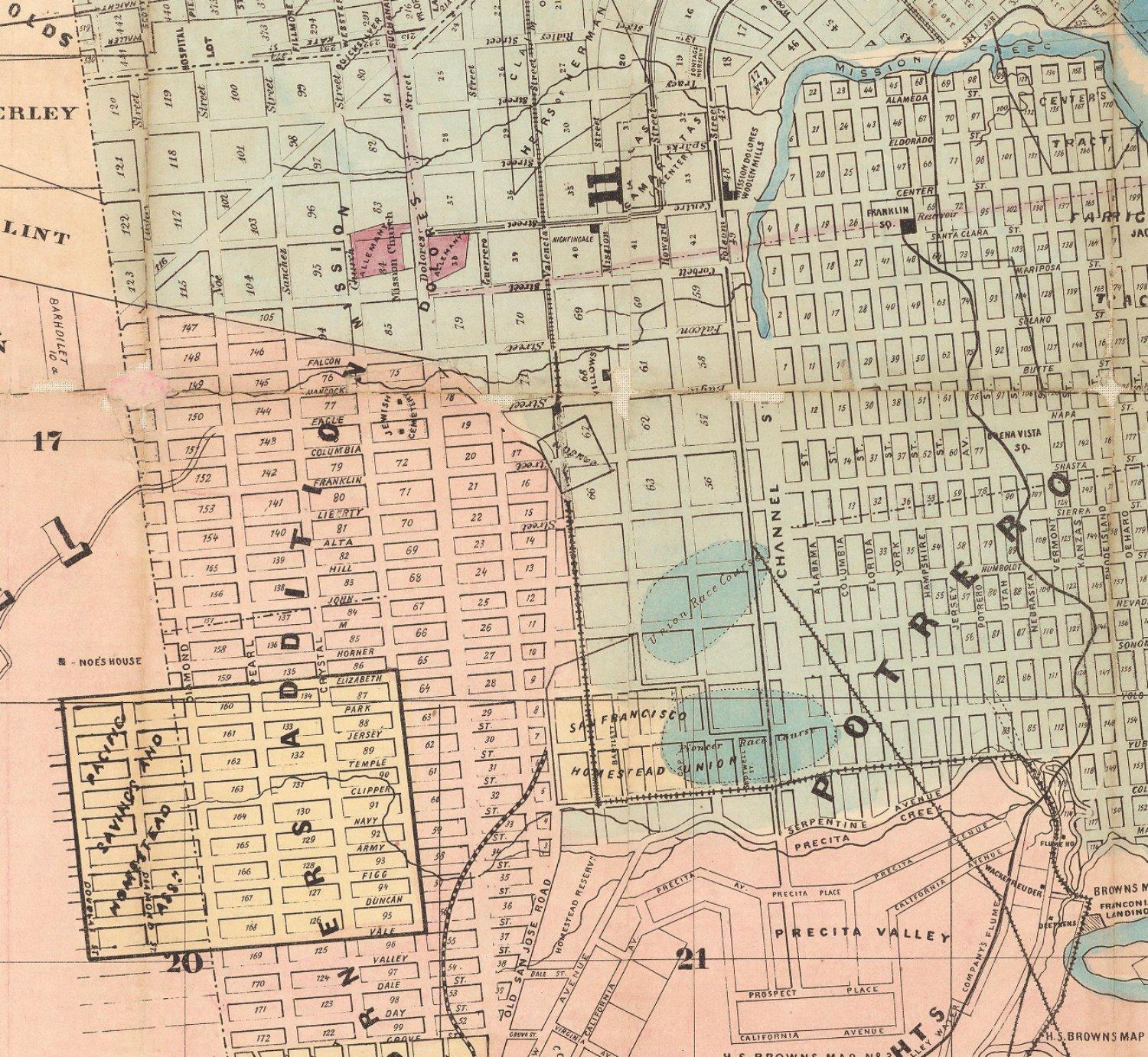
Gordon’s 1958 listing

" Gordon H 'Claire) clk Met Life Ins r Belmont

Directory transcription

Four households lived on Hill Street in 1940

No. 15
Peter and Eileen Maloney, and their son Joseph. Peter was a druggist. The household paid $37.50 a month.
No. 17
Dave and Ester Schubert, their two daughters, and lodger Salvador La Rue, a driver for a laundry. Dave was a street railway conductor.
No. 19
Sam Mayerson, a widower born in Russia. The census describes him as a renter.
No. 21
Edmund and Katherine Bridgeman, and their daughter Edna. Edmund worked in a liquor warehouse.

1940, sheet 9B1940, sheet 10A

1940, sheet 9B
1940, sheet 9B
1940, sheet 10A
1940, sheet 10A

Muriel Shubert edits Mission High School’s yearbook

While living at No. 17, Muriel edited the spring 1940 issue of The Mission. The student staff interviewed and photographed one student from each grade for an issue that followed students at work and at play. The title spread credits Muriel as editor, and page 74 captions a photograph of her with the yearbook’s mock-up.

The Mission, title spread and p. 74 Muriel’s household at No. 17

Greenberg Tire Co. serves drivers on Valencia

The classified telephone directory lists Greenberg Tire Co. at 1058 Valencia, near the southwest corner of Hill and Valencia. It appears among tire businesses in the 1942 directory.

1942 classified telephone directory 1946 aerial photograph

Aerial view of the Hill and Valencia corner in 1946.
1946 aerial of the corner, four years after the directory listing. UCSB Library.

Louis and Ruth Gernhardt may have bought the building by 1946

Louis A. and Ruth Anita Gernhardt owned the building by 1946; the date they acquired it remains unknown. Louis (1896–1962) served as a U.S. Army corporal in World War I. He and Ruth (1901–1969) were living together in San Francisco by 1921. They lived in the city in the 1930s and are buried together at Golden Gate National Cemetery. Louis worked at Gernhardt-Strohmaier, the stove and appliance firm at 18th and Mission. A 1927 reconveyance for a $55,000 loan on the store property names Louis A. and Ruth alongside L. J. and Julia Gernhardt and J. C. and Clara Strohmaier. By 1958 Louis A. was the firm’s vice president, and the couple lived in Daly City. The same directory lists Louis A. Jr. as a salesman for the firm. A 1922 directory advertisement lists the firm’s gas stoves and ranges. San Francisco’s historic resource survey documents the 1937–38 Streamline Moderne remodeling of the Mission storefront.

1921 directory1922 business advertisement1946 ownership record1958 directoryCity survey of the store1930 city directoryGolden Gate National Cemetery burial records1946 ownership record · scan1927 store loan reconveyance

The 1927 reconveyance names all three couples and the southeast corner of 18th and Mission.
Edwards Abstracts, June 8, 1927, p. 4.
1921 directory

Gernetti John (Eda) whsemn r 175a Corbett Av Gernhardt Louis A (Ruth) (Gernhardt-Stroh- maier Co) r 78a Page

Directory transcription
1958 directory

Gernhardt-Stroh- Gernhardt Louis A (Ruth) F-pres maler Co r Daly City

Directory transcription
City survey of the store, PDF page 26
The ownership evidence

Andrews lists Louis A. Gernhardt and a co-owner initialed R in 1943. The 1946 block book gives both names, Louis A. and Ruth A. Gernhardt. The 1935 block book lists the Mayersons, and the 1940 census records Samuel Mayerson renting No. 19. The transfer date and any owners between the two families remain undocumented.

1943 property directory1946 owners

1943 property directory
1946 owners
1946 owners

The block book pairs the Gernhardt names with the parcel map

1946 assessor block book showing the 15–21 Hill Street parcel.
The assessor maps lot 8A beside the two Valencia lotsThe 50-foot lot 8A appears next to Valencia lots 8 and 8B. The facing owner list names Louis A. and Ruth A. Gernhardt.The outline follows the mapped lot boundaries.

The Giustis make their home at No. 19

Harry Giusti was living at No. 19 by 1944. By 1950, he and Nina shared the home with their daughters Sandra, six, and Linda, one. Harry worked as a mechanical engineer for an electrical contractor and later for Bechtel. He was still listed at No. 19 in 1972, 28 years after the earliest record found.

Nina Elizabeth Nelson Giusti (1921–2005) was the daughter of Peter and Hulda Nelson and a graduate of San Francisco’s Mission High School. Her obituary records four children and service on the Rio Nido Homeowners Association board. It gives her burial place as Cypress Lawn.

1944 telephone directory1950 census, sheet 73, lines 24–271963 directory1969–70 directory1972 street directoryNina’s Chronicle obituary1950 census, sheet 73, lines 24–27 · scan

1969–70 directory

-- FILIBERTO (NELLA) WINDOW CLN CROSETTI BROS H922 ATHENS ST -- FRANK (ELLIA) APT MGR H3637 FILLMORE ST APT 103 GLORIA F PRES PICO BATTERY MFG CO H165 SOUTHWOOD DR -- HARRY A (NINA E) ENG BECHTEL H19 HILL ST

Directory transcription

Streetcars carry wartime recruitment signs past 22nd and Valencia

In April, Waldemar Sievers photographed Market Street Railway car No. 804 on Route 11 carrying a sign recruiting men and women as transit workers. The ornate storefront at 3296 22nd Street fills much of the background, and the sign for Frankie Brown’s hangs on the right. A second Sievers photograph from May shows Route 9 car No. 278 with a Coast Guard recruitment advertisement and the same Gothic Revival corner behind it. A parked car carries a gasoline ration sticker.

April photograph · OpenSFHistory / wnp27.50132 May photograph · OpenSFHistory / wnp14.1598 1947 view of the storefront

A streetcar with wartime recruitment signs at Valencia and 22nd in 1944.
April 1944 streetcar at Valencia and 22nd. Waldemar Sievers, OpenSFHistory / wnp27.50132.

Joseph Maloney grew up at No. 15 and served as a B-24 radio operator and gunner during World War II.

October 1944 photo of a B-24 crew, with former 15 Hill resident Joseph Maloney second from the left in front.
Joseph Maloney serves on a B-24 crewMaloney is second from the left in the front row. Photograph courtesy of Joseph Maloney, Bancroft Library oral history.

The building and the Valencia corner can be seen before the corner became a service station.

July 29, 1946 · Hill Street before the corner service station with the present lot marked.
An aerial photograph shows Hill Street before the corner service stationThe four-flat property sits just west of the buildings on Valencia. The film margin is dated July 29, 1946. The UCSB flight index catalogs this frame under 1947. UC Santa Barbara Library, GS-CP, frame 2-29.The outline follows the modern lot, aligned to Hill and the intersections on Valencia and Guerrero.

Tom Gray photographs a streetcar outside the future Boogaloos

Gray catches Muni car No. 432 passing 3296 22nd Street, across Valencia from Hibernia Bank. The city’s survey dates the Gothic Revival building to 1927. Its corner ornament and tall window band identify the same storefront that later housed Coffee Don’s and appears as Boogaloos in “Semi-Charmed Life.” The four Hill Street flats sit outside the frame.

Tom Gray photograph · OpenSFHistory / wnp27.7767 City historic survey · Block 3616, lot 013

A streetcar passes the building that later housed Boogaloos in 1947.
1947 streetcar at Valencia and 22nd. Tom Gray, OpenSFHistory / wnp27.7767.

The building stood beside the older Valencia corner buildings before the bank’s later drive-through project.

1948 · Hill and Valencia from above with the present lot marked.
An aerial photograph captures the building beside the Valencia corner buildingsThe four-flat building’s front roof and rear lot appear immediately below Hill Street. The corner buildings on Valencia predate Hibernia Bank’s drive-through project.The red outline projects the present 50 × 114 ft parcel onto the city’s georeferenced image.

City image tileParcel geometry

Joseph Disantoro owned the building by 1949

Andrews names Joseph Disantoro as the owner of the four-flat property in 1949. In April 1950, the federal census recorded a Joseph DiSantoro on Chenery Street in San Francisco. He was 62, widowed, born in Italy and a naturalized U.S. citizen. He co-owned a liquor store and reported working 36 hours the previous week.

The 1955–56 directory lists Joseph with Tina and the business Frank & Joe’s. In 1960 the directory names Joseph DiSantoro and Frank J. Oneto as the partners in that liquor store at 5170 Mission Street. Joseph was listed as retired in 1966. The 1973 directory calls him Giuseppe and lists him with Christina. The names and trade fit the census record. The shared name and trade suggest that he was the owner listed in 1949.

At the January 1975 demolition hearing, the owner’s realtor said his unnamed client was 88 and had owned the building for more than 30 years. The age is close to the census entry. The claimed length of ownership would put the purchase before January 1945, although the 1946 assessor book still lists the Gernhardts.

1950 census, sheet 331955–56 directory1949 property record1958 directory1960 business listing1966 directory1973 directory, original page1975 hearingDeath index lead1949 property record · scanJanuary 9, 1975 hearing minutes, p · scanJanuary 9, 1975 hearing minutes, p · scanJanuary 9, 1975 hearing minutes, p · originalJanuary 9, 1975 hearing minutes, p · scanJanuary 9, 1975 hearing minutes, p · originalJanuary 9, 1975 hearing minutes, p · scanJanuary 9, 1975 hearing minutes, p · originalJanuary 9, 1975 hearing minutes, p · scanJanuary 9, 1975 hearing minutes, p · original

1950 census, sheet 33, line 3. Joseph DiSantoro appears at the top of the excerpt.
National Archives census sheet 33, full page
1955–56 directory

The alphabetical listing names Joseph and Tina DiSantoro and identifies Frank & Joe’s as his business.

Directory transcription
1958 directory

DiSantoro Jos (Christina; Frank & Joe's) h1525 Cayuga Di-brow Ann (wid Albert K) b240 Arlington

Directory transcription
1966 directory

" Ruth retd h261 Clara apt 3 DiSantoro Jos (Christina) retd h1525 Cayuga av

Directory transcription
1973 city directory, Giuseppe and Christina DiSantoro
1949 property directory

1950s

Families stay as the corner changes

A service station occupied the Valencia corner beside the building by 1950. Nearby Mission Street stores promoted the corridor as the “Miracle Mile” in 1952. Esther Shubert and Harry Giusti were still listed at Nos. 17 and 19 in the mid-1950s, when Roy Crawford first appeared at No. 15.

1950 Sanborn map San Francisco Planning, Mission Street commerce Mid-century residents

James and Patricia Macauley live at No. 21 with their daughters

James W. and Patricia M. Macauley lived at No. 21 with their daughters Nancy and Janice in 1950. Both parents were 25 and born in California. James was an accountant who worked for W. S. Boutell. He was still listed at No. 21 in 1955–56. The census spelled their name McCauley; telephone and city directories used Macauley.

1950 census, sheet 11, lines 27–301950 telephone directory1951 city directory, p. 8081955–56 street directory1950 census, sheet 11, lines 27–30 · scan

1951 city directory, p. 808
1955–56 street directory

15 Crawford Roy H V A VA 66491 16 Peterson Ruth RO A VA 47103 16a Hill Henry A A AT 80251 17 Shubert Esther Mrs A AT 25293 18 Bunton Ernest EO A VA 42162 19 Giusti Harry A A MI 72120. 20 DeSassise Frank @ & AT 21816 20 1% Kurpieski Walter A & MI 84501

Directory transcription

James and Lee Toscano live at No. 15

The 1950 census at No. 15 records James W. Toscano as a sales supervisor in the beverage business and Lee as a sales correspondent in metal foil. Both were born in California. In 1951, Polk still lists the couple at No. 15, giving James’s occupation as driver and naming Lee’s employer, Reynolds Metals Company, where it lists her as office secretary.

1950 census, sheet 75, lines 26–271951 city directory, p. 13081950 census, sheet 75, lines 26–27 · scan
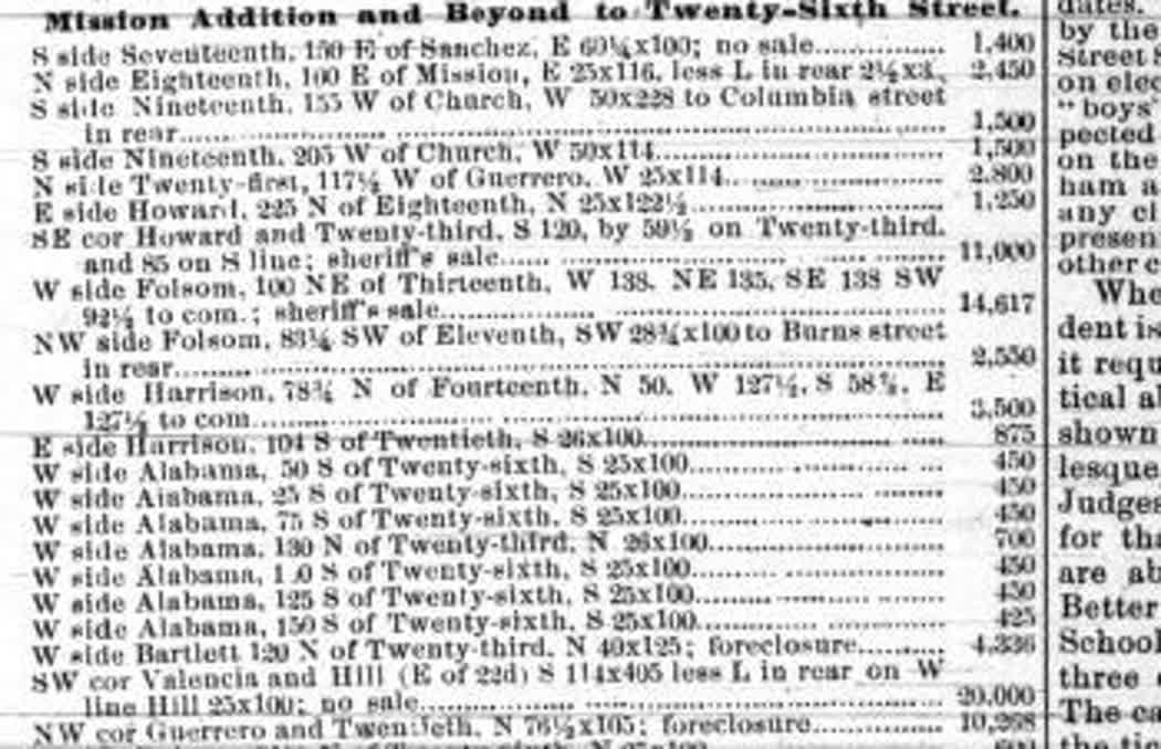
1951 city directory, p. 1308

Families and lodgers lived in the building in 1950

No. 15
James W. and Lee Toscano, both born in California. James supervised beverage sales. Lee worked as a sales correspondent in the metal foil industry.
No. 17
David W. and Esther Shubert, and a Russian-born lodger named Philip H., whose surname appears to read Carver. David worked for the municipal railway. Esther was a garment seamstress.
No. 19
Harry A. and Nina E. Giusti and their daughters Sandra and Linda, all born in California. Harry worked as a mechanical engineer for an electrical contractor.
No. 21
James W. and Patricia M. McCauley and their daughters Nancy and Janice, all born in California. James was an accountant.

1950 No. 21 · sheet 111950 first visit · sheet 121950 Nos. 17 and 19 · sheet 731950 No. 15 · sheet 75

1950 No. 21 · sheet 11
1950 first visit · sheet 12
1950 Nos. 17 and 19 · sheet 73
1950 No. 15 · sheet 75
1950 fire insurance map labeling 15, 17, 19 and 21 as four flats.
Sanborn places the building beside a Valencia service stationSanborn sheet 706 shows the current building and the auto-service lot on the Valencia corner.The outline follows the four-flat lot shown on the revised sheet.

The map shows a main block spanning almost the full 50-foot frontage and extending about 54 feet back from Hill. A one-story projection on the east side reaches about 67 feet back. The 1922 contract specifies four wood-frame flats, two stories and a basement. The date of the rear projection and the opening floor plan are still unknown.

1950 Sanborn sheet 706 · scan November 1922 contract March 1930 roof view
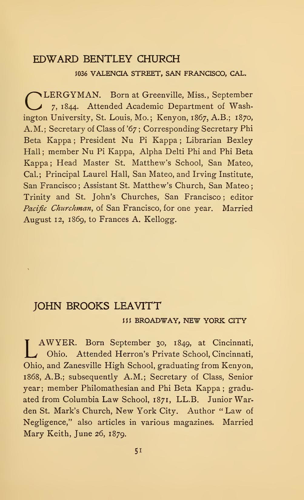
A possible match for Samuel Mayerson lived in San Jose

At 53 Pleasant Street, the census lists Samuel Mayerson, a 71-year-old naturalized citizen born in Russia. He was the head of household and shared the address with three men listed as lodgers. The 1950 Sanborn edition shows a two-story wood-frame dwelling at No. 53, one house in from Carlysle Street.

The name, birthplace and ten-year age progression fit the former Hill Street owner. The 1940 census recorded him as a widower at No. 19. The San Jose entry says divorced. A family record linking the two addresses remains to be found.

The California death index lists a Samuel Mayerson born October 25, 1878, who died in Santa Clara County on November 20, 1961. The birth date fits both census ages. His connection to the Hill Street family is still provisional.

1950 San Jose census, sheet 14, lines 7–10 Street name on the following sheet 1940 Hill Street census, sheet 9B, line 76 1950 Sanborn map, sheet 87 Detail of 53 Pleasant Street 1961 state death index entry

Bury-Vanham sells tires on the corner

The 1955–56 directory lists Bury-Vanham Tire Co. at 1058 Valencia. The alphabetical listing names Robert H. Bury and Thomas H. Vanham. The 1950 Sanborn map shows a service station on the corner, and a 1956 aerial shows the open forecourt. The records do not establish whether the tire company operated the station.

1955 directory listing 1955–56 tire dealers 1950 Sanborn map 1956 aerial photograph

Aerial view of the Hill and Valencia corner and forecourt in 1956.
1956 aerial showing the corner forecourt. UCSB Library.

Polk tracks households in the building

1955–67. Polk lists Roy H. Crawford at No. 15 in 1955–56, 1966, and 1967. In 1955–56, it lists Esther Shubert at No. 17, Harry A. Giusti at No. 19, and James W. Macauley at No. 21. In 1967, it lists Edith E. Foley at No. 17, Giusti at No. 19, and Robert R. O’Balle at No. 21.

1955–56 reverse directory1966 reverse directory1967 reverse directory

1955–56 reverse directory

15 Crawford Roy H V A VA 66491 16 Peterson Ruth RO A VA 47103 16a Hill Henry A A AT 80251 17 Shubert Esther Mrs A AT 25293 18 Bunton Ernest EO A VA 42162 19 Giusti Harry A A MI 72120. 20 DeSassise Frank @ & AT 21816 20 1% Kurpieski Walter A & MI 84501

Directory transcription
1966 reverse directory

17 Foley Edith E VA6-7549

Directory transcription
1967 street directory. Crawford appears at No. 15 and O’Balle appears at No. 21.

Roy and Grace Crawford lived at No. 15

Roy H. Crawford lived at No. 15 for more than a decade, appearing there from the 1955–56 directory through 1967. By 1967, he was a mechanic for the U.S. Navy and lived with his wife, Grace.

1955–56 street directory1966 street directory1967 alphabetical directory1967 street directory1967 street directory · scan
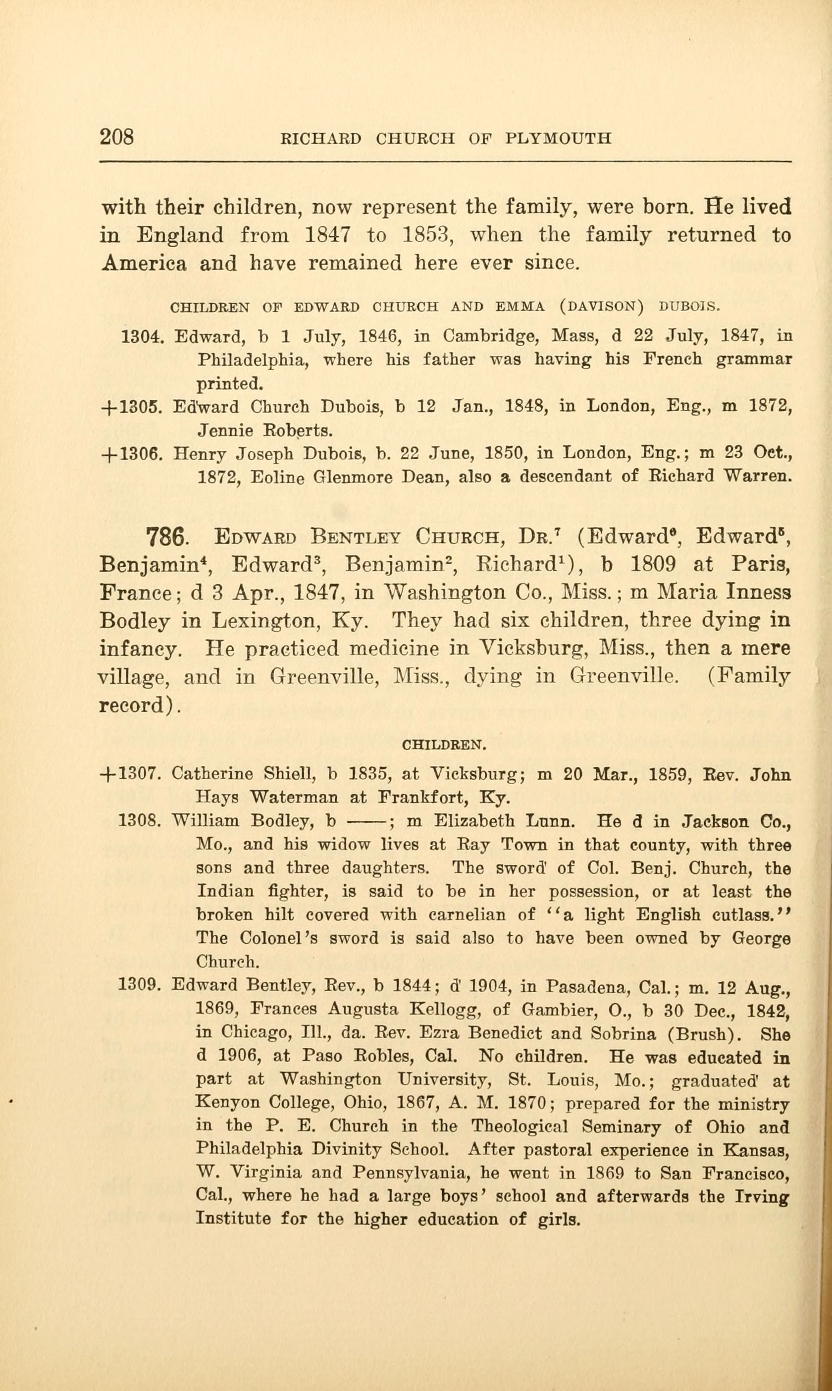
1955–56 street directory

The Hill Street listings place Roy H. Crawford at No. 15.

Directory transcription
1966 street directory

The Hill Street listings again place Crawford at No. 15.

Directory transcription
1967 alphabetical directory. The entry shows Roy and Grace Crawford, Roy’s job, and No. 15 Hill.

By the mid-1950s, a service-station forecourt occupied the Valencia corner just east of the building.

September 8, 1956 · The building and the Valencia corner with the present lot marked.
An aerial photograph shows the building uphill from the service stationA low building and open forecourt occupy the Valencia corner shown as a service station on the 1950 Sanborn sheet. The building stands just uphill. UC Santa Barbara Library, GS-VLX, frame 1-89.The outline follows the modern lot, aligned to Hill and the intersections on Valencia and Guerrero.

1960s

Two generations next door

In 1962 the city’s Mission neighborhood marked its ties to Mexico with a statue of Miguel Hidalgo in Dolores Park. By the middle of the decade, Sandra Giusti O’Balle and Robert O’Balle lived at No. 21 next door to her parents at No. 19. Later directory editions list the Zamaconas at No. 15 and Andre Hernandez at No. 21.

Mission District history, 1962 Hidalgo statue The O’Balles and Giustis Late-1960s residents

The property lay just west of a zoning boundary, and the map later carried the bank’s demolition case number.

1960–1965 zoning block book showing the 15–21 Hill Street parcel.
The zoning block book places lot 8A west of the R-3 and C-2 boundaryLot 8A sits immediately west of the red R-3/C-2 zoning line. The city later wrote the 1974 demolition case number over the parcel.The outline follows the mapped lot boundaries.

A zoning map traces the boundary beside the four-flat lot

A citywide aerial places the Hill Street block within the wider Mission and San Francisco landscape.
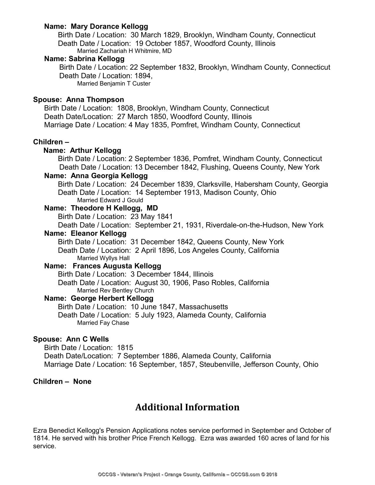
April 10, 1960 · the Mission in a citywide frame with the present lot marked.
A USGS aerial photograph captures the Mission and the East BayThe U.S. Geological Survey frame spans San Francisco and part of the East Bay. USGS EarthExplorer, photo B590450100744.The dashed outline marks the vicinity from the catalog’s frame corners. The available scan is citywide.

USGS frame record

The photograph shows the relationship between Hill Street’s short residential block and busy Valencia Street.

July 24, 1963 · From Guerrero to Mission Street with the present lot marked.
An aerial photograph follows Hill Street east from GuerreroThe aerial follows Hill east from Guerrero to Valencia and shows how the short residential street meets the longer commercial blocks. UC Santa Barbara Library, CAS-SF, frame 1-77.The outline follows the modern lot, aligned to Hill and the intersections on Valencia and Guerrero.

The roof and rear yard reveal how the building occupied its lot before the later rear addition.

May 11, 1965 · The four-flat roof and rear lot with the present lot marked.
An aerial photograph shows the roof and rear yardThe closer frame shows the roof along Hill and the open part of the lot behind it. UC Santa Barbara Library, CAS-65-130, frame 1-62.The outline follows the modern lot, aligned to Hill and the intersections on Valencia and Guerrero.

Edith E. Foley lives at No. 17

Edith lived at No. 17 in 1966 and was still listed there in 1972. She worked as a press feeder at Reynard Press. The firm’s earlier Mission District shop was at 2700 19th Street. By 1966 it was a division of Jeffries Banknote Company on Sansome Street.

1966 street directory1966 alphabetical directory 1972 alphabetical directory1958 Reynard Press listing1966 Reynard Press listing

1966 street directory

17 Foley Edith E VA6-7549

Directory transcription
1958 Reynard Press listing

REYNARD PRESS, O J Nusser Pres, E H Nusser V-Pres, F S Nusser Sec-Treas, Printers, Pub- lishers, 2700 19th, Zone 10, Tel ATwater 2-5802 Reynaud Alf (Grace resratch tech CofCal Top h565 Page apt 4

Directory transcription
1966 Reynard Press listing

REYNARD PRESS CO (Division of Jef- fries Banknote Co), James W Or- rington Pres, O Jay Nusser V-Pres Frank S Nusser V-Pres, Litho- graphers, Financial Printers and Engravers, 1045 Sansome, Tel 981-7882

Directory transcription

Robert and Sandra O’Balle live next door to her parents

Robert R. and Sandra O’Balle lived at No. 21 in 1966, next door to Sandra’s parents, Harry and Nina Giusti. Robert worked as a roofer for Humbert Roofing Company and was still listed at No. 21 in 1967. Nina Giusti’s obituary names Sandra O’Balle, married to Robert, as her daughter, connecting the two households.

1966 alphabetical directory1967 street directoryNina Giusti’s obituary1967 street directory · scan
1966 alphabetical directory

Robt R (Sandra) roofer Humbert Roofing Co h21 Hill

Directory transcription
San Francisco Chronicle, February 26, 2005

Nina Giusti’s family named Sandra O’Balle and her husband Robert in the obituary.

José and Hilda Zamacona lived at No. 15

José M. Zamacona lived at No. 15 in 1968, and Hilda A. was listed with him in 1969–70. The flat was listed as vacant in 1971. José was listed there again in 1975 and in 1980–82; Po Ho was listed there in 1977. The gaps leave their exact dates of residence open.

1968 directory, p1971 Hill Street listings1975 street directory, p1977 street directory, p1980 street directory, p1981 street directory, p1982 street directory, p1968 directory, p · scan1971 Hill Street listings · scan1975 street directory, p · scan1977 street directory, p · scan1980 street directory, p · scan1981 street directory, p · scan1982 street directory, p · scan
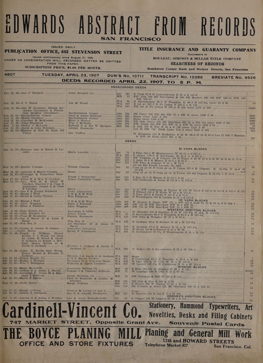
1969–70 household listing

José M. and Hilda A. Zamacona appear together at No. 15.

Directory transcription

Four households lived in the building in 1968

No. 15: José M. Zamacona. No. 17: Edith E. Foley. No. 19: Harry A. Giusti. No. 21: A. M. Hernandez.

1968 directory, p

1968 directory, p. 267. Hill Street starts at the bottom of the third column and continues at the top of the fourth.

The Zamaconas, Foley, Giusti and Hernandez lived on Hill Street

The street directory lists José M. Zamacona at No. 15, Edith E. Foley at No. 17, Harry A. Giusti at No. 19, and A. M. Hernandez at No. 21. The alphabetical directory lists Hilda A. Zamacona with José.

1969–70 street directoryZamacona household entry

Zamacona household entry

-- JOSE M (HILDA A) H15 HILL ST -- LINO C (MARIE F) RETD H219 CURTIS ST

Directory transcription

1970s

Neighbors keep the building standing

The Mission’s two BART stations opened in November 1973. In 1975, Hibernia Bank sought to replace the occupied flats with a nine-space parking lot. Neighbors brought letters, photographs and a petition to City Hall, and the Planning Commission unanimously denied demolition.

BART, opening of the Mission stations Demolition hearing

A Kentucky Fried Chicken is built at Hill and Valencia

The city’s preservation review dates the construction of the one-story Kentucky Fried Chicken building on the southwest corner to 1970. It describes a shingled roof, concrete-block walls and aluminum-frame windows. A 1972 directory lists the restaurant at 1058 Valencia. City planning later identified the corner parcel as 1050 Valencia.

City historic resource evaluation 1972 city directory

Kentucky Fried Chicken at Hill and Valencia, with Bajone’s and Hibernia Bank along Valencia Street in 1988.
Kentucky Fried Chicken, Bajone’s and Hibernia Bank in 1988Looking south along Valencia from Hill Street. Max Kirkeberg, February 15, 1988. San Francisco State University, Max Kirkeberg Collection.

No one was listed at No. 15 in 1971

No. 15: Listed vacant. No. 17: Edith E. Foley. No. 19: Harry A. Giusti. No. 21: Andre Hernandez.

1971 Hill Street listings

1971 Hill Street listings. No. 15 is marked vacant, and No. 21 lists Andre Hernandez.

Poets and publishers gather at 1018 Valencia

In the January 1972 issue of Sisters, the Lesbians Speak Out Collective listed 1018 Valencia, near 21st Street, as the address for submissions to its anthology. The notice invited poetry, songs, drawings, and short fiction.

Alejandro Murguía remembers the same storefront as a Third World Communications gathering place. At one reading in the 1970s, Pedro Pietri performed “Puerto Rican Obituary,” and Jessica Hagedorn, Ntozake Shange, and Víctor Hernández Cruz were among the readers. Murguía estimated that about 150 people crowded into the space. The reading’s exact date remains unverified.

Anthology call in Sisters, p. 27 Murguía’s account and audio narration

Judith Lynch photographs the Guerrero end of Hill

Lynch’s March 1973 slide shows the Italianate at 948 Guerrero, directly across from where Hill ends, beside an apartment building the archive dates to 1962. In March 1974 she photographed the painted entry portico of 77–79 Hill on the south side near Guerrero. Her collection also includes a wider view of the front and a close-up of its Corinthian columns.

The house at 948 Guerrero helps place the undated family snapshot looking west along Hill.

948 Guerrero · wnp25.11978 March 1974 portico at 77–79 Hill · wnp25.10848 Front of 77–79 Hill · wnp25.10486 Portico close-up · wnp25.11079

948 Guerrero near the west end of Hill Street in March 1973.
948 Guerrero, March 1973. Judith Lynch, courtesy Victorian Alliance; OpenSFHistory / wnp25.11978.

The assessor photographs the front of the building

The photograph reverse is stamped July 18. Box 48, bundle 432, file 1.

View the assessor photograph on About

The 1974 assessor photograph of 15–21 Hill Street.
15–21 Hill, July 17, 1974. San Francisco Assessor photograph.

A family snapshot looks west along the Hill Street block

Two people pose beside a flowering street tree, with parked cars and the houses across Guerrero behind them. The slope, T-intersection and paired bay windows in the background match a modern view west from Hill. The building at 15–21 sits east of the camera’s view. The car styles and clothing suggest the 1970s. The mid-1970s placement is an estimate; the exact year and spot where the photographer stood are unknown. The photograph was shared online in September 2025.

Original family photograph Modern street view for comparison Judith Lynch’s 1973 photograph of 948 Guerrero

Family photograph looking west along Hill toward Guerrero.
Family photograph, estimated mid-1970s; shared on Reddit in 2025.

Four households lived in the building in 1975

No. 15: José Zamacona. No. 17: Edward R. Palacios. No. 19: George W. Lollar. No. 21: Andre M. Hernandez.

The directory supplies names for this edition. The January demolition hearing described four occupied flats and recorded household sizes.

1975 street directory, p

1975 street directory, p. 268. The four Hill Street listings include Andre M. Hernandez.

The Lollar family lives at No. 19

Before living on Hill Street, George W. and Alta M. Lollar shared a Guerrero Street address with Larry G. in 1963. George worked in the Fairmont Hotel laundry, and Larry was a student.

George was living at No. 19 Hill in 1975. By 1977, he was retired and Alta and Larry were listed with him at No. 19.

1963 directory, p1975 street directory, p1977 alphabetical directory, p1975 street directory, p · scan
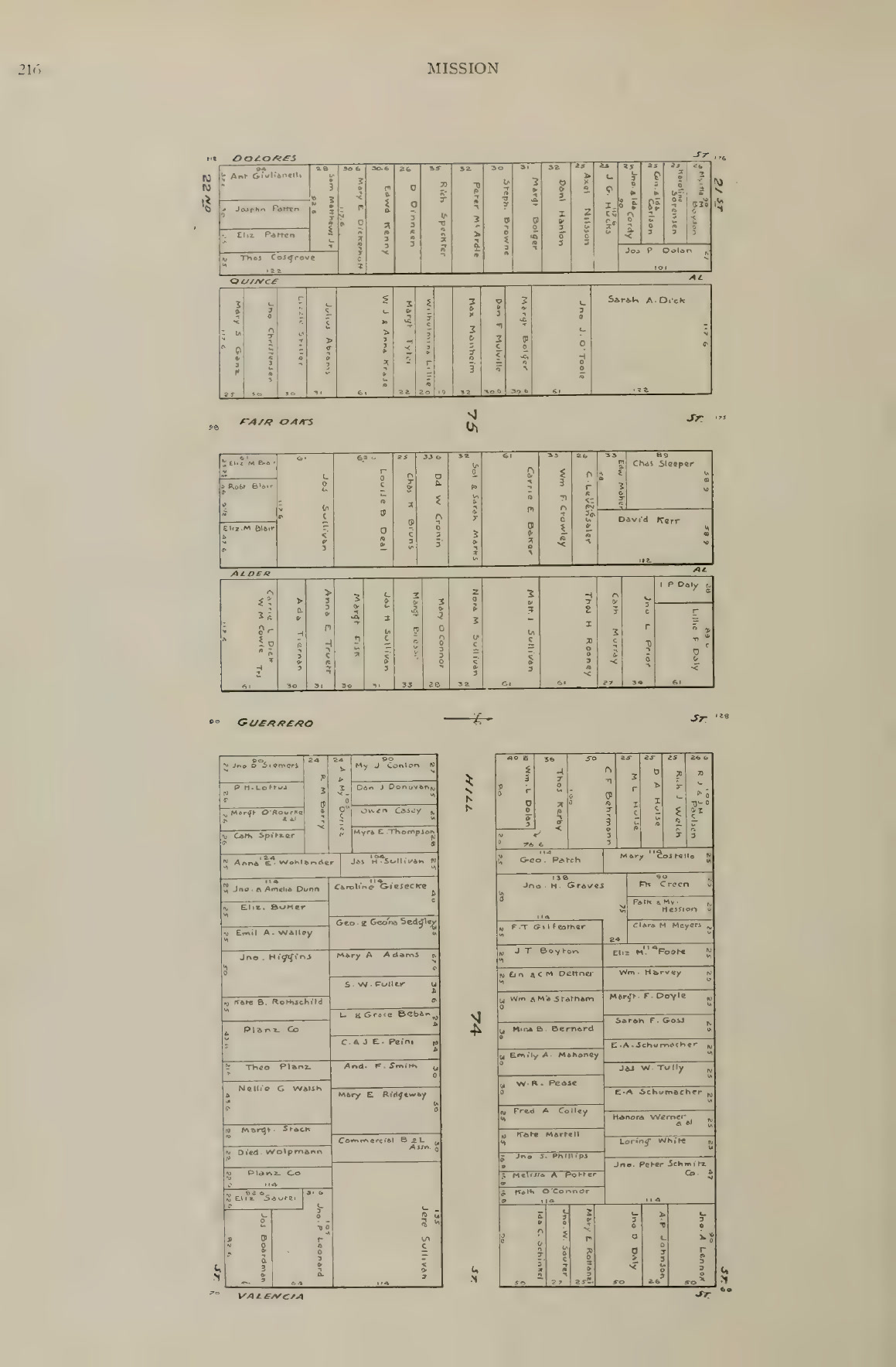
1963 directory, p. 921. George worked in the Fairmont laundry and Larry was a student.
1977 alphabetical directory, p. 600. George W., Alta M. and Larry G. Lollar appear at No. 19.

Hibernia Bank wants to demolish the building

Hibernia Bank sought to demolish the building for a nine-space parking lot and drive-through exit onto Hill Street. All four flats were occupied. Neighborhood spokesman Larry Farage presented photographs, letters, and a petition with 92 signatures. About 50 people raised their hands in opposition at the hearing. The Planning Commission unanimously denied the application in Resolution 7280, case CU74.53.

Zoning administrator R. Spencer Steele described four households totaling 12 people. Realtor Emmett Callon, representing the owner, said the building brought in a little over $400 a month in total rent and less than $2,000 in annual net income. Callon said the owner had held the building for more than 30 years.

The commissioners visited the property that afternoon. The zoning administrator reported three issues flagged by the Bureau of Building Inspection. The storage areas needed sprinklers, the stairways needed handrails, and permanent wiring was needed in place of long extension cords. The minutes also refer to a recent Sunday newspaper walking tour that pictured Hill Street. The minutes leave the newspaper and the properties it pictured unidentified.

Original minutes, pp. 4–8Hibernia branch streetscape, 1988

January 9, 1975 hearing minutes, p. 4
January 9, 1975 hearing minutes, p. 5
January 9, 1975 hearing minutes, p. 6
January 9, 1975 hearing minutes, p. 7
January 9, 1975 hearing minutes, p. 8

Po Ho lived at No. 15 and August Losso at No. 21

No. 15: Po Ho. No. 17: Edward R. Palacios. No. 19: George W. Lollar. No. 21: August Losso.

The alphabetical directory also names Magdalena Palacios at No. 17 and Alta M. and Larry G. Lollar at No. 19.

1977 street directory, p

1977 street directory, p. 281. The entry at No. 21 reads August Losso.

August Losso lived at No. 21

The 1977 city directory names August Losso at No. 21. A likely match is the man of that name who lived with his daughter Irene A. Zerbato and her husband Henry across the street at No. 22. The 1950 census records him there as a 65-year-old widower born in Italy and a naturalized U.S. citizen. The 1962 directory still lists him at No. 22.

The 1948–49 directory lists two August Lossos on Hill Street, a carpenter at No. 22 and August Jr. at No. 22½.

1950 census, sheet 6, lines 19–211962 alphabetical directory, p1977 street directory, p1948–49 directory for both Lossos1977 street directory, p · scan

1948–49 directory for both Lossos

The directory lists August Losso Sr. as a carpenter at No. 22 and August Jr. with Anita at a neighboring Hill Street flat.

Directory transcription
1950 census, sheet 6, lines 19–21. August Losso lived with Henry and Irene Zerbato at No. 22 Hill.
1962 alphabetical directory, p. 966. August Losso appears at No. 22 Hill, across the street.

1980s

Life after the demolition vote

José Zamacona was again listed at No. 15 by 1980, and Fernando and Lusia Vareda lived at No. 21. The city designated the nearby Liberty-Hill Historic District in 1985. Max Kirkeberg’s 1988 slides show Hibernia Bank and its drive-through beside the corner. The city logged repairs to the building’ rear stairs in 1989.

1980 residents Liberty-Hill designation Kirkeberg’s Valencia photographs 1989 rear stairs

José Zamacona lived at No. 15 in 1980

No. 15: José Zamacona. No. 17: R. K. Thiesfeld. No. 19: Robert Tyler. No. 21: F. Vareda.

The 1981 alphabetical directory gives F. Vareda’s first name as Fernando.

1980 street directory, p

1980 street directory, p. 361. R. K. Thiesfeld appears at No. 17 and Robert Tyler at No. 19.

The city’s zoning map retained the case number for the unsuccessful proposal to demolish the building.

1980s zoning block book showing the 15–21 Hill Street parcel.
The city marks the demolition case on the zoning mapIn addition to the zoning boundaries, the city marked the Liberty-Hill Historic District and case CU74.53 on this sheet.The outline follows the mapped lot boundaries.

A zoning map marks the Liberty-Hill Historic District

Johnny A. Bajone lived at No. 17 in 1981

No. 15: José Zamacona. No. 17: Johnny A. Bajone. No. 19: Robert Tyler. No. 21: Fernando Vareda.

The alphabetical directory also places Lusia A. Vareda at No. 21.

1981 street directory, p

1981 street directory, p. 1749. Johnny A. Bajone appears at No. 17.

Johnny A. Bajone lives at No. 17

Johnny A. Bajone lived at No. 17 in 1981 and 1982. North Mission News says Johnny Bajone operated the jazz club at nearby 1062 Valencia from about 1978 to August 1, 1988. The club’s own 1985 advertisement confirms it was named for its owner. A possible earlier match, John Bajone, worked in construction in 1972.

North Mission News on the club’s ownership Mal Waldron at the club Malo’s homecoming show 1981 street directory, p1982 street directory, p1972 alphabetical directory. A John Bajone worked in construction.1981 street directory, p · scan1982 street directory, p · scan
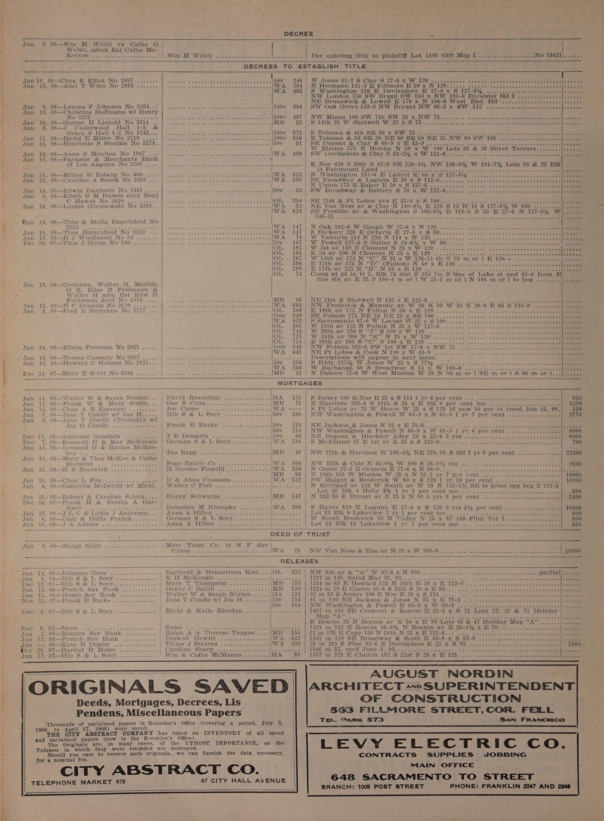
1972 alphabetical directory. A John Bajone worked in construction.

Debra Patch lived at No. 19 in 1982

No. 15: José Zamacona. No. 17: Johnny A. Bajone. No. 19: Debra Patch. No. 21: Fernando Vareda.

The alphabetical directory again lists Fernando with Lusia A. Vareda.

1982 street directory, p

1982 street directory, p. 340. Debra Patch appears at No. 19.

Mal Waldron plays next to Hill Street

The pianist opened his first set at Bajone’s with Fire Waltz, a piece he had recorded with Eric Dolphy and Booker Little in 1961. Jazz magazine Coda reviewed the night at the newly remodeled club. Eddie Moore played drums and Frank Tusa played bass. Trumpeter Benjamin Jones joined them in the third set.

The club at 1062 Valencia took its name from its owner, Johnny Bajone, who is listed at 17 Hill in the early 1980s. A 1984 calendar lists appearances by Jamco with Jamie Davis and by blues singer Maxine Howard at the same address.

Coda’s contemporary concert review Coming Up!, November 1984 club listings Bajone’s 1985 advertisement

African Roots of Jazz books a reunion at Bajone’s
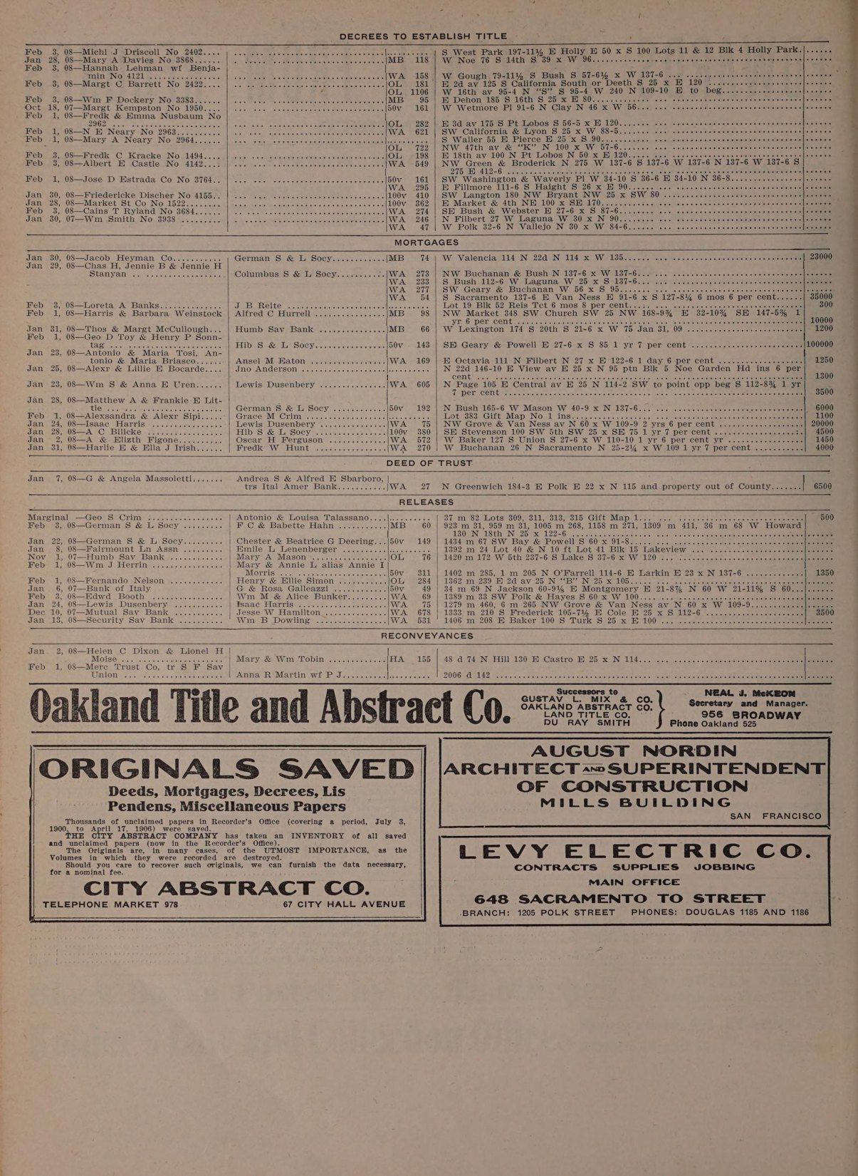
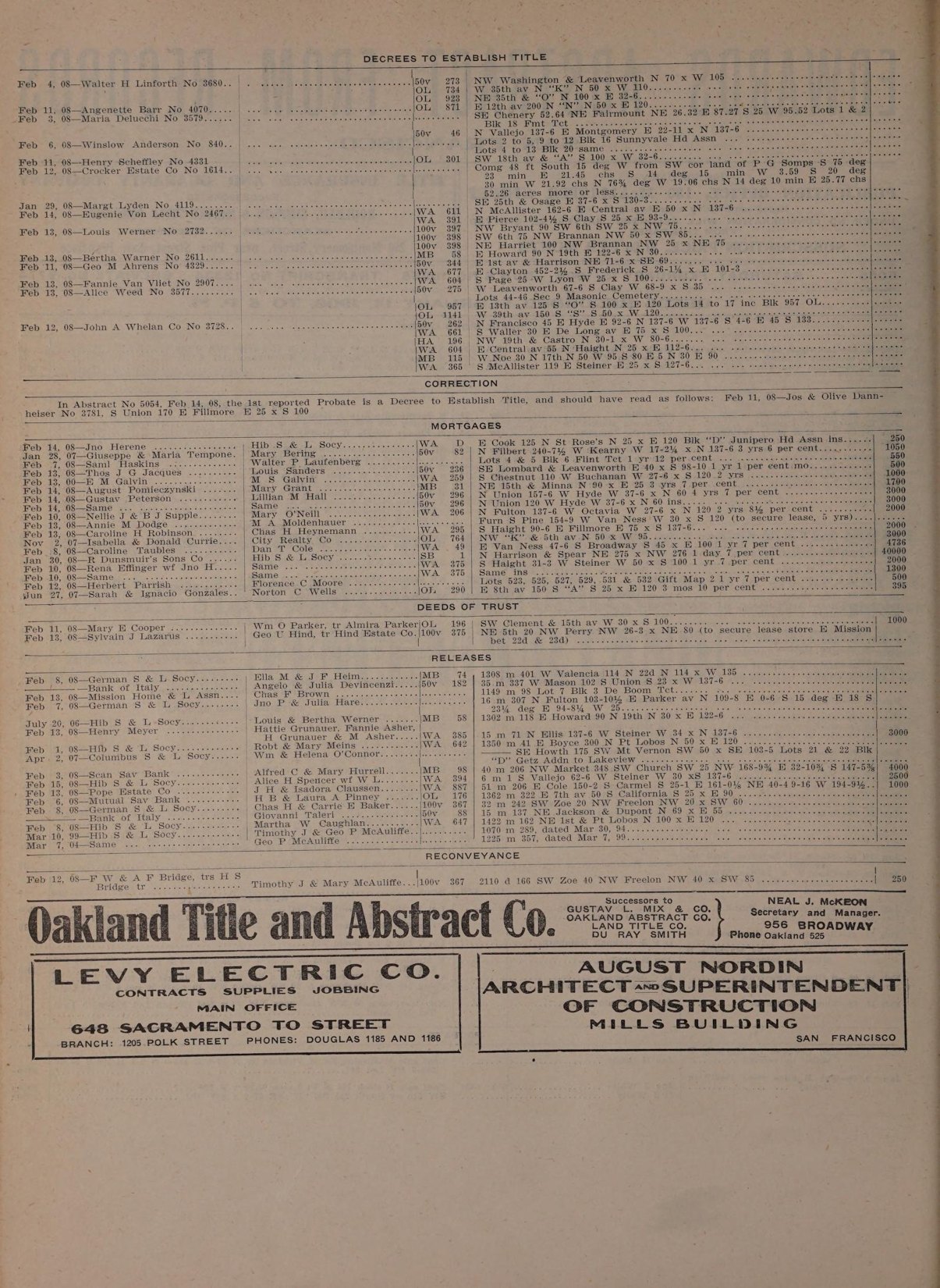
Two local papers advertised a Sunday reunion at 1062 Valencia. The Coming Up! calendar billed drummer E. W. Wainwright Jr., pianist George Cables, violinist Michael White, saxophonist Jules Broussard, vibraphone and marimba player Rickey Kelly, bassist Jeff Carney and percussionist Carlos Baratta. The listings give 5 to 9 p.m. and a $6 cover.

Wainwright formed African Roots of Jazz in 1977. Members recorded an album in 1981 to support the group’s work. A recording of the Bajone’s reunion has yet to surface in the sources reviewed.

San Francisco Sentinel, February 3 listing Coming Up!, reunion lineup Album reissue and group history Johnny Bajone at No. 17

The property remained on the block after the city rejected the bank’s demolition proposal in 1975.

1987 · Hill and Valencia after the demolition vote with the present lot marked.
An aerial photograph shows the block after the demolition voteThe National Aerial Photography Program frame covers the Mission from Dolores Park to the wider street grid. UC Santa Barbara Library, NAPP, frame 511-126.The dashed outline marks the estimated lot vicinity from Hill and Valencia. The image resolves the street grid at this scale.

Max Kirkeberg photographs the Hibernia drive-through and its neighbors

On February 15, Max Kirkeberg photographed the Hibernia Bank façade and drive-through from the Valencia side. In the same view, Bajone’s occupies the building that would become the Marsh. On March 2, he photographed the Victorians and stores across Valencia from Hill, including Lasts Paint Clearance.

Hibernia and the drive-through, looking north Bajone’s and Hibernia, looking south Harvey Real Estate north of Hill Lasts Paint Clearance opposite Hill Victorians opposite Hill East side north of Hill East side south of Hill

Hibernia Bank and its drive-through, looking north on Valencia in 1988.
Hibernia Bank and the drive-through, February 15, 1988. Max Kirkeberg, San Francisco State University.

Malo plays a packed homecoming show at Bajone’s

North Mission News reported that the San Francisco Latin rock band behind “Suavecito” drew a standing-room-only crowd at 1062 Valencia. The newspaper said Ernie Meyer took over the club on August 1, 1988, after Johnny Bajone had run it since about 1978. It also described the club’s Thursday Brazilian nights under Meyer.

The original article includes a photograph of the band. Max Kirkeberg’s photographs from earlier that year show the club next to Hibernia’s drive-through.

North Mission News, January 1989, p. 10

The city records repairs to the rear stairs

The city lists repairs to the rear stairs.

City parcel report

1990s

The building beside the bank

An early-1990s aerial shows the four-flat roof and rear yard beside the bank and its paved lot. In 1997, Third Eye Blind’s first music video caught the storefronts around Valencia and 22nd.

Early-1990s aerial 1997 building work Third Eye Blind on Valencia

The city and the Liberty Hill Neighborhood Association plant 79 trees on Valencia

The Urban Forestry Division worked with the neighborhood association to plant trees between 20th and 26th streets, a stretch that includes Hill and Valencia. The city’s Graffiti and Beautification program funded the project.

Department of Public Works annual report · Urban Forestry

The Marsh takes over the former Bajone’s jazz club

The Marsh began as a Monday-night performance series at the Hotel Utah. In December 1992 it rented the former Bajone’s theater at 1062 Valencia, between Hill Street and the old Hibernia Bank. The company bought the building in 1996 and developed it into a community arts center.

The Marsh later appears in Film SF’s records for Love & Taxes, a film based on a solo show.

The Marsh’s institutional history 1988 photograph of Bajone’s

An aerial photograph shows the building beside the bank’s parking area

Hill Street runs across the image and Valencia runs down the right. The building’s roof and rear yard appear next to the bank and its parking area. The city viewer labels the two layers 1993 and 1995. Matching cars and shadows indicate the two layers likely come from the same flight.

City layer labeled 1993 with the present lot marked.
City layer labeled 1993The footprint and rear yard are visible below Hill Street.The red outline projects the present 50 × 114 ft parcel onto the city’s georeferenced image.

City layer labeled 1995San Francisco historical aerial viewerCity parcel geometry

Sanborn still labels the building as four flats

1990s Sanborn, volume 7, sheet 706
1990s Sanborn, volume 7, sheet 706Outline of the present 50 × 114 ft lot.

The city’s reproduction identifies the sheet as dating to the mid-1990s. It still labels the property as four flats.

The city records beam and header work at the building

The city lists beam and header work at the building.

City parcel report

Third Eye Blind films “Semi-Charmed Life” near the old Hibernia Bank

In the music video for Third Eye Blind’s debut single, singer Stephan Jenkins walks past Valencia Cyclery. A man works at a typewriter outside Boogaloos at 3296 22nd Street, across Valencia from the former Hibernia Bank at 1098 Valencia. The video continues east along 22nd toward Mission, where the Leed’s Shoes sign appears.

Jenkins told The San Francisco Standard that he wanted to direct a darker video about addiction, but the label president turned him down. The interview also identifies Illinois Street in Dogpatch as another filming location. The band performs in front of a large vault door, and the location of those interior shots remains unverified.

The corner storefront appears in 1944 and 1947 streetcar photographs.

Official music videoStephan Jenkins on filming on ValenciaJenkins on the shoot and his original conceptMission locations and video stillsBank at 1098 ValenciaThe bank and the block in 1988 Historic bank photographs

A man at a typewriter outside Boogaloos with the Hibernia Bank reflected in the window.
Still from the 1997 “Semi-Charmed Life” video, via Uptown Almanac.

The color photograph preserves the building’s façade and trim after the 1974 black-and-white assessor photograph.

Color photograph of the stucco façade, arched entrance, and reddish trim.
An assessor photograph shows the façade in colorThe car suggests the late 1990s or 2000s. The reverse has a faint date stamp and a later annotation connecting lot 8A to condo lots 106–109. Assessor photograph, box 48, bundle 432, file 2.

2000s

One parcel becomes four

In 2009, San Francisco adopted the Eastern Neighborhoods plans, including a plan for housing, transportation and industry in the Mission. The building had occupied one parcel until that year. The condominium map gave each flat its own parcel number and kept the four addresses.

Eastern Neighborhoods plans 2009 condo map

Robin Williams drops in to perform at The Mock Café

Robin Williams performed at The Mock Café’s small comedy room at 1074 Valencia on March 17, 2000. He returned for two more sets in June and performed five sets at The Marsh from August to September. An archival collection holds a 38-page transcript of the March 17 set and a VHS tape labeled September 7 at The Marsh. Its catalog can be read online.

Comedian W. Kamau Bell remembers people walking along Valencia to dinner or the laundromat and crowding into the café when they heard Williams was there. Bell recalls Williams working on material that later appeared in his HBO special. Beth Lisick reported a separate surprise hour at The Marsh on August 11, after Men Fake Foreplay.

Boston University finding aid, boxes 6, 7 and 45 W. Kamau Bell’s firsthand account 2000 listing at 1074 Valencia Beth Lisick’s August 2000 account

Brian Copeland premieres his solo show at The Marsh

At The Marsh, 1062 Valencia near Hill, Brian Copeland premiered Not a Genuine Black Man, his autobiographical play about race and growing up in San Leandro. The theater describes it as San Francisco’s longest-running solo play.

The Marsh moved into the former Bajone’s jazz club in 1992. The same address later appears in the city’s filming records for Love & Taxes, another film based on a solo show.

The Marsh on Copeland’s premiere Show synopsis and photos The Marsh’s venue history

Spork opens in the former KFC

Spork opened in the former Kentucky Fried Chicken building at 1058 Valencia in April 2007. Neil Jorgensen and chef Bruce Binn retained elements of the fast-food space, including an exhaust hood turned into a light fixture. City planning identified the property as 1050 Valencia and later reviewed plans to replace the one-story building.

San Francisco Chronicle, April 2007 2010 city planning review

Field of Mirrors comes to Ritual Coffee

Philippine American Writers and Artists lists a Litquake reading from its anthology Field of Mirrors at 1026 Valencia, just north of Hill. The organizer records a lineup of editor Edwin Lozada and contributors Karen Llagas, Francisco Peñones, Barbara Jane Reyes, Tony Robles, Gayle Romasanta and Marianne Villanueva.

Organizer’s event archive Book cover and contributors

Rumba musicians take to the street at Valencia and 22nd

A percussionist writing in June 2010 recalled a 2009 Sunday Streets rumba at 22nd and Valencia, with onlookers gathering around the dancers. The 2009 Mission route ran along Valencia on June 7 and July 19. The recollection leaves the date of the performance open.

Percussionist’s June 19, 2010 account 2009 Mission route and dates

The city’s working map retained the former lot number and the 1974 demolition case reference.

Planning department’s working block map showing the 15–21 Hill Street parcel.
The Planning Department map still labels the property lot 8AThis archived copy still labels the site lot 8A. The former demolition case number, CU74.53, appears within the lot.The outline follows the mapped lot boundaries.

The city’s block map carries the earlier demolition case number

One parcel becomes four condo lots

Parcel Map 5285 divided lot 008A into four condo lots. Nos. 15, 17, 19 and 21 became lots 106, 107, 108 and 109 respectively. The owner’s statement names Michael D. Bailey in 2009. The survey cites an earlier deed recorded on April 9, 1997, reel G857, image 297. The city recorded the subdivision as document 2009-I850222 in Condominium Map Book 111, pages 77–78.

Recorded-map indexParcel Map 5285, owner’s statementParcel Map 5285, boundary surveyCity parcel reportAssessor rollParcel Map 5285, owner’s statement · scanParcel Map 5285, boundary survey The outline follows the surveyed lot on the site plan and the block · scan

Parcel Map 5285, the condominium boundary survey
Parcel Map 5285 assigns each flat a lot numberThe outline follows the surveyed lot on the site plan and the block diagram.

The city recorded the map as document 2009-I850222, Condominium Map Book 111, pages 77–78. The tables link street numbers 15–21 to the new condo lots.

Recorded-map indexOwner’s statement, sheet 1

Owner’s statement, sheet 1

2010s

Changes at the back of the building

By 2012, photographs showed an addition over the former bank drive-through along Valencia. The city’s review of the neighboring Valencia project placed the building between that project and the Liberty-Hill Historic District. An application for rear decks and ground-floor access was filed in 2014. The city issued the permit in 2016 and recorded completion in 2019.

Kirkeberg’s repeat photograph 2013 city review Rear addition permit

Planning diagram of the building and neighboring buildings before the 2014 rear addition application.
City planners draw the building before the rear additionThe city’s environmental report for 1050 Valencia shows the building hatched on lot 8A. It spans the Hill Street frontage, has a shallow recess on each side and leaves an open yard behind.The outline follows lot 8A. The arrow in the source points to the proposed building on the neighboring lot.

The figure gives a view of the exterior outline before the 2014 application. Its outline differs from the 1950 fire insurance map, which labels a one-story rear projection. The 2010 figure has no floor plans or separate outlines for each story.

2010 environmental report cover Figure 4, PDF p. 193 1950 Sanborn Rear addition permit

An addition takes the place of the bank drive-through

Max Kirkeberg returned to Valencia 24 years after photographing Hibernia Bank. His repeat photographs show an addition where the drive-through had been. The former bank retains its arched openings and now carries a Social Security sign.

North from 22nd Street, first view North from 22nd Street, second view 1988 photographs

The west side of Valencia from 22nd toward Hill in 2012.
Valencia north from 22nd, February 22, 2012. Max Kirkeberg, San Francisco State University.

Max Kirkeberg photographs Sunday Streets near Hill

The city approved four Sunday closures that included the mouth of Hill at Valencia. On the first date, Kirkeberg photographed people filling Valencia toward 22nd. San Francisco State University catalogs that slide and a view north from 21st in the same series.

John G. Stehlin also photographed a queer street performance on 22nd at Valencia, outside the 22nd Street Co-Op. He recounts that the performers began after a July 1 Sunday Streets closure ended and that police moved the audience back to the sidewalk. His dissertation’s list of figures dates the image to 2013, while the July 1 date matches the city’s 2012 permit.

City approval and route Kirkeberg’s photograph toward 22nd Kirkeberg’s photograph from 21st Stehlin’s photograph and account, pp. 101–102

People in Valencia Street during Sunday Streets in 2012.
Sunday Streets on Valencia, May 6, 2012. Max Kirkeberg, San Francisco State University.

Lost Weekend Video screens films in its basement

Lost Weekend Video’s Cinecave, at 1034 Valencia between Hill and 21st, put a 25-seat screening room below the video store. Filmbalaya advertised a double feature there in November 2012. The room also hosted comedy, and San Francisco’s Entertainment Commission records list Adam Pfahler of the band Jawbreaker as the permit applicant in 2015.

Filmbalaya’s 2012 screening announcement KALW audio and interviews Entertainment Commission minutes Storefront photo and account of the Cinecave

Lost Weekend Video’s purple and yellow sign at 1034 Valencia.
Lost Weekend Video, 1034 Valencia. Max Kirkeberg, February 27, 2012. San Francisco State University.

City planners review a project next to the building

The city identifies 15–21 Hill as the parcel between the neighboring Valencia project and the designated Liberty-Hill Historic District.

2013 Valencia project record

2013 Valencia project record, PDF page 125

A rear addition and decks are proposed

The application filed August 21, 2014 covered a rear addition, new ground-floor access for the lower flats, and decks. Permit 201408214383 was issued April 5, 2016. Sprinkler and monitoring work was completed in 2018. The city marked the addition complete on August 15, 2019.

Addition permitPlanning caseDataSF permit index

Love & Taxes shoots at 20 Hill and The Marsh

Film SF lists 20 Hill Street, across from the building, and The Marsh, 1062 Valencia, as shooting locations. Josh Kornbluth developed the autobiographical solo show with David Dower and plays himself in the film, which his brother Jacob directed. The director’s filmography dates the theatrical release to 2017.

The Jewish Film Institute’s 2015 festival archive identifies The Marsh as the filming location for scenes of Kornbluth’s solo show within the movie. Kornbluth appears onstage about three and a half minutes into the film. The scene shot at No. 20 and whether 15–21 Hill appears in the film remain unverified.

Film SF location records Jewish Film Institute festival archive Josh Kornbluth on the solo show Jacob Kornbluth’s filmography The Marsh’s screening page and trailer Film on Tubi

Lit Crawl brings comics to The Marsh Café

Litquake’s program lists “Draw ’Til You Crawl: The Craft of Comics” at 1074 Valencia. Rina Ayuyang, Tessa Brunton, Ed Luce and Thien Pham were billed to read from projected panels. The same program lists Kundiman West’s “Not Your Model Minority” at Lost Weekend Video, 1034 Valencia, and “Storytelling with Litography” at the Make Out Room.

Litquake’s original program, printed p. 85

Quitters uses 24 Hill Street

Film SF records 24 Hill, on the same side as No. 20, for Noah Pritzker’s first feature. Pritzker and Ben Tarnoff co-wrote the story of a San Francisco teenager, played by Ben Konigsberg, whose family is coming apart. The film premiered at SXSW in 2015.

The location record gives the address. The exact scene and any view of the building remain unverified.

Film SF location records SXSW archive Director Noah Pritzker on filming in San Francisco Theatrical listing Official trailer

2020s

The same footprint on the modern map

The revised 2021 assessor map shows the four condominium parcels inside old lot 8A. A few years later the city changed the layout of Valencia beside the property, replacing a center-running bikeway with side-running lanes that opened in May 2025.

2021 assessor map SFMTA, Valencia bikeway opening

The former single property is shown as four condominium parcels within the same lot boundary.

Assessor block map revised in 2021 showing the 15–21 Hill Street parcel.
The updated assessor map shows four condo lots within the former lotThe 50 × 114 ft outline encloses condo parcels 106–109 on the former lot 8A.The outline follows the mapped lot boundaries.

The assessor revises the map of block 3617

Valencia Lights chooses the former Hibernia bank for outdoor projections

Slide and Spin advertised three Saturday evenings of holiday projections on the exterior of 1098 Valencia, the former bank and Social Security office at 22nd. The flyer credits Avenue Greenlight with funding. The same intersection appears in Third Eye Blind’s 1997 video. The flyer documents the program, and a photograph or video of the projections is still to be verified.

Valencia Lights flyer and announcement Historic photograph of the bank

Archival collections

SFPL building research guideAssessor photo collectionHistoric Recorder holdingsOnline Recorder search1951 assessor block books